Taylor Highway on the way to Chicken
Deutsche Version hier: Taylor Highway und Top of the World Highway per Fahrrad
Cycling the Top of the World Highway and Taylor Highway
Country: Alaska, USA and Yukon, Canada
From Tok to Dawson City
Lesson learned: Don’t let the Chicken Campground fool you!
Laughed about: The reason why chicken is called chicken
Most wonderful miracle: A bus full of German tourists
Greatest challenge: Drinking Tequila with a human toe in it
Days on the bike: 5
Kilometers cycled: 310
Average Kilometers per day: 62
Total Kilometers cycled till Dawson City: 20,278
Missed the last one? Here’s Cycling Alaska Part 2
I have never been a big fan of having breakfast in the mornings. In fact my home-breakfast contains of a cup of coffee or two. But on this trip I wake up hungry every morning. Martine had long packed her things and left, when we finally made our way to Tok’s supermarket. I felt like buying half the store.
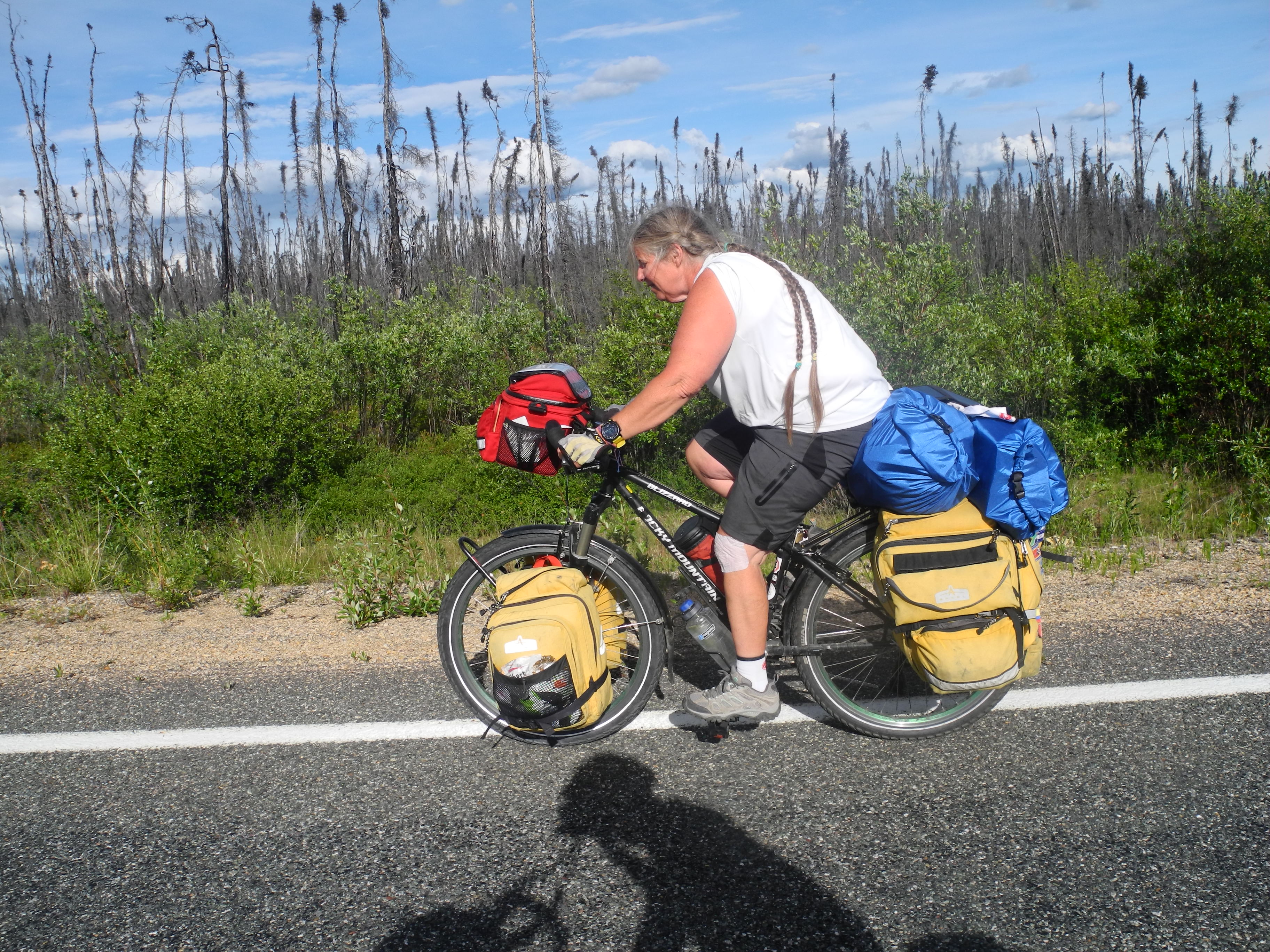
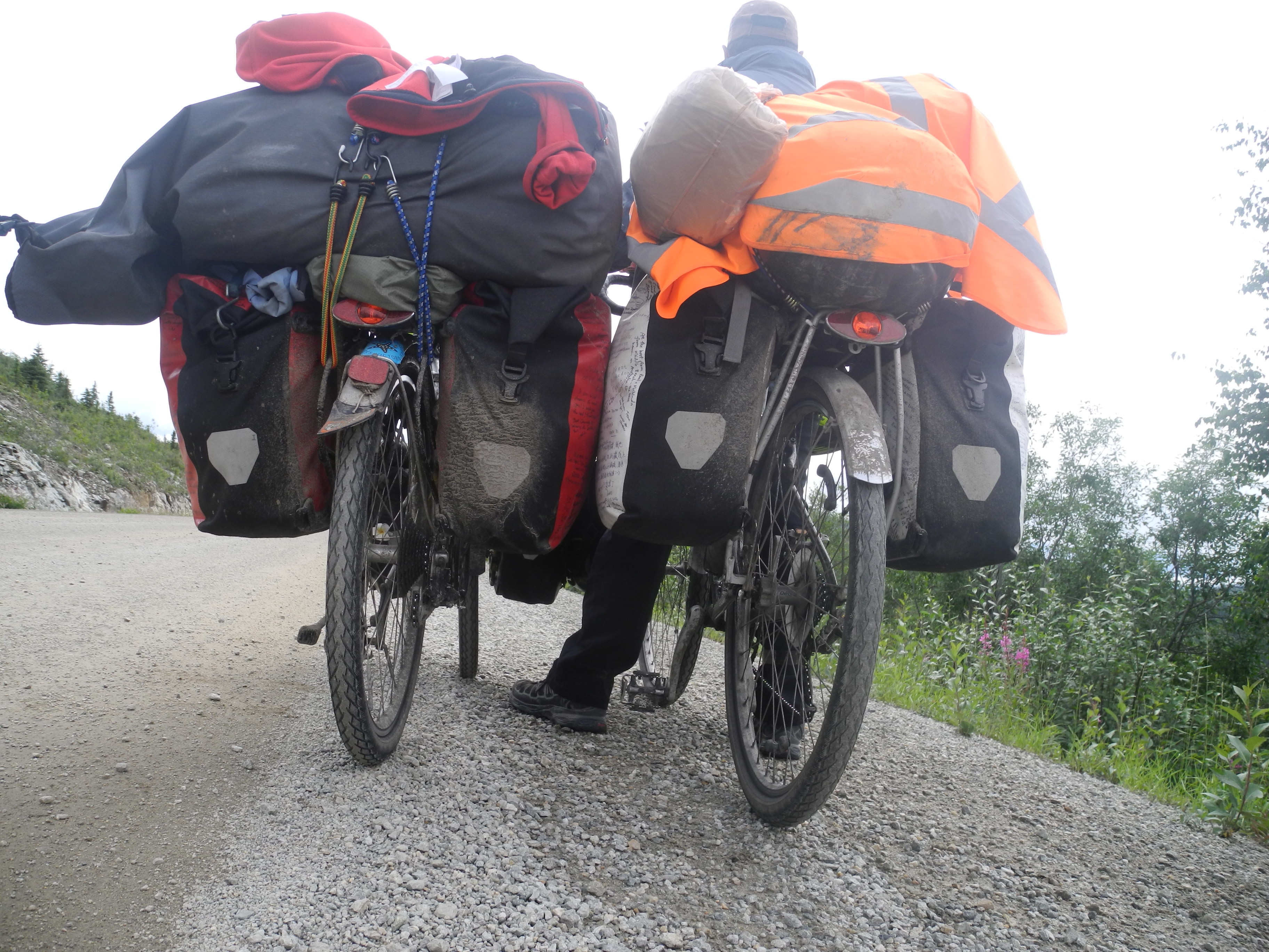
With all panniers close to bursting we found ourselves on a scale. We each carry 120 pounds of bike and bags (plus driver)!
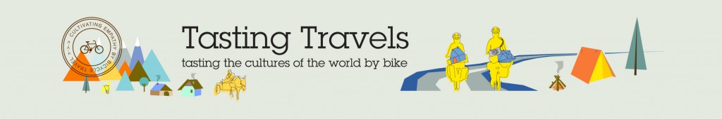
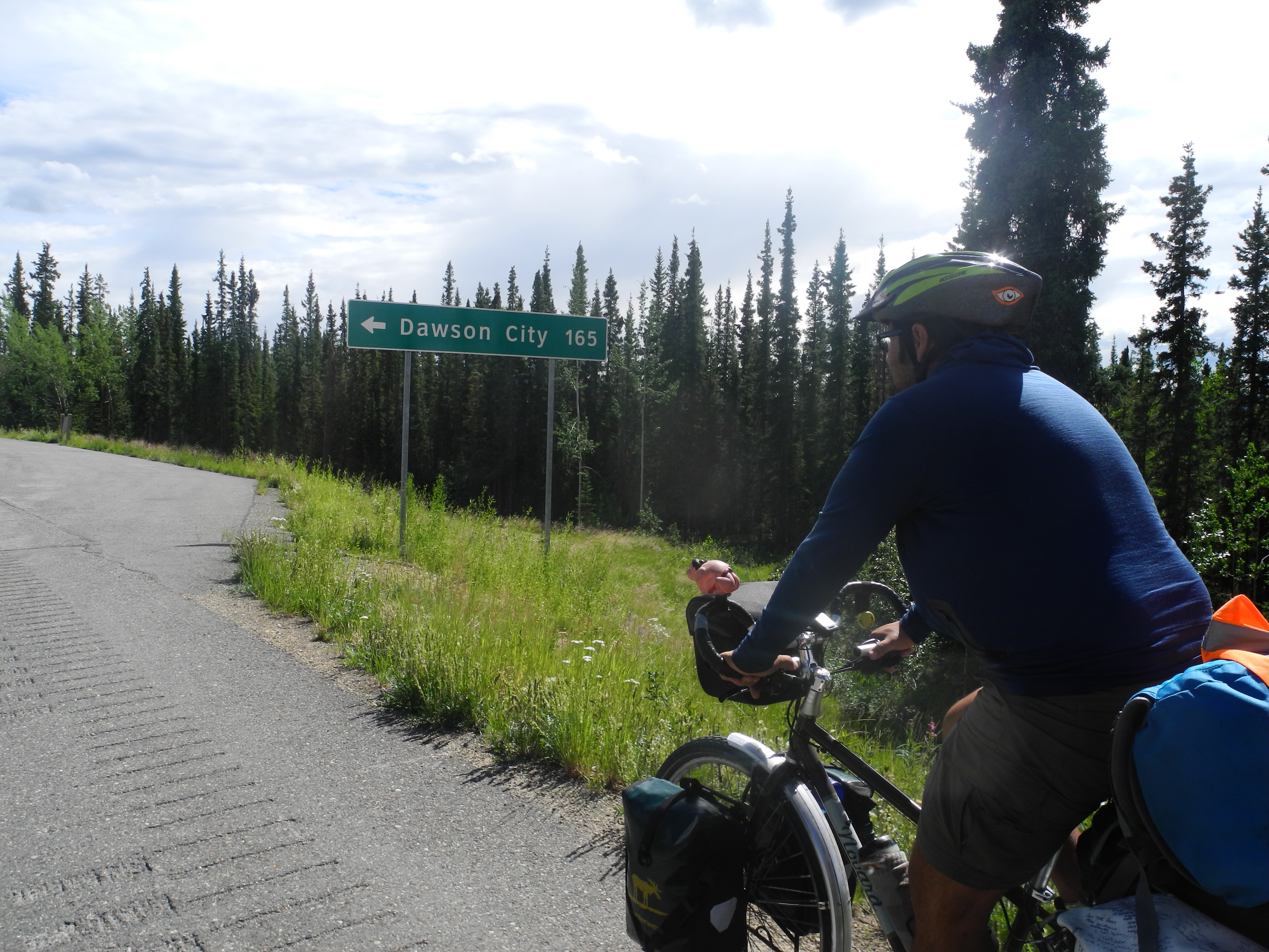
We followed the “Alcan” (Alaska-Canada Highway) for 20 flat Kilometers, then we turned left onto the Taylor Highway. A long climb awaited us but the wind died down. I prefer mountains rather than wind. Climbing 1000 meters means rolling the same amount back down some day. But fighting with headwinds for a week doesn’t automatically mean that we’ll be pushed by tailwinds for the following week.
On the Alcan Highway
The daily morning shower was over and the sun burnt us. The few thin trees didn’t provide any shade at all. It was a hot 20 kilometer climb before we reached the first stretches of descent.
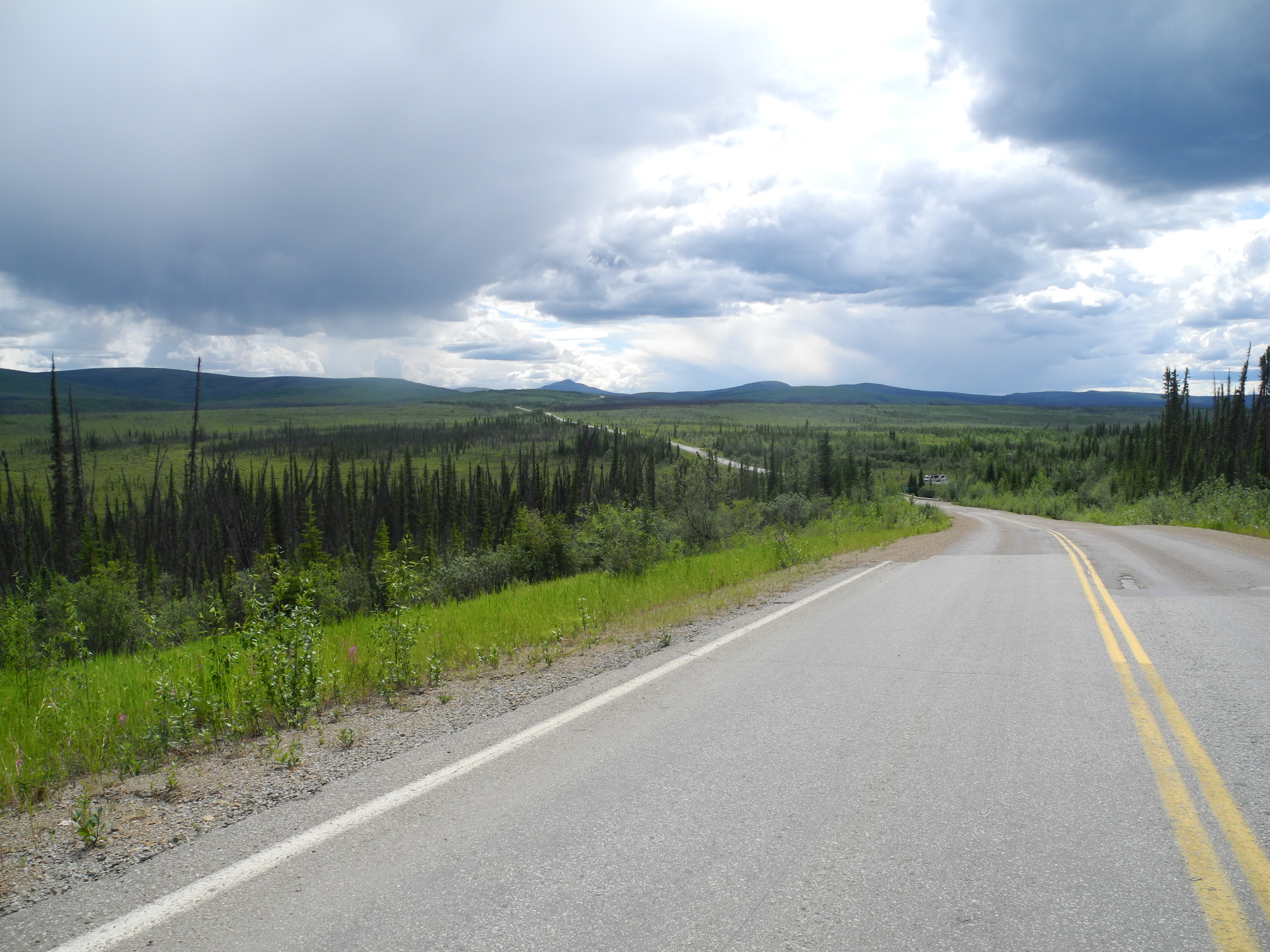
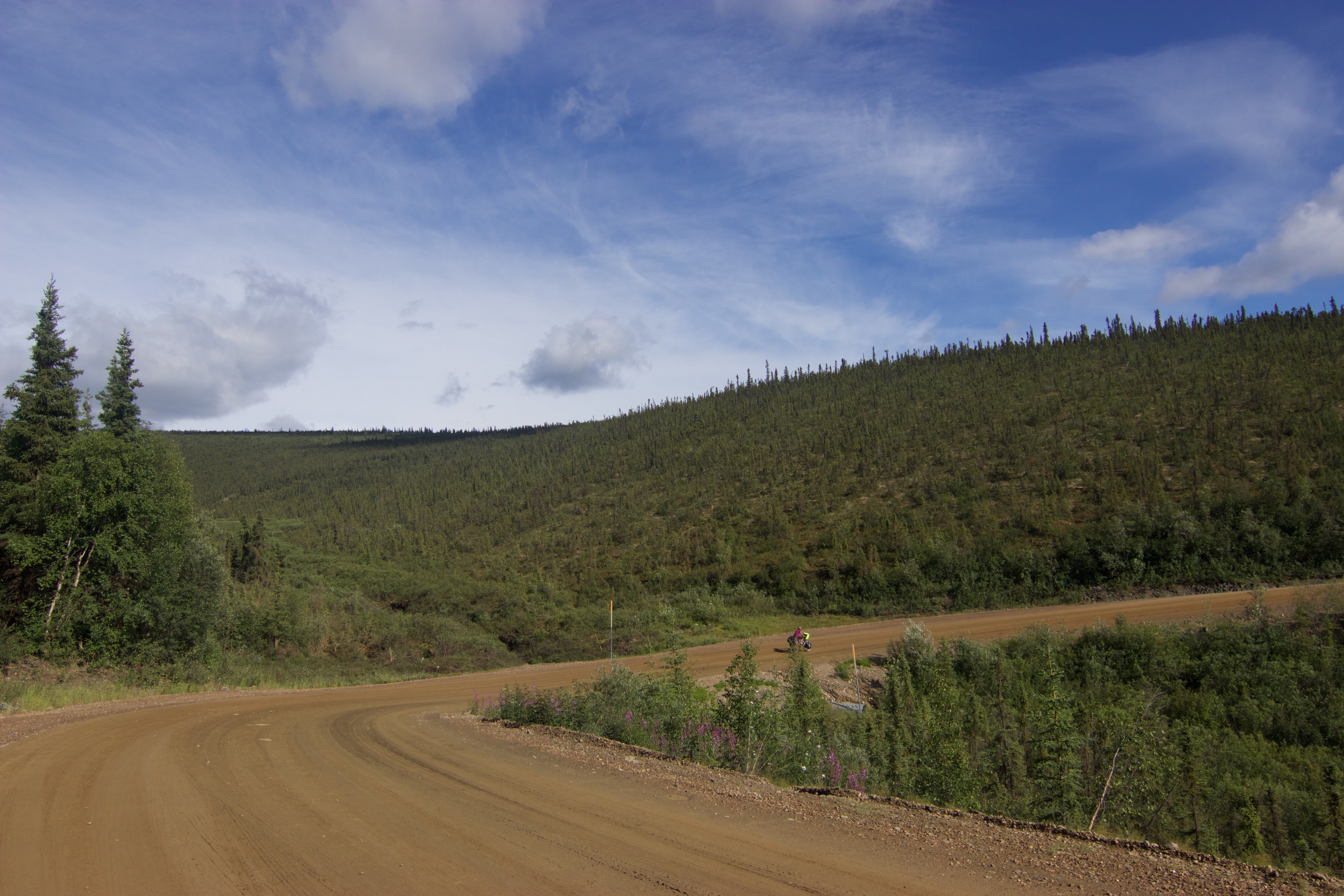
Taylor Highway to Chicken
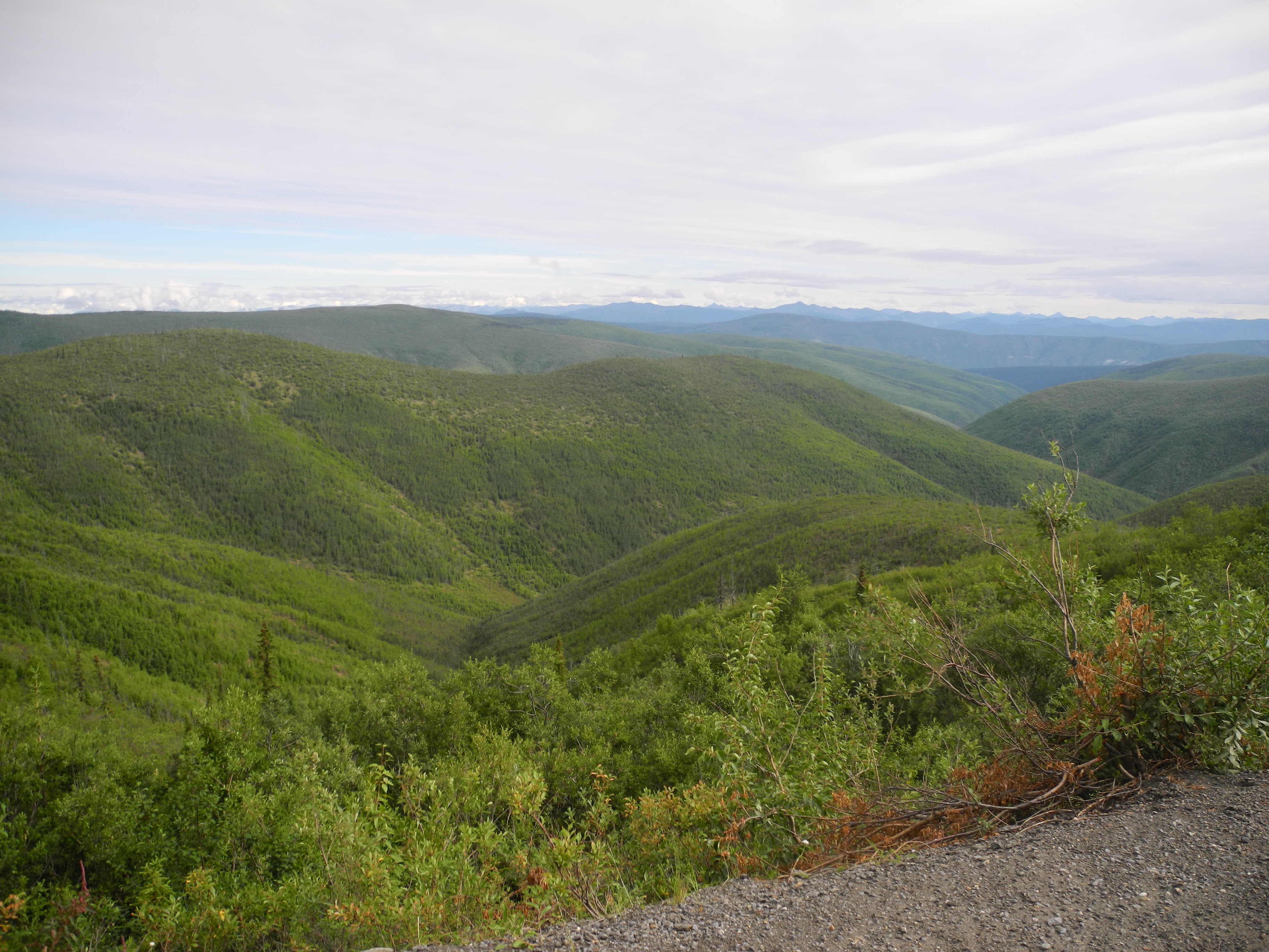
But well, the view down onto the endless sea of spruce was quite impressive. I was on the lookout for every movement between the bushes, but couldn’t spot a single bear, moose or caribou.
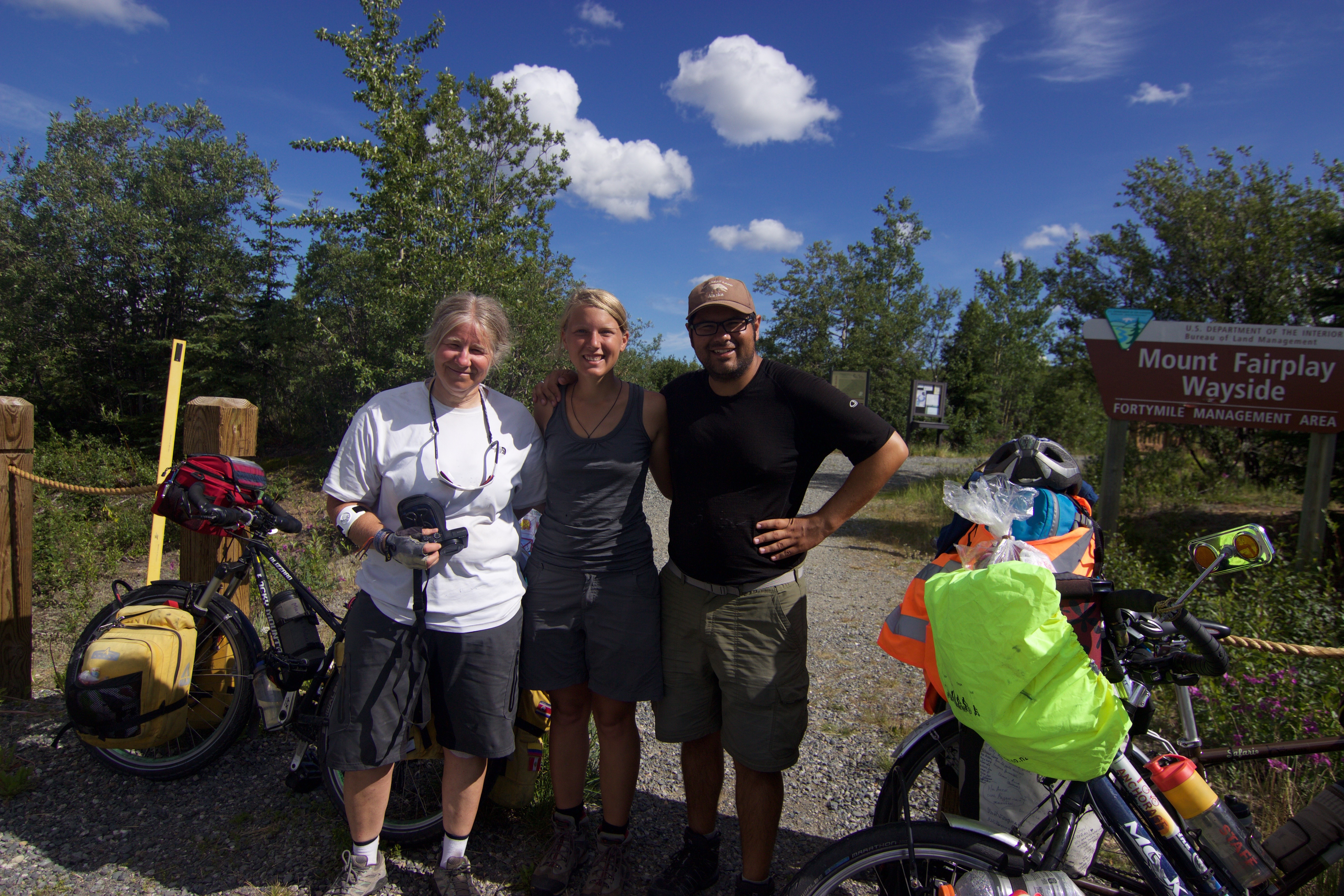
Martine and Roberto
An Italian Road-cyclist told us that Martine was having a break not too far from us. And just a few curves later something moved up on the end of the road.
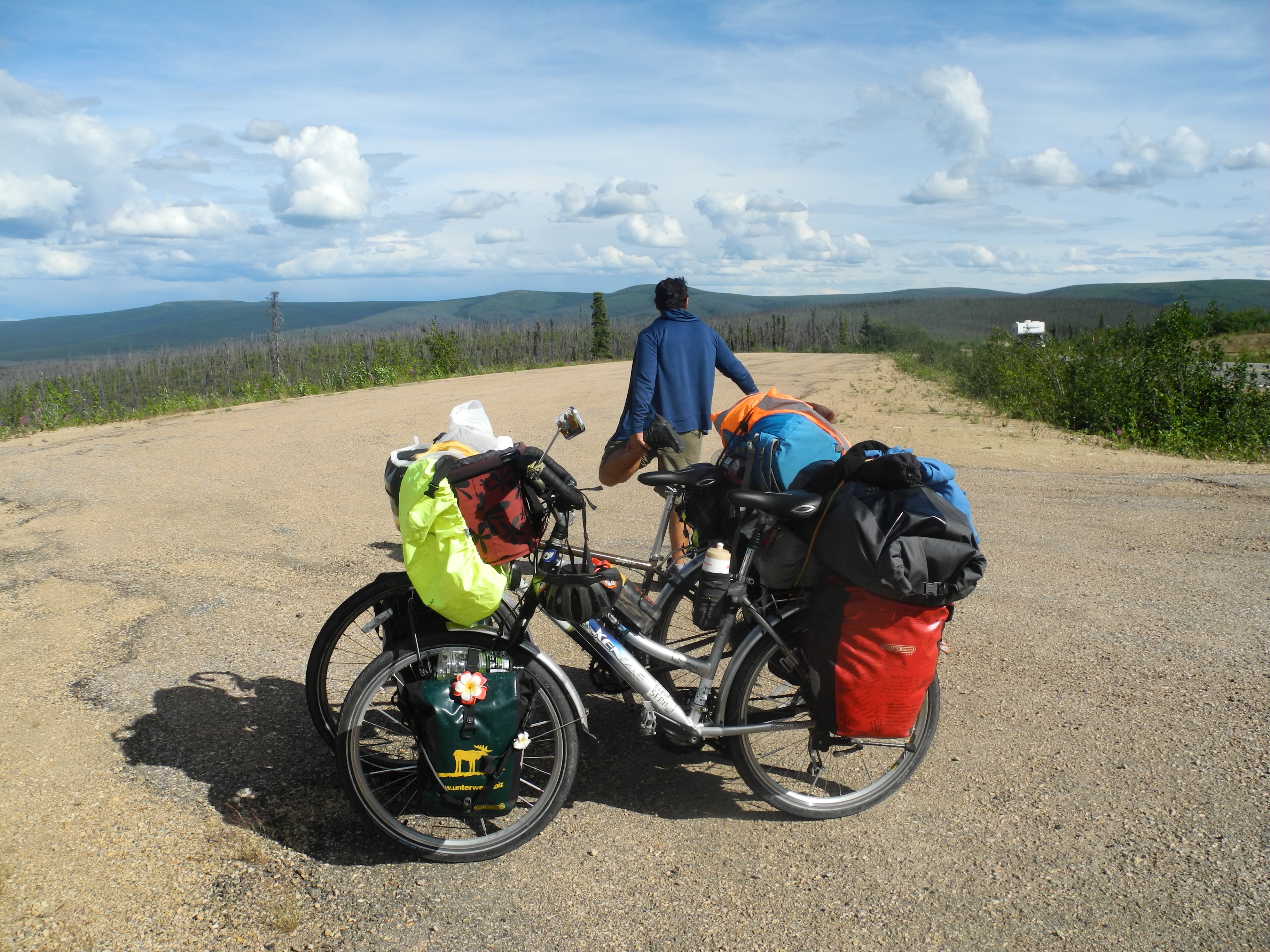
Stop at a pullout due to a lack of walls or kickstands, we simply leaned the bikes against each other
I was wondering though, why Martine ran left and right and back again. The closer we got the clearer it gets: we confused the species. What we saw wasn’t a Homo Sapiens, but two Arctic Foxes!
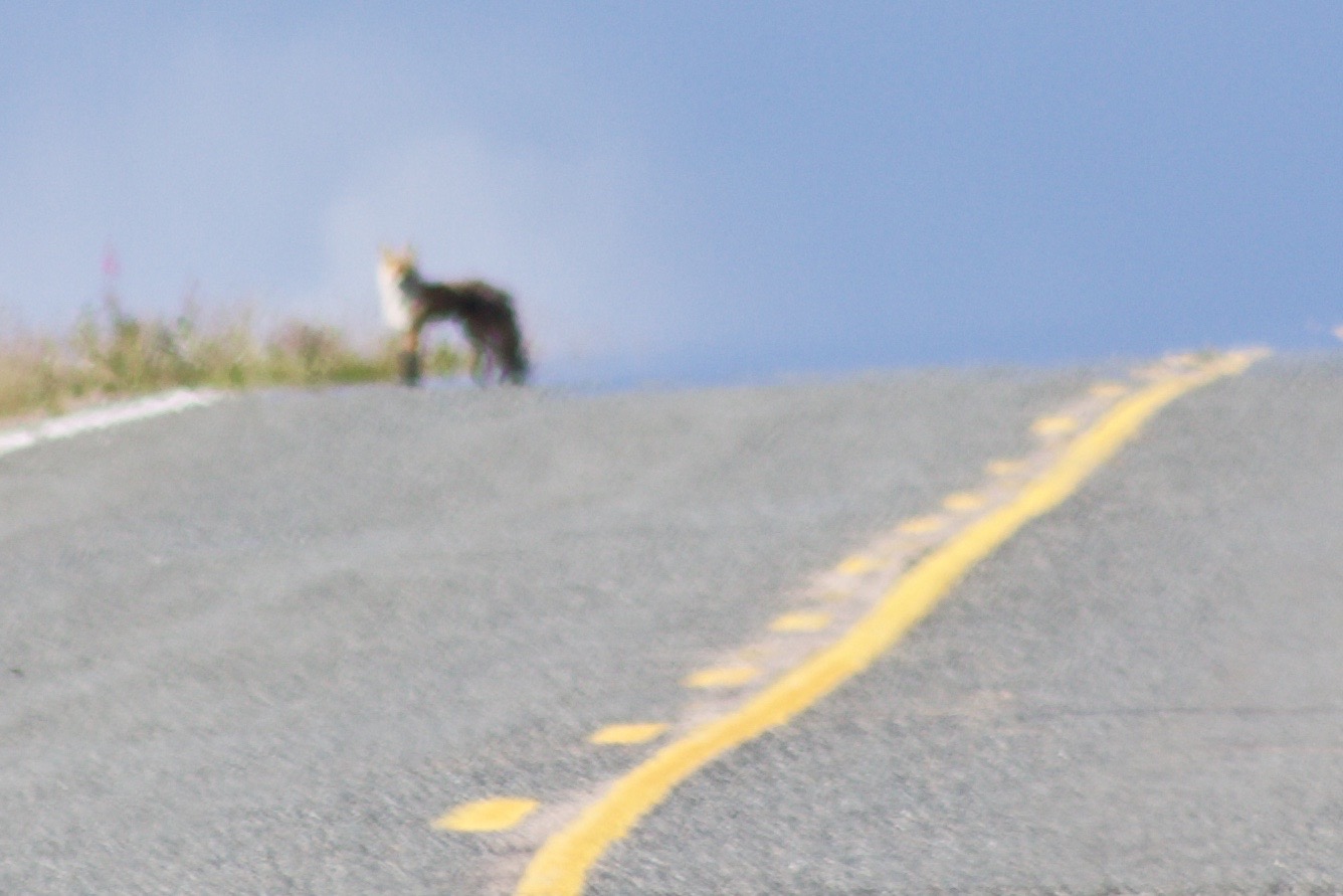
Doesn’t look all that much like Martine once you’re a bit closer

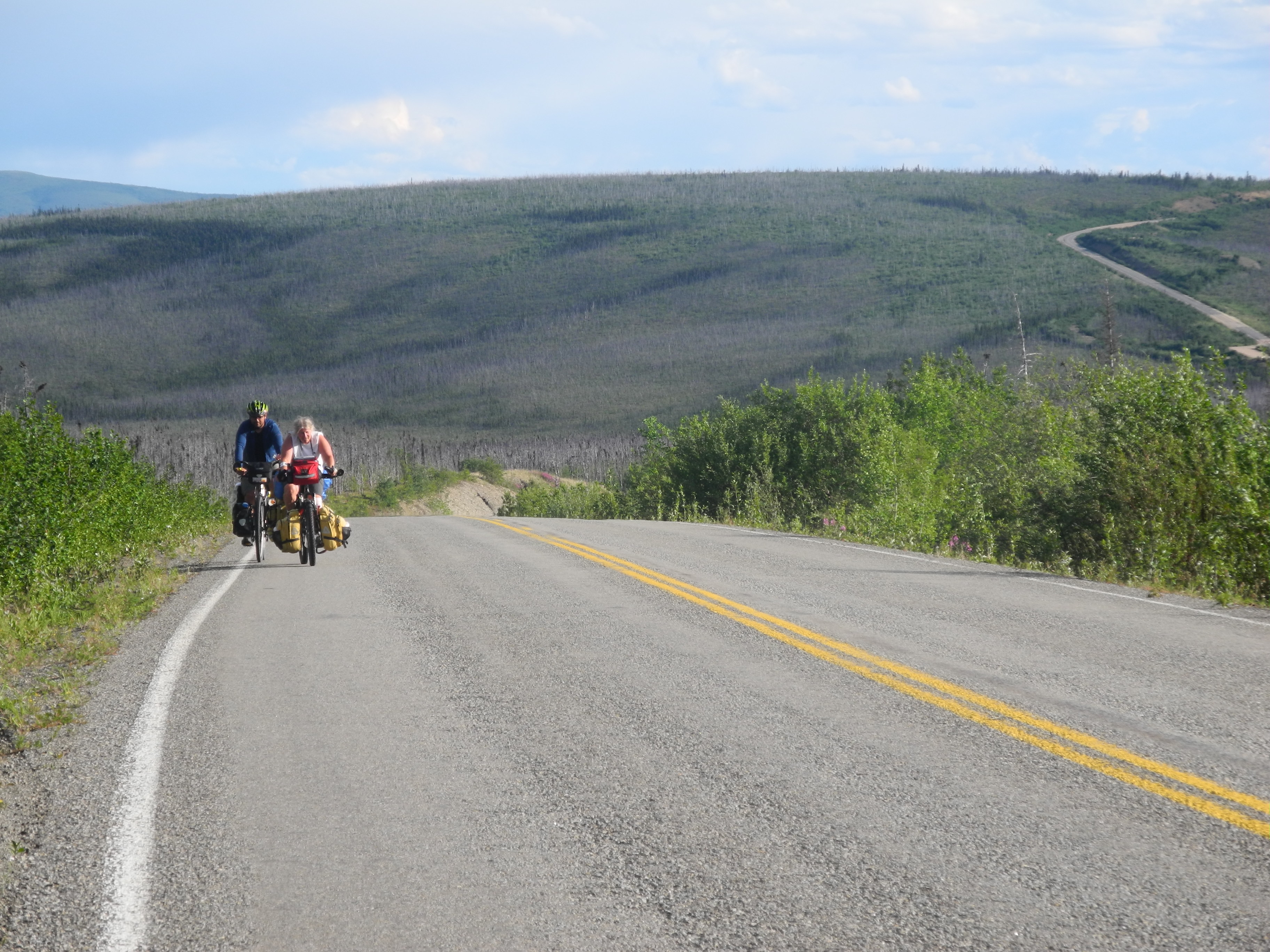
On the Taylor Highway. Look at all these burnt trees!
Martine waited few kilometers further. In this arid landscape she had found a pond and decided to fill up her water bottles. Martine likes to carry at least nine liters of water per day, but I’ll get more into detail about that in the next blog entry.

There have been forest fires around.
The plants recover in no time. Now it’s so green!
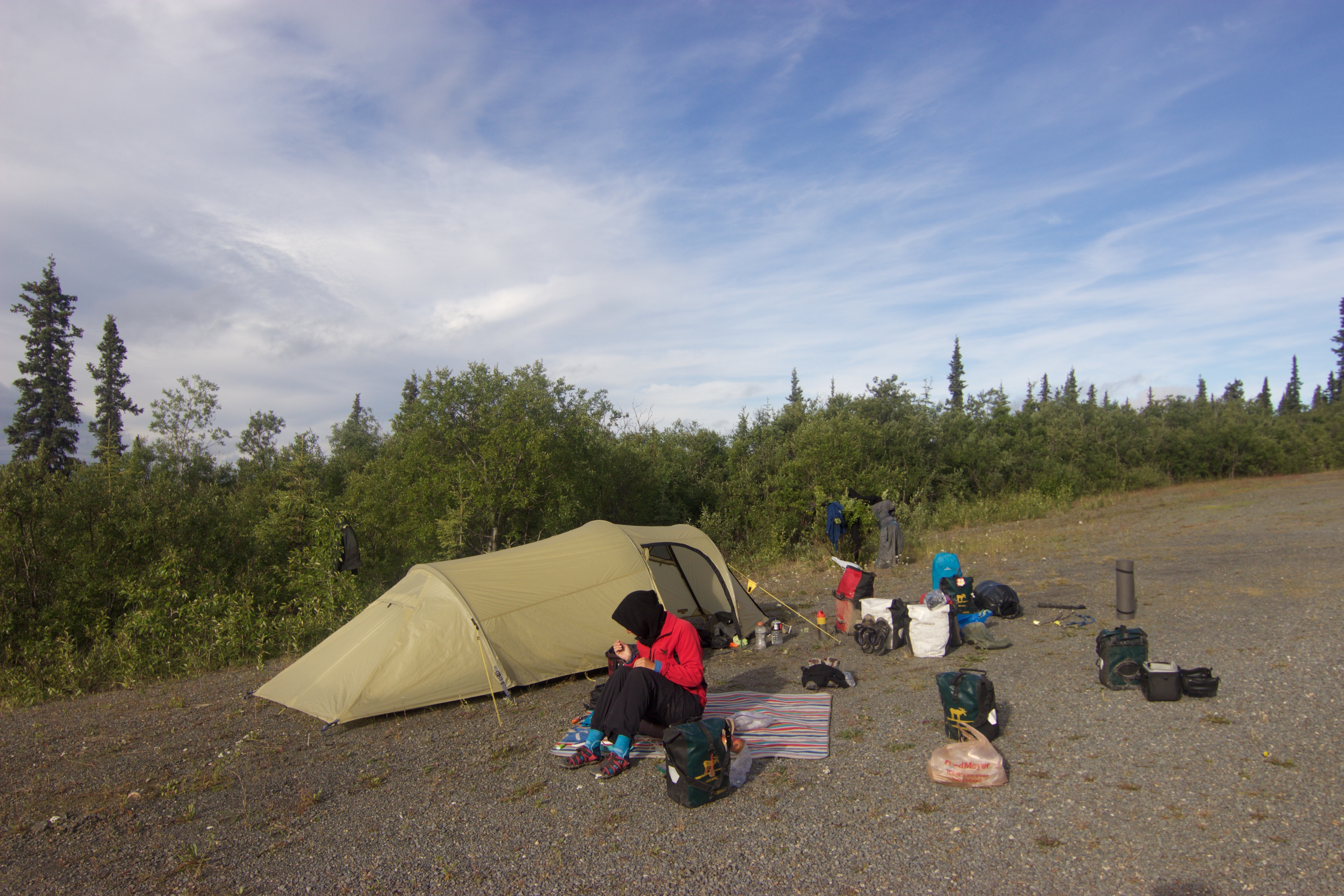
We filled our bottles too, biked a little further and spent the night on a big gravel pullout with (old) moose tracks but no bear poop.
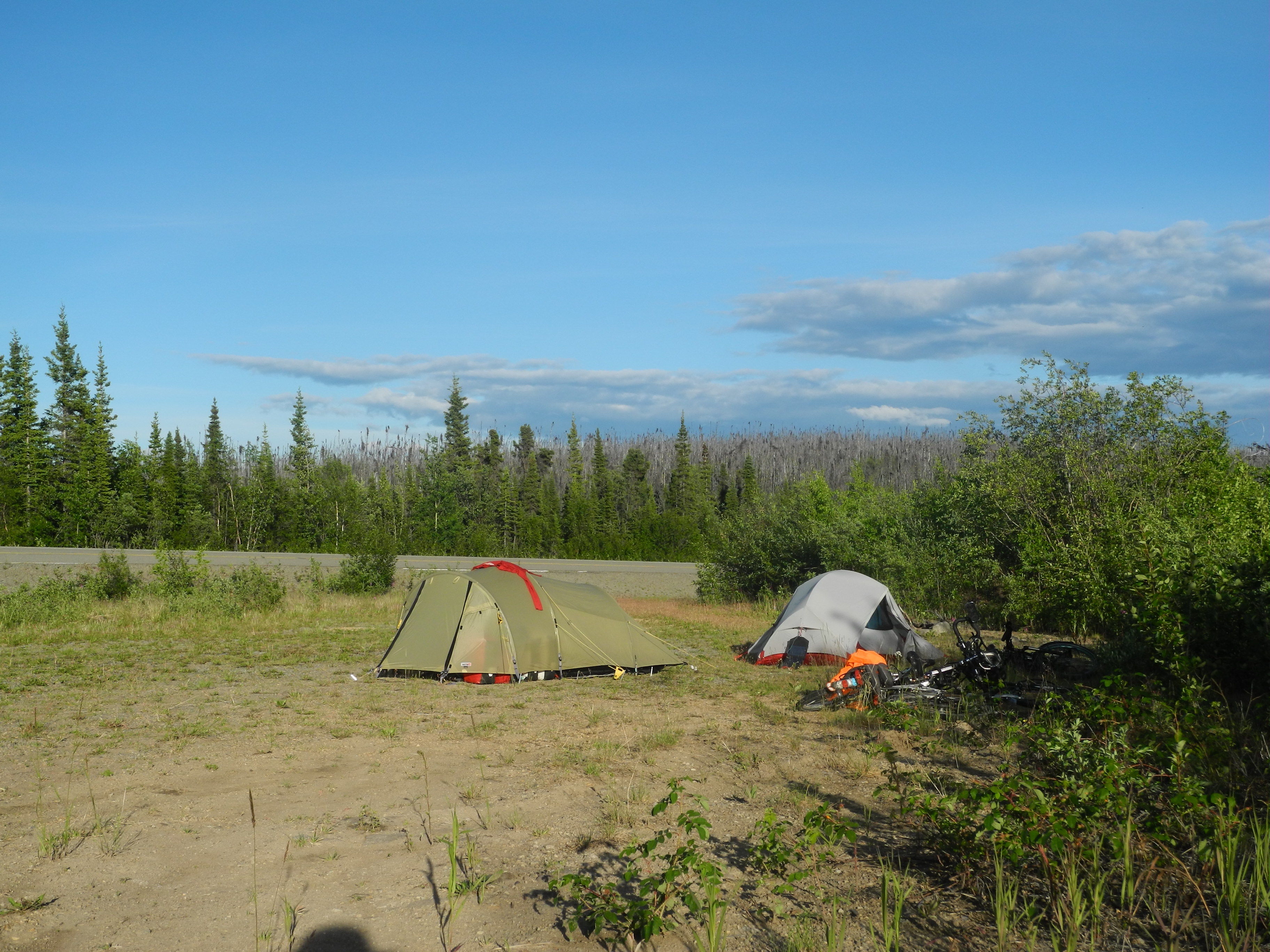
Good spot for the night
I fled the hot tent at 6 am and began to darn some broken shirts and undies. Another fox came to join us for breakfast. We didn’t share our food though. Feeding the wildlife is not only illegal, but also both dangerous for the people as well as the animals.
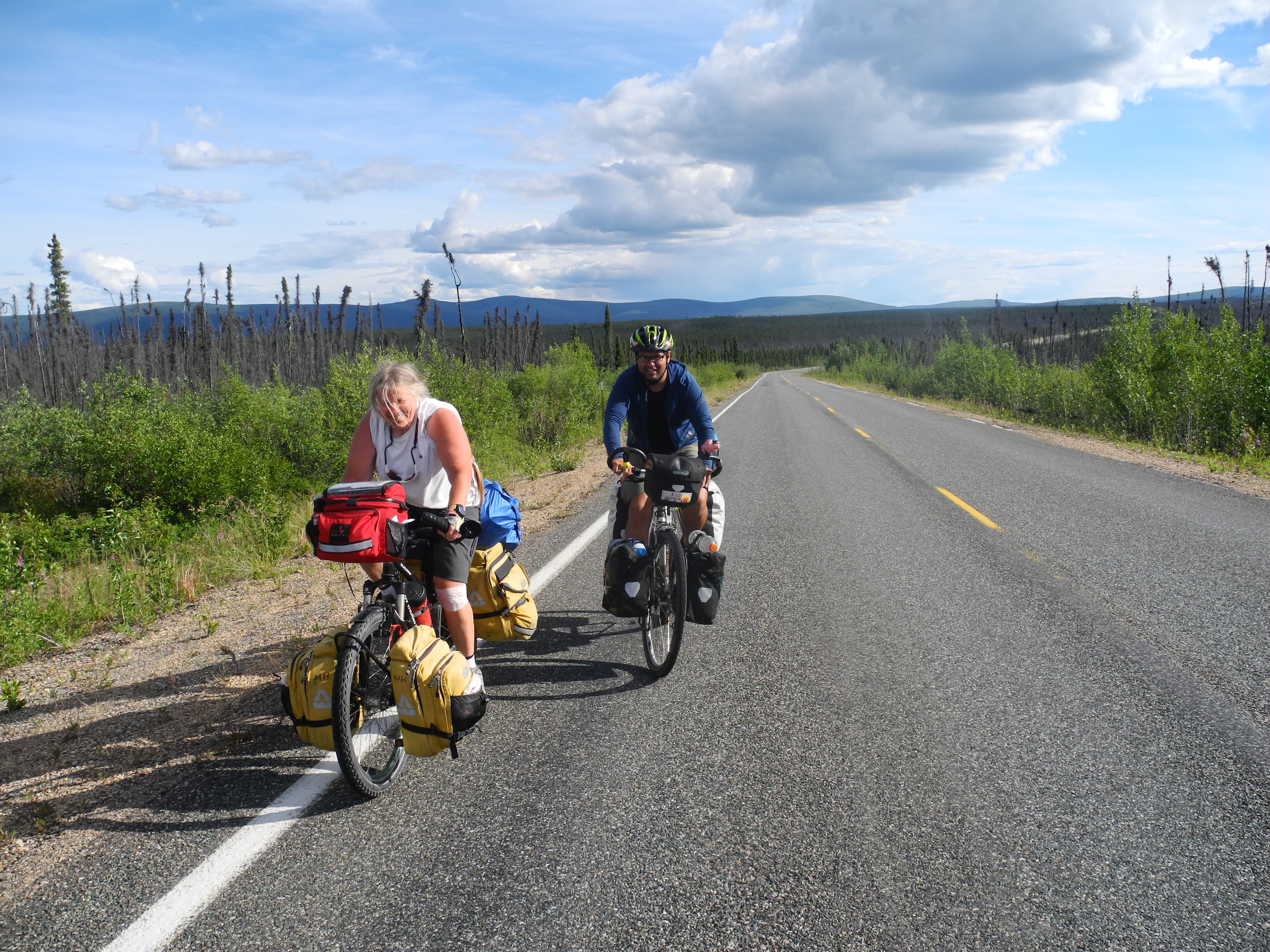
Martine and Roberto
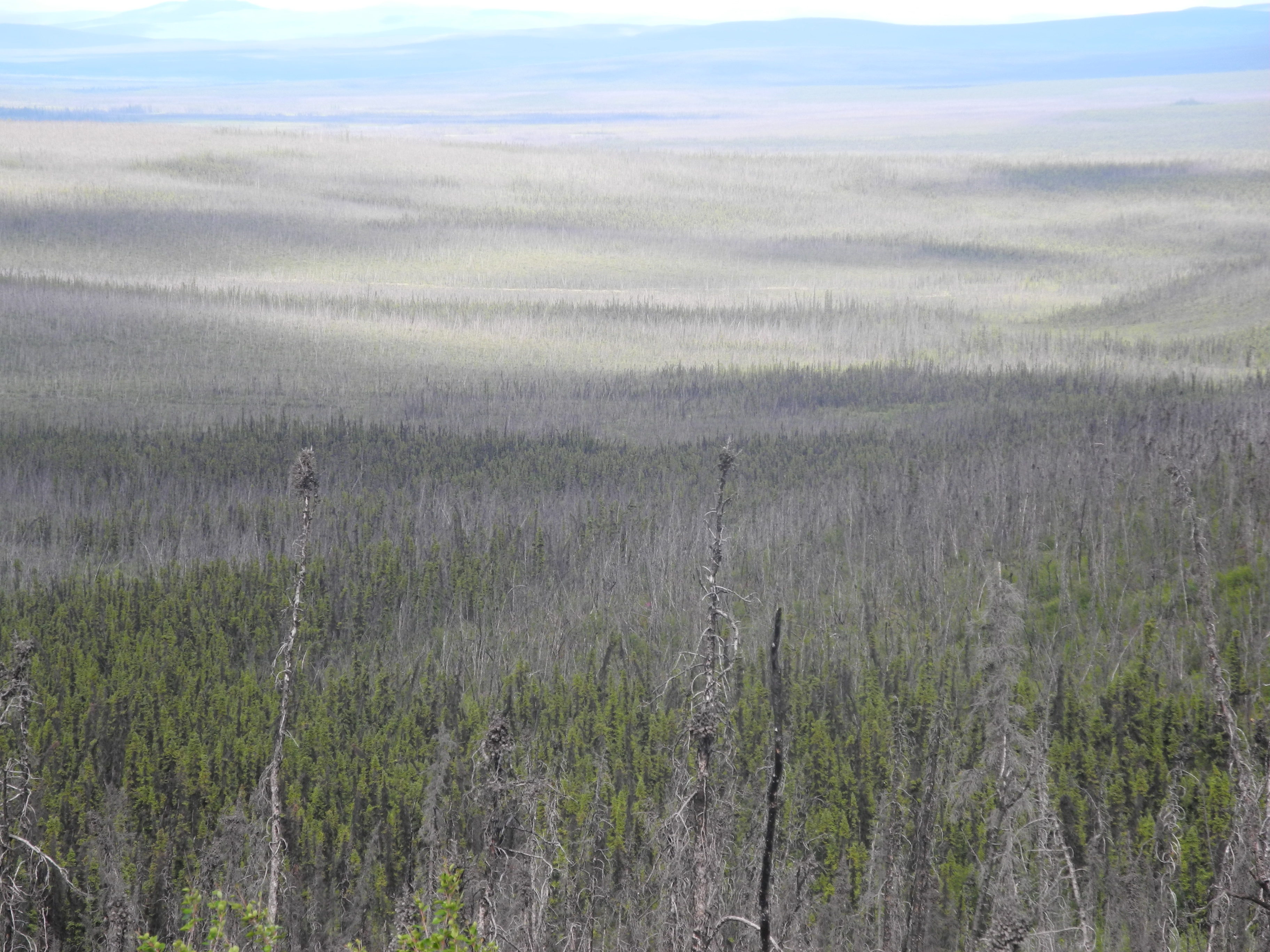
Forest and dead trees as far as the eye can reach
We kept on climbing and climbing, but it was by far not as bad as I had expected it. At a campground we fled under the roof of a shelter pavilion. It was time for shade. We cooked some lunch, filled the bottles with potable water and enjoyed the break.
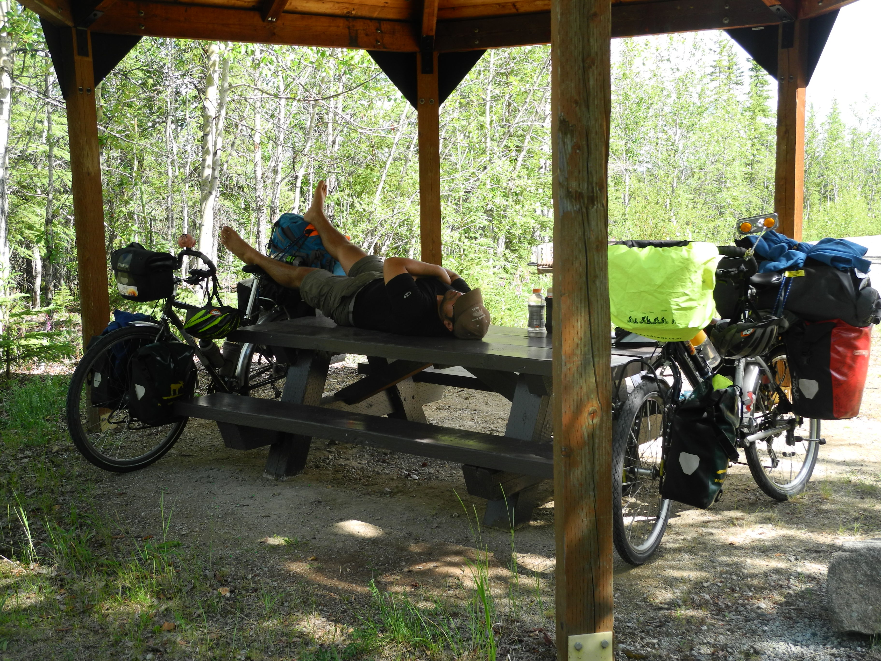
Well deserved lunchtime nap
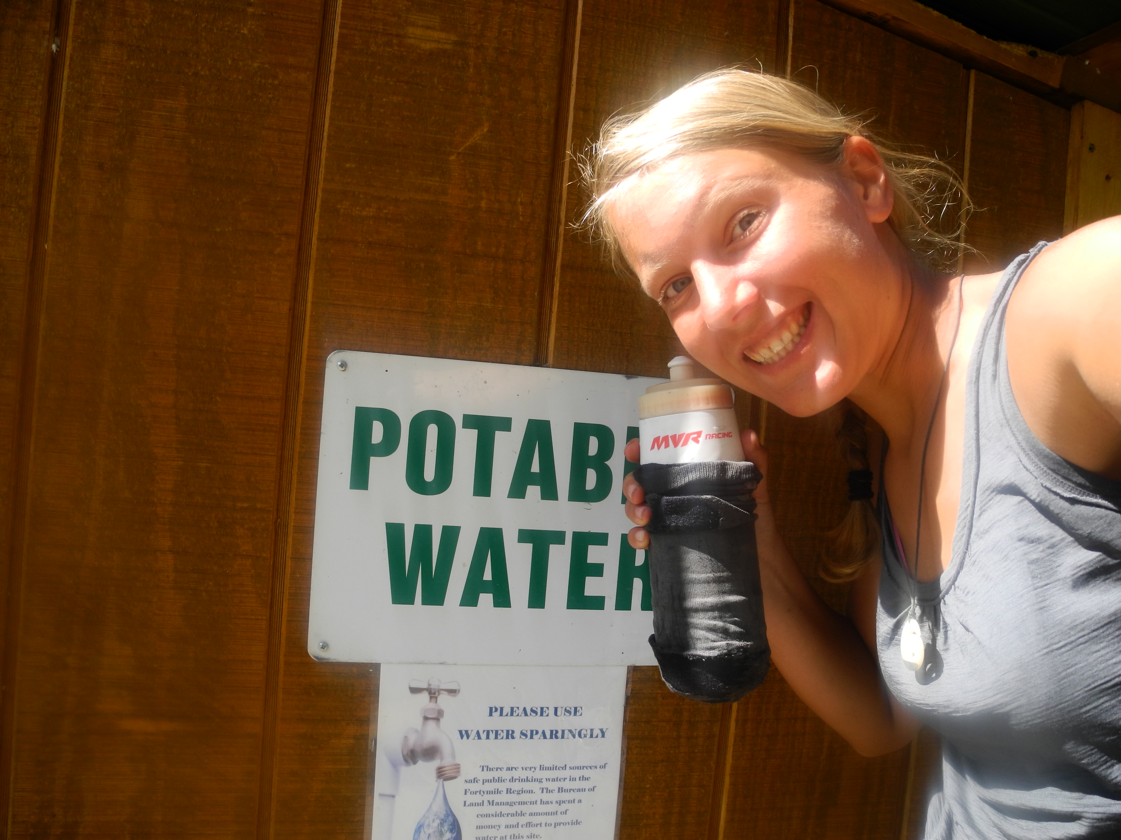
Potable water!
The small town of Chicken wasn’t far. There was a cow moose enjoying a bath in a pond just before town.
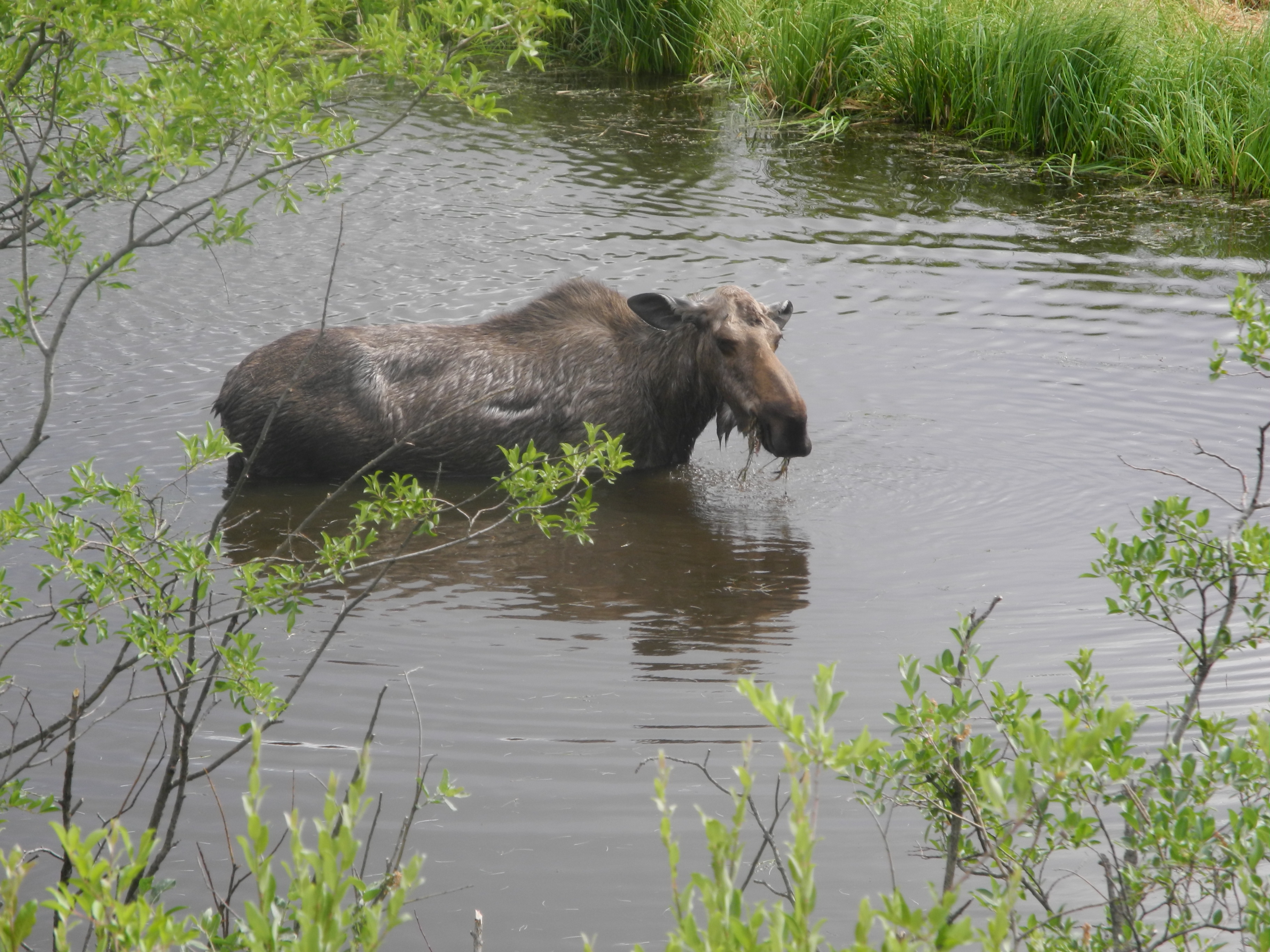
The moose was hot too
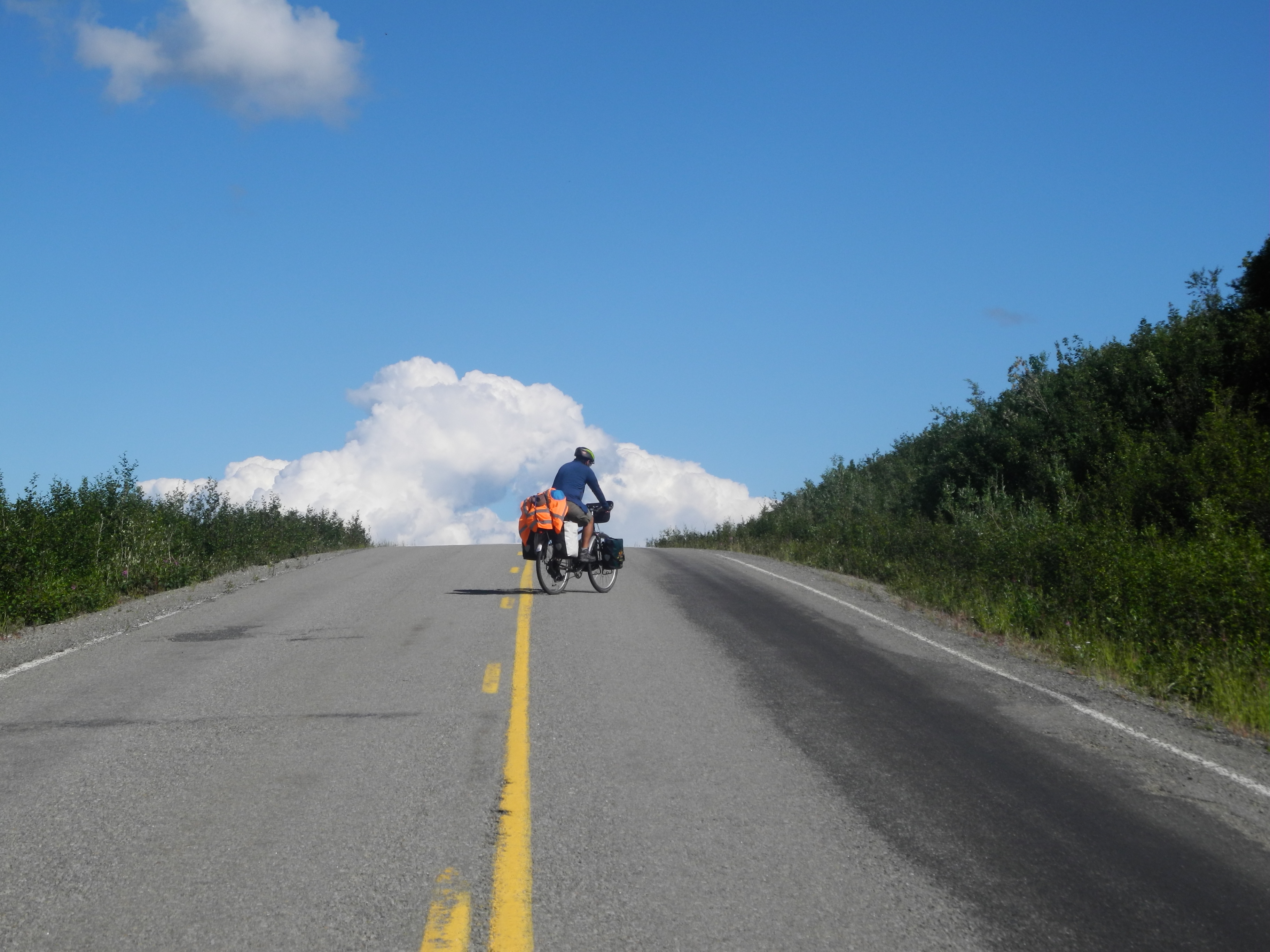
Going towards the Top of the World – literally.
Cycling up some “stairs”
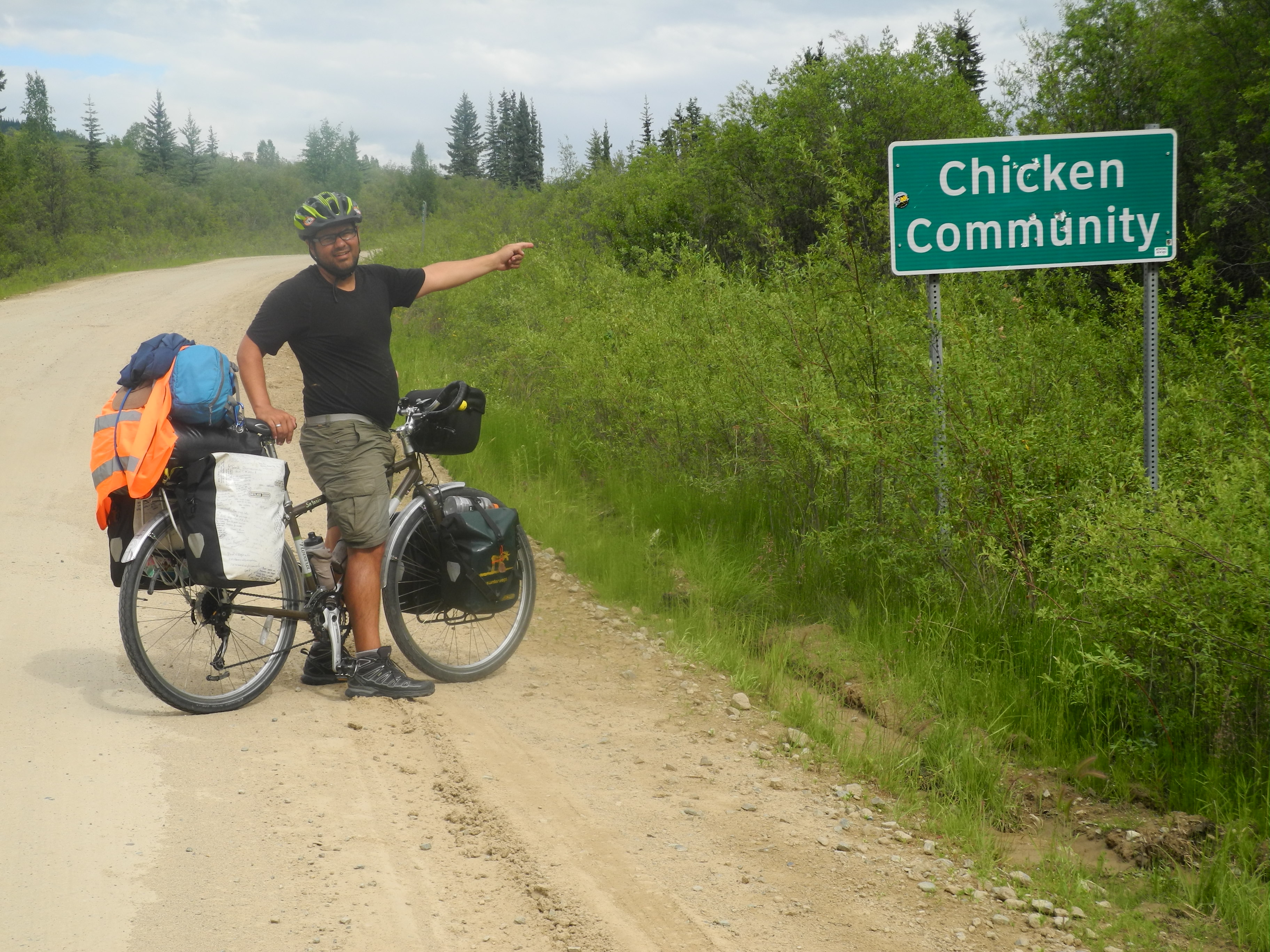
Chicken was home to about 15 people (10 in winter, up to 100 in summer). The town’s name was created in times of gold mining and gold panning.
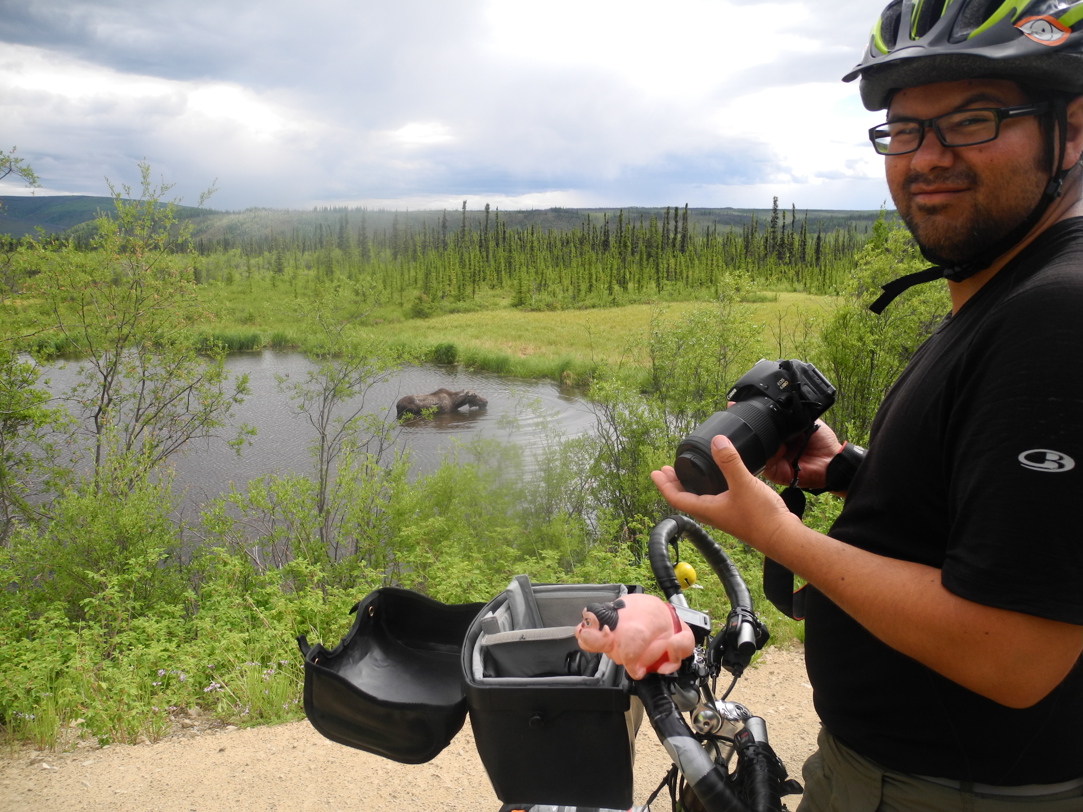
The moose couldn’t have cared less for our presence
The original idea was to call the town Ptarmigan, because so many of these birds lived around here. But nobody really knew how to spell Ptarmigan, and as they didn’t want to embarrass themselves, they simply called their town “Chicken”.
Are you a chicken, Marty?
Chicken has three public outhouses but no flush toilet, no public phone, no cell phone reception. The road to chicken is closed from late October to early April and the only way in and out during that time is by air.
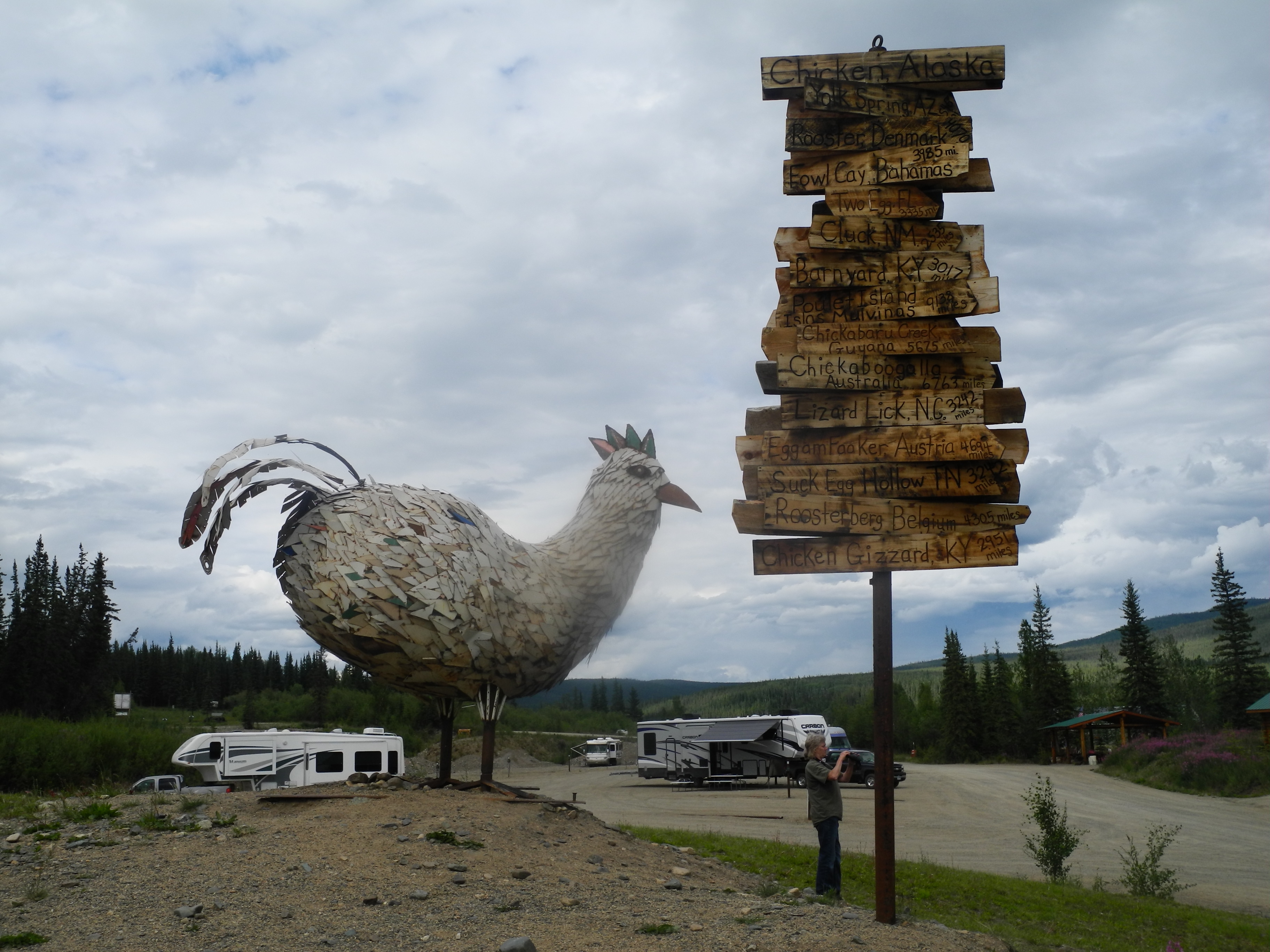
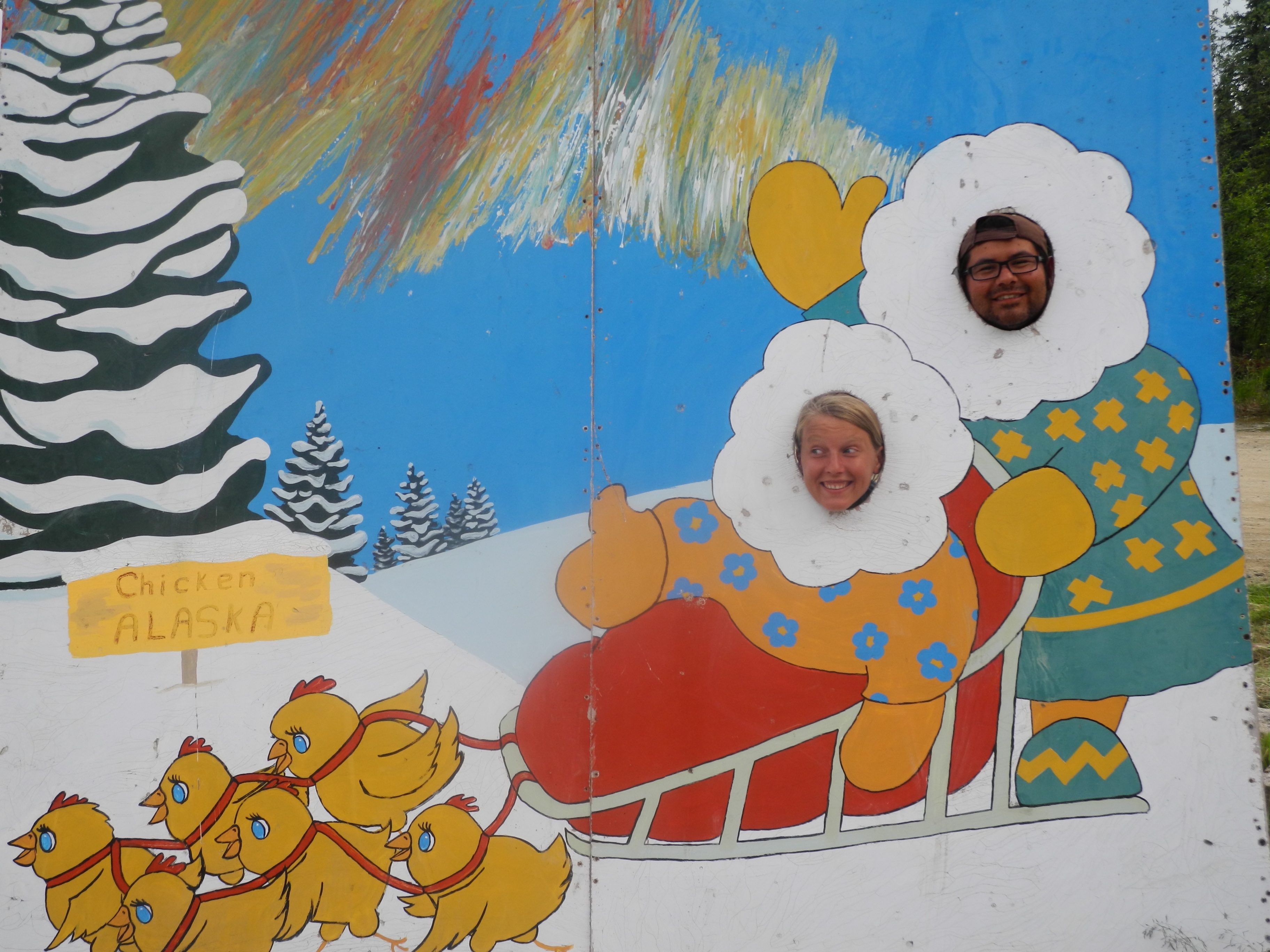
From Chicken, Alaska to Rooster, Denmark
Chicken was a sleepy little village until Susan Wiren, owner of Chicken’s “downdown” (three shops), brought the first adventurous tourists.
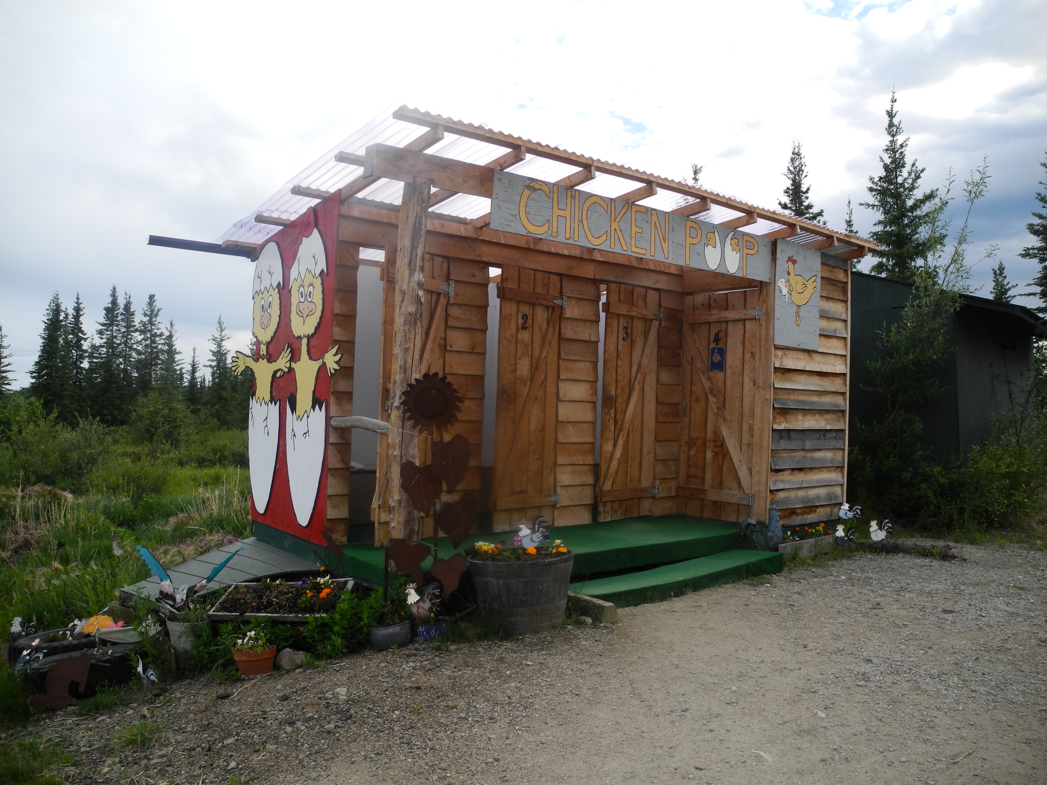
Chicken’s public outhouses
Now she lived from the sale of key chains, stickers, delicious cinnamon rolls, reindeer sausage, shirts and booze. It was her brilliant marketing skills that turned the forgotten miner’s town into the touristy Chicken.
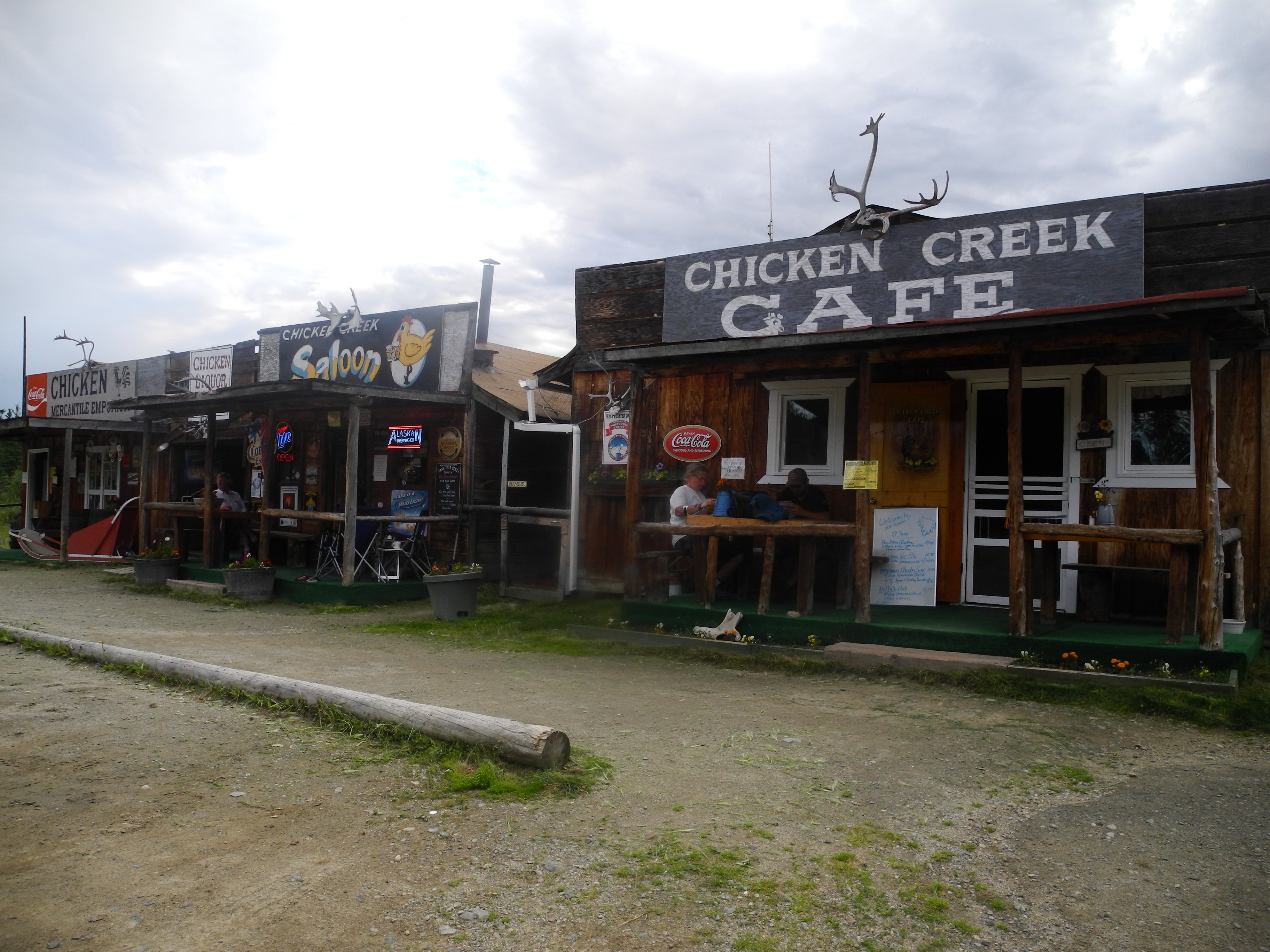
Chicken Downtown
Susan lets visitors camp for free behind downtown. If only we had known that before we paid for the campground. They advertised free fire wood, free Wi-Fi and showers.
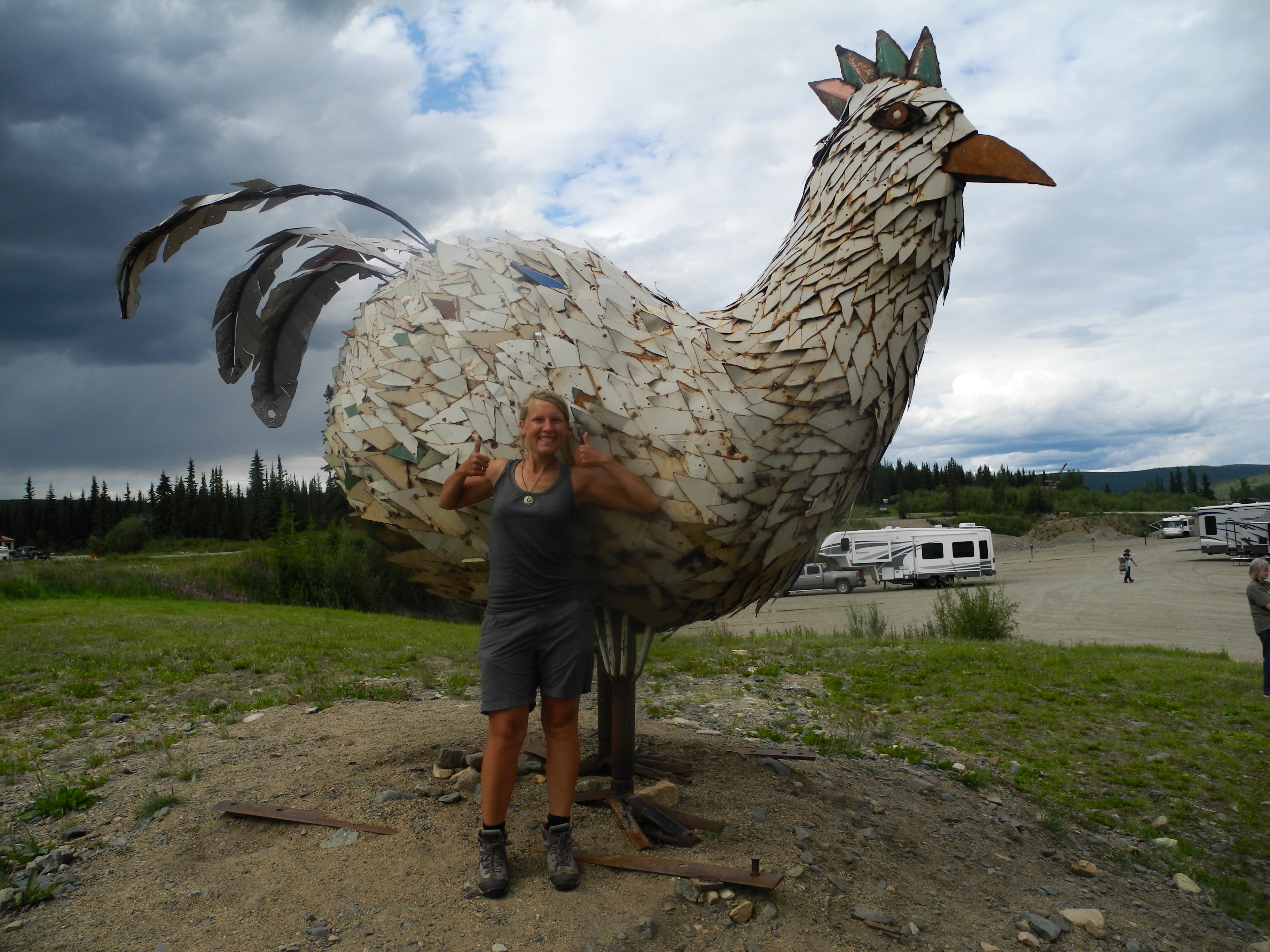
Posing with chicken’s chicken
Well, there was a fire ban, so no fire wood. There was a wife to connect to, but it was so slow that it took full 20 minutes until I was able to read an email. And the shower eats far more coins per minute than we had brought.
We clearly have made it to Chicken.
On departure day’s morning we visited Susan’s restaurant and she gave us two of yesterday’s cinnamon rolls for free. It was a busy morning for Susan who ran the restaurant by herself until 11 am, so she just made her own customers help out.

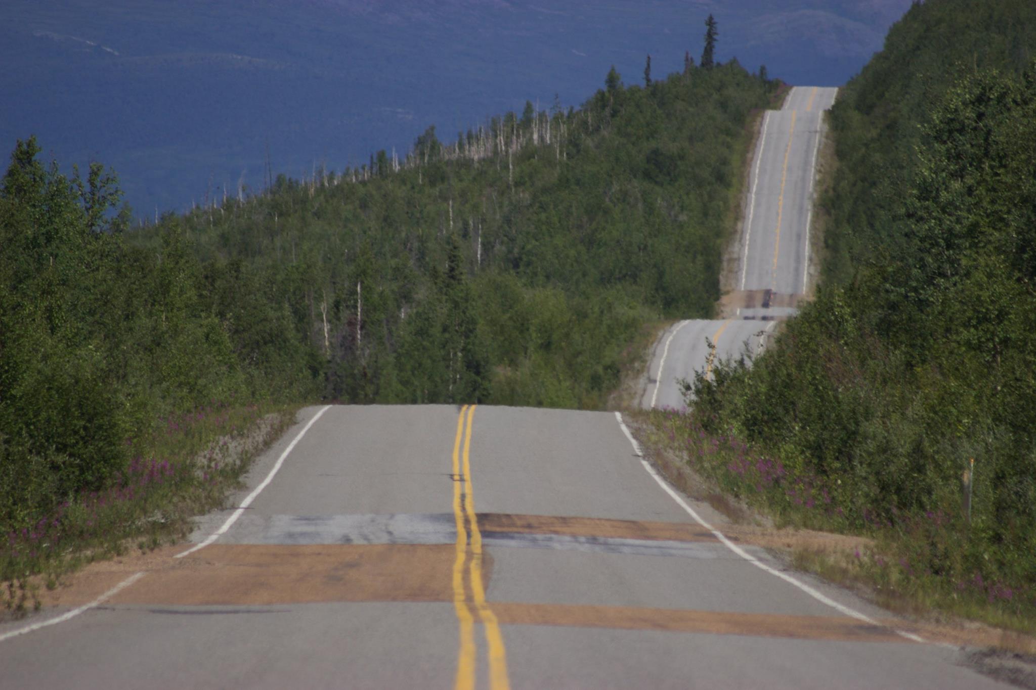
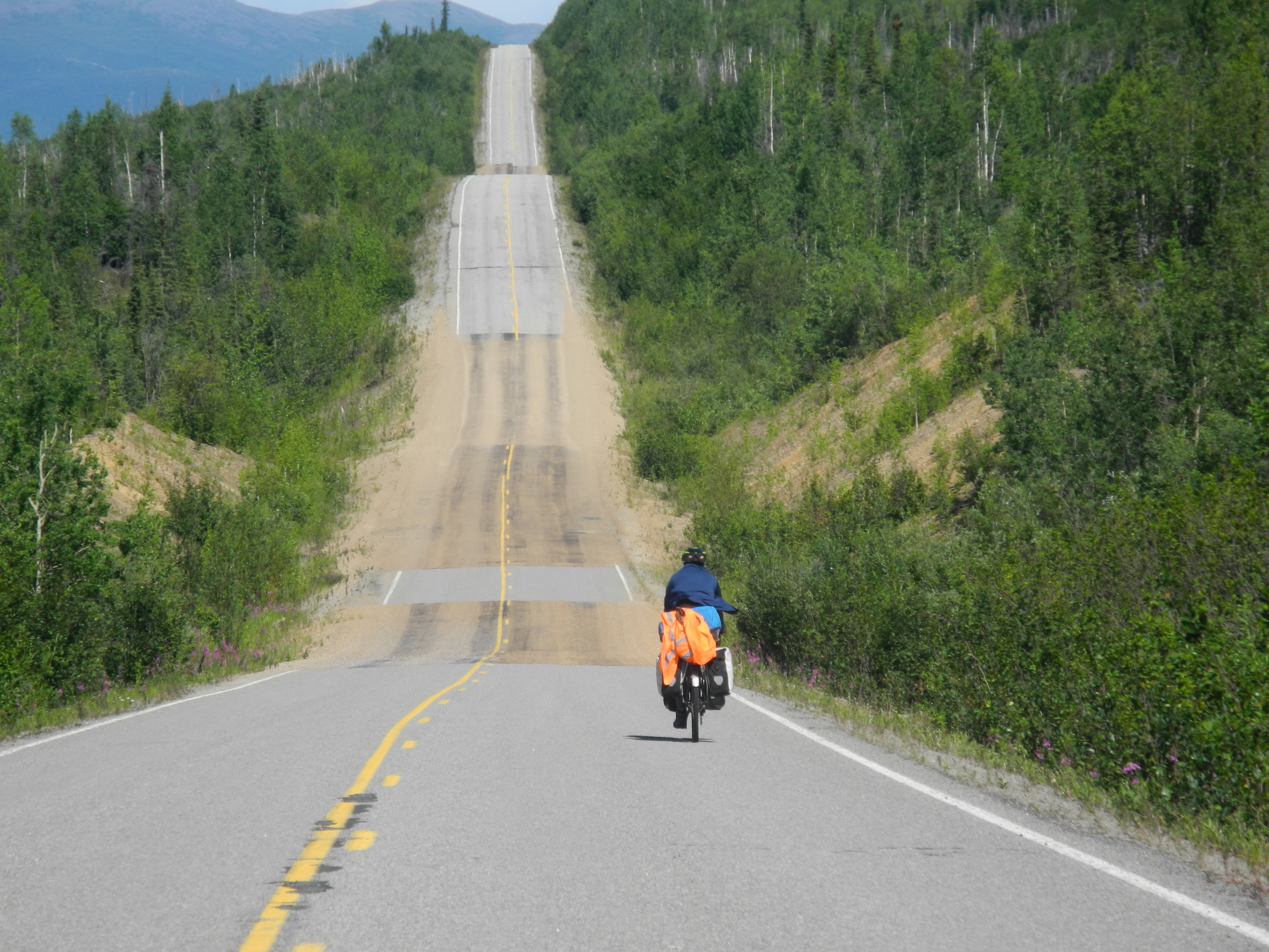
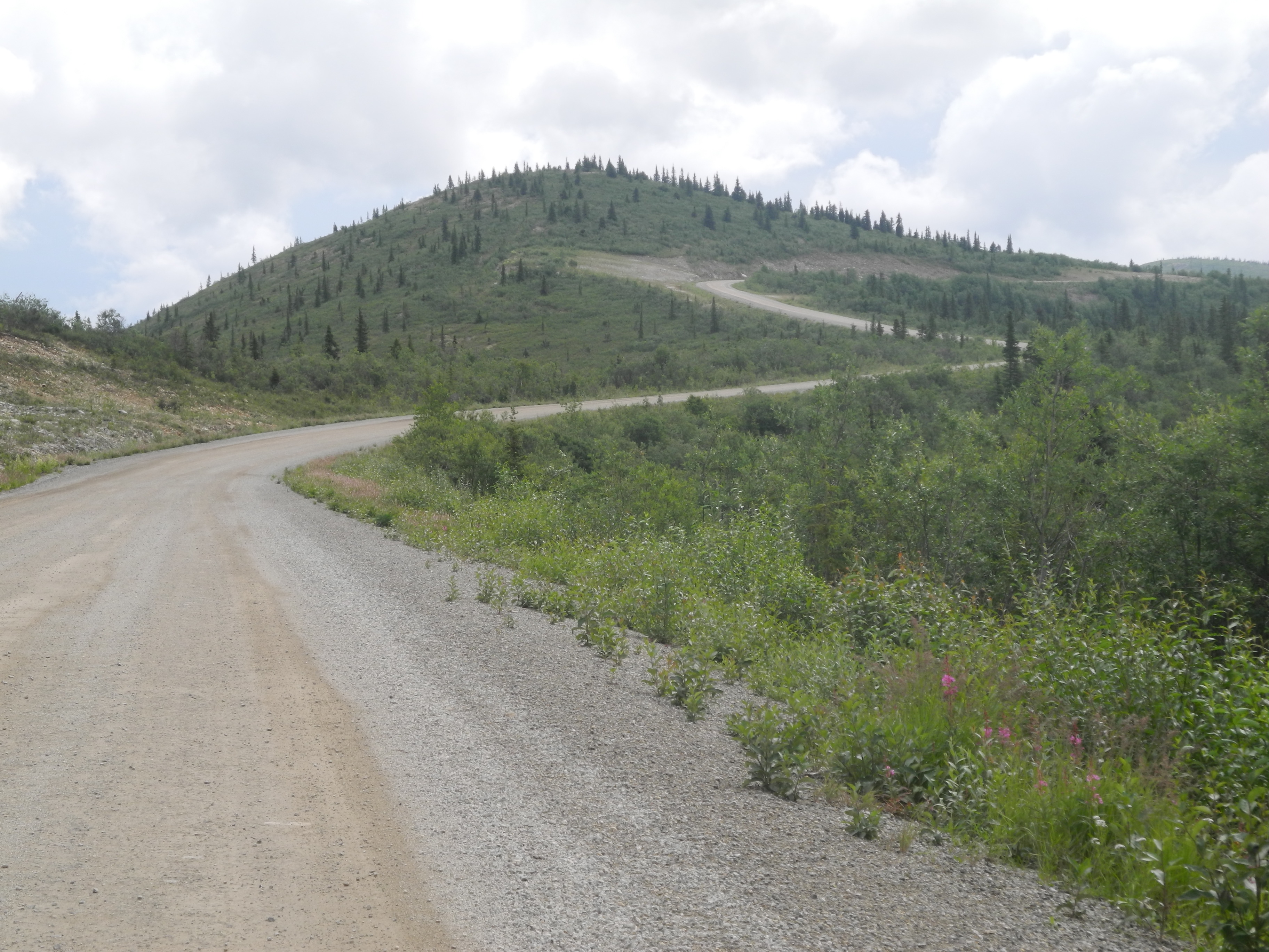
Up and down
She sent a young man outside to shout “Paul, breakfast is ready” and made an elderly lady clean her own tray and bring it back to the counter.
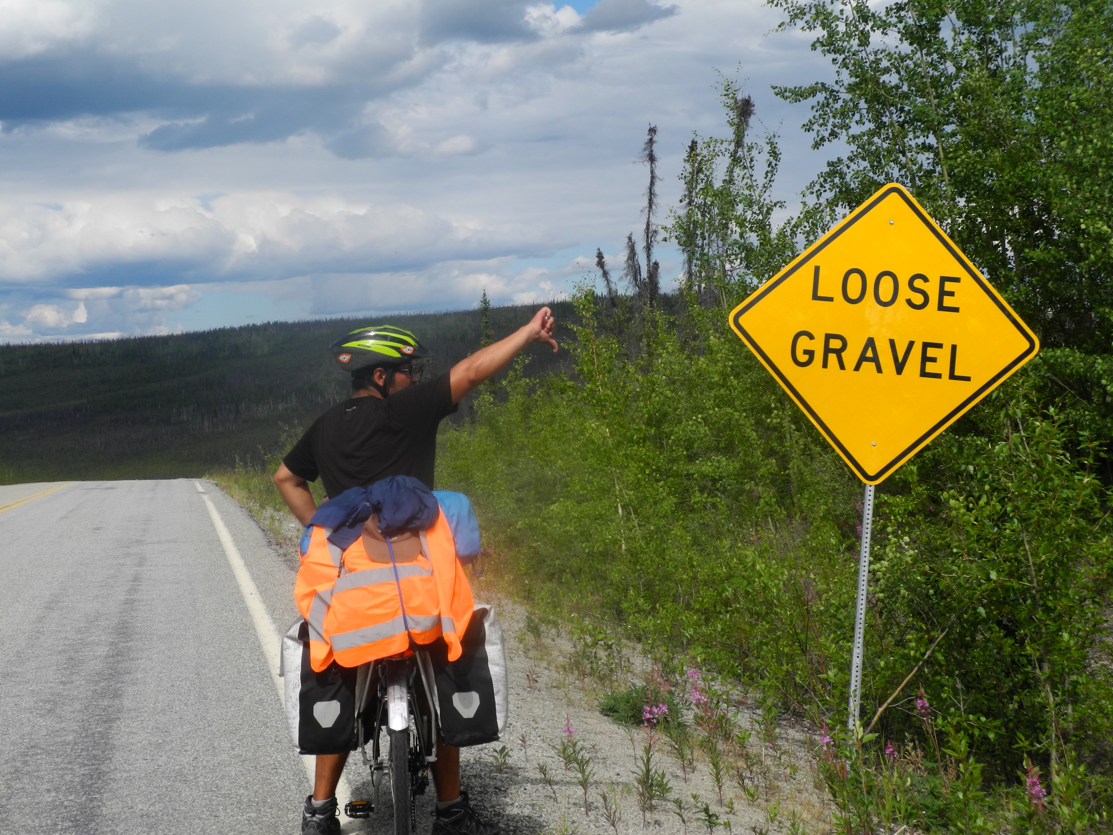
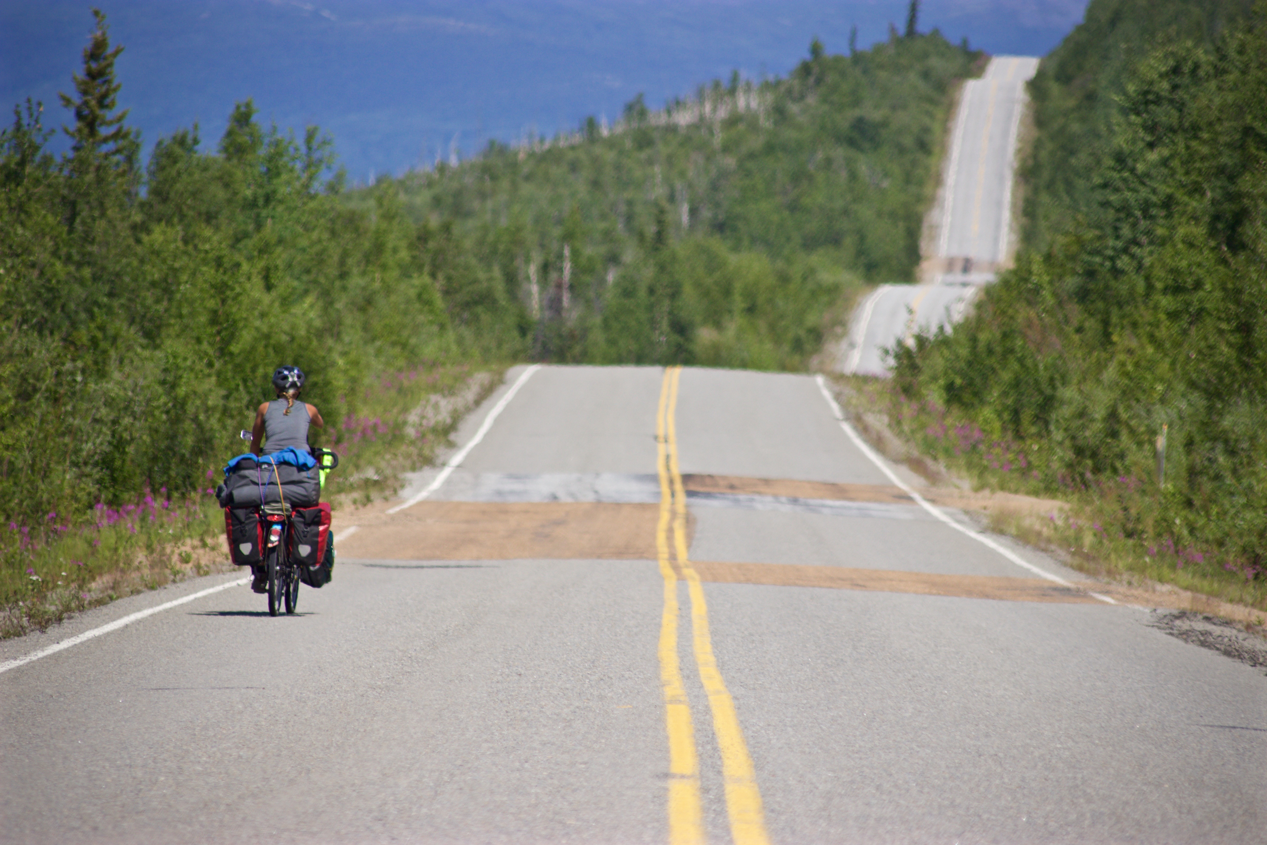
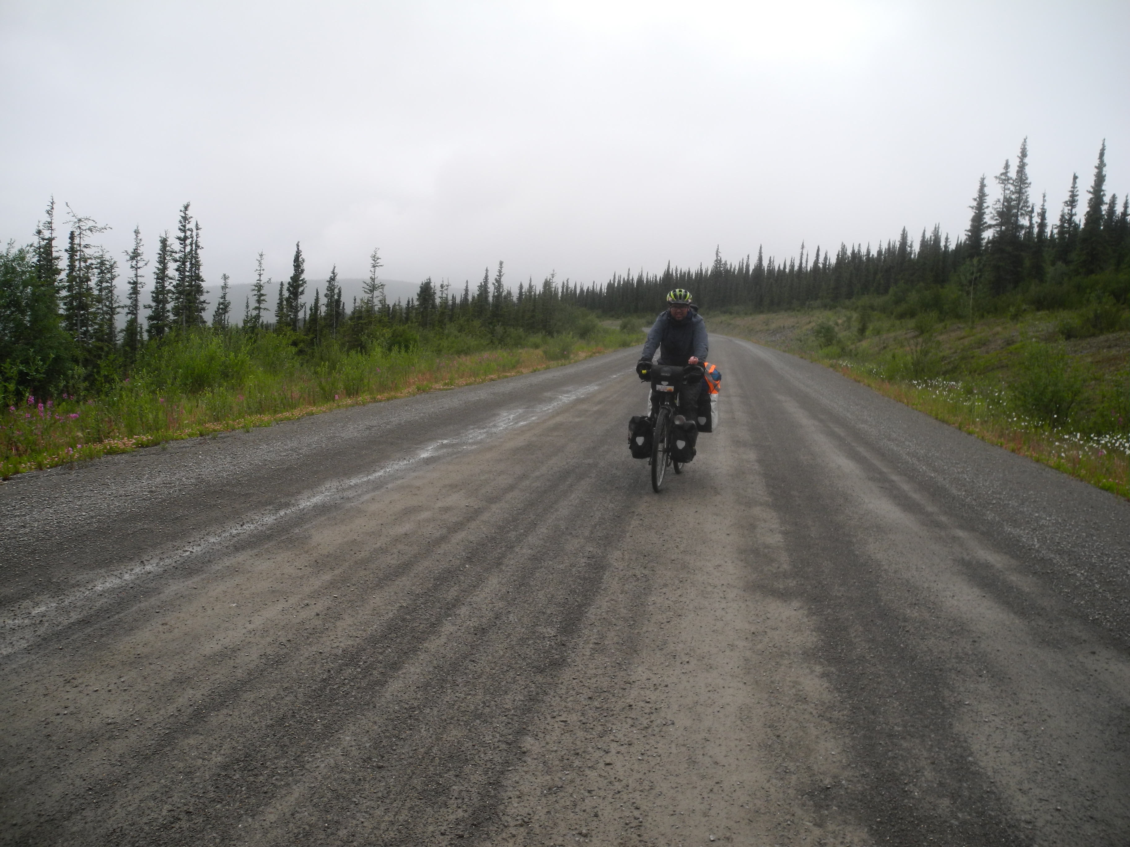
The pavement ended some kilometers before Chicken. Loose gravel is a cyclist’s nightmare
Martine had long been gone when we were ready to start the day’s ride. The road lacked asphalt since just before Chicken, but the surface was in very good conditions. Out of the blue we were surprised by a rainstorm. My rain pants were somewhere inside my panniers and by now it was raining too much to open them.
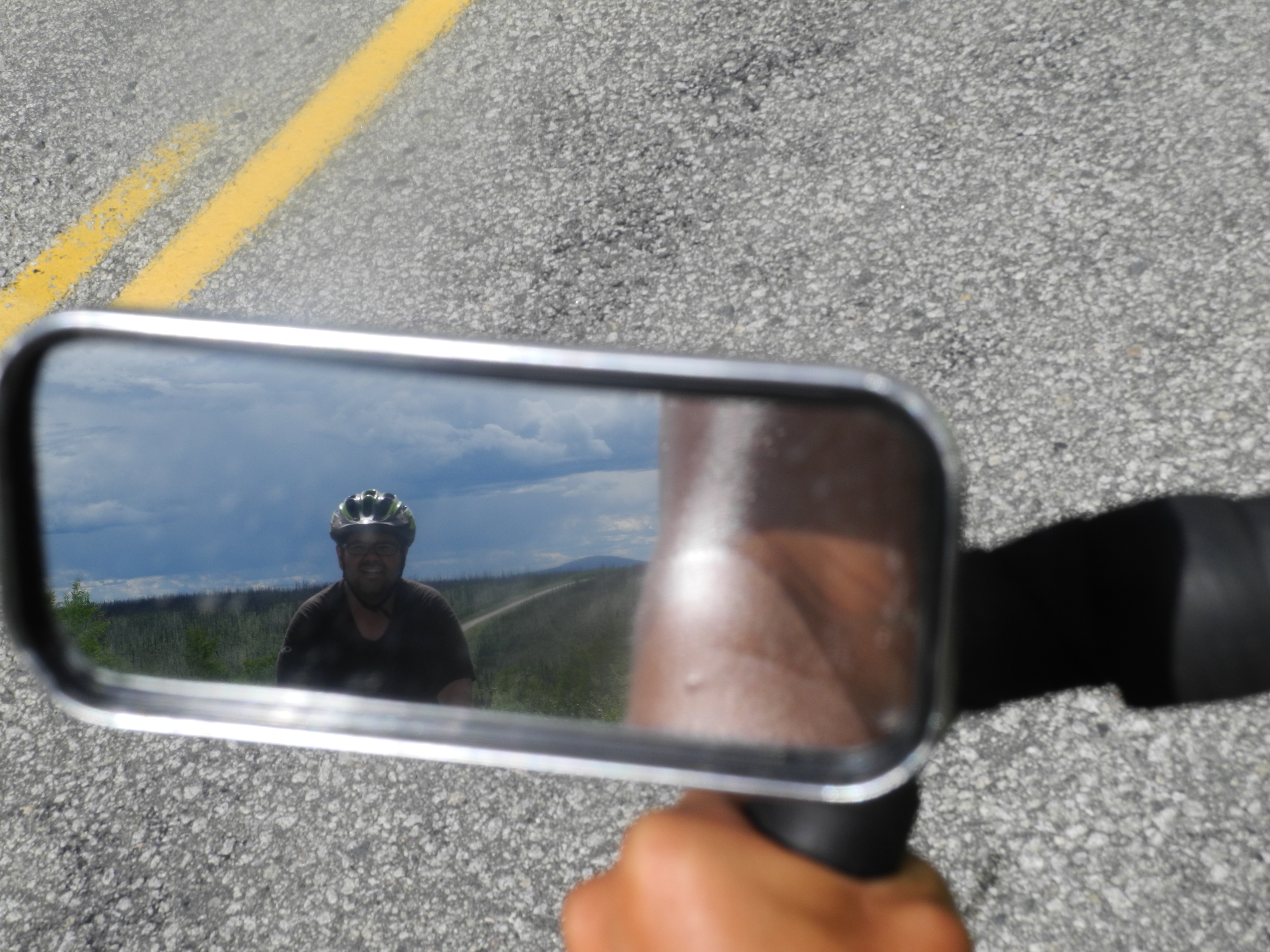
Good views on the Taylor Highway!
We biked as fast as we could because we knew that it couldn’t be far till the next campground, where Martine had found shelter. It was too late. We were soaked to the skin. I was freezing under the little rooftop, so we prepared some tea and quick pasta. I changed clothes and continued the day in sandals, because my hiking boots had filled up like sponges.
Goodbye pavement.
Martine had problems with her knees and decided to hitch a ride up to Boundary. We biked. For quite a while we followed the Jack Wade Creek, a public Gold panning creek that was open for everyone who brought a pan.
Unfortunately we didn’t have a pan. Or time. Or the know-how. Later we found out that there was still quite a bit of gold left in the Jack Wade Creek.
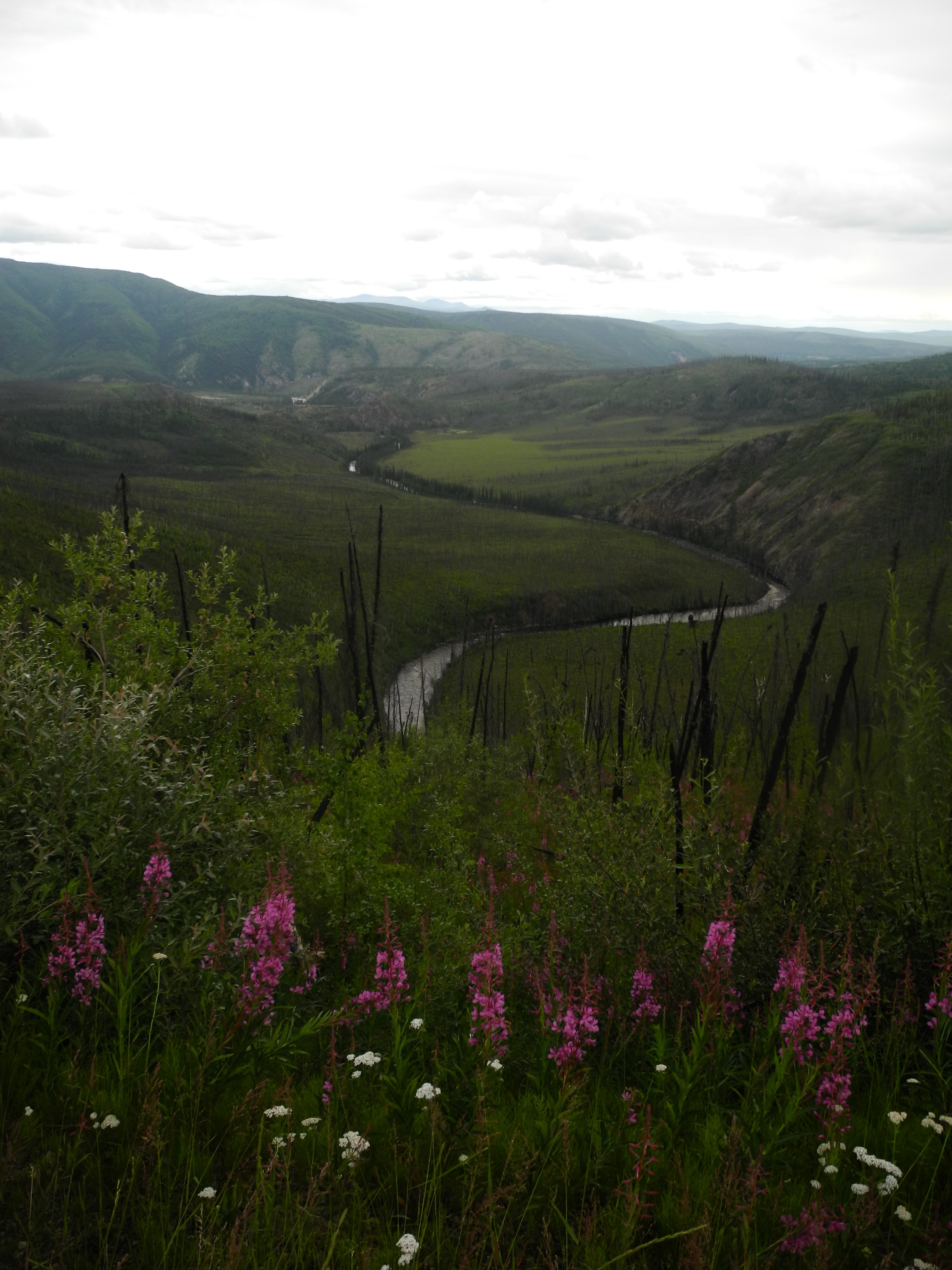
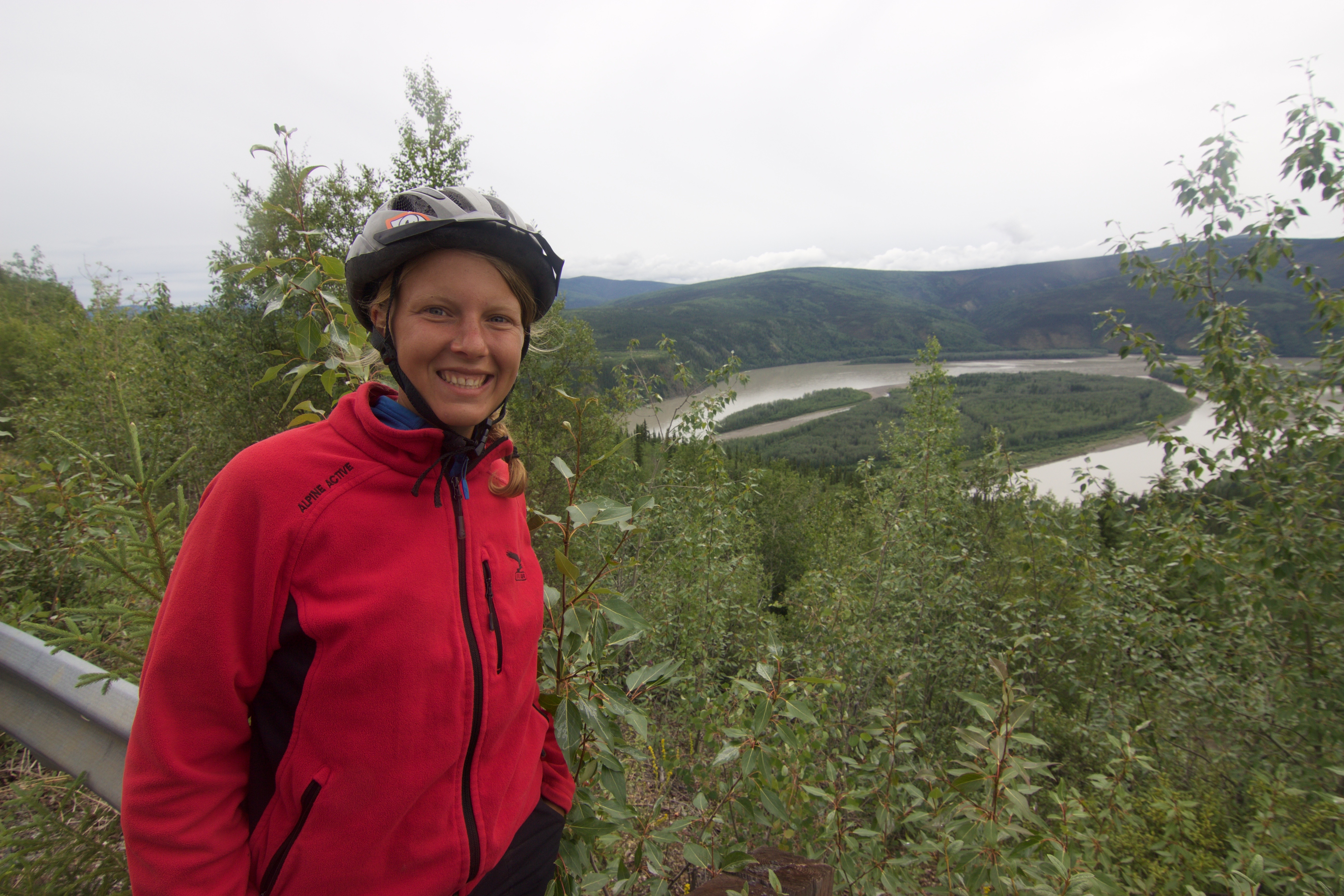
Nice views down onto the river, just before the first raindrops fell on us.
This roads led us all the way up to the “Top of the World”

The Jack Wade Creek is free for anybody to pan for gold. I wish we had brought some pans and time (and know-how).
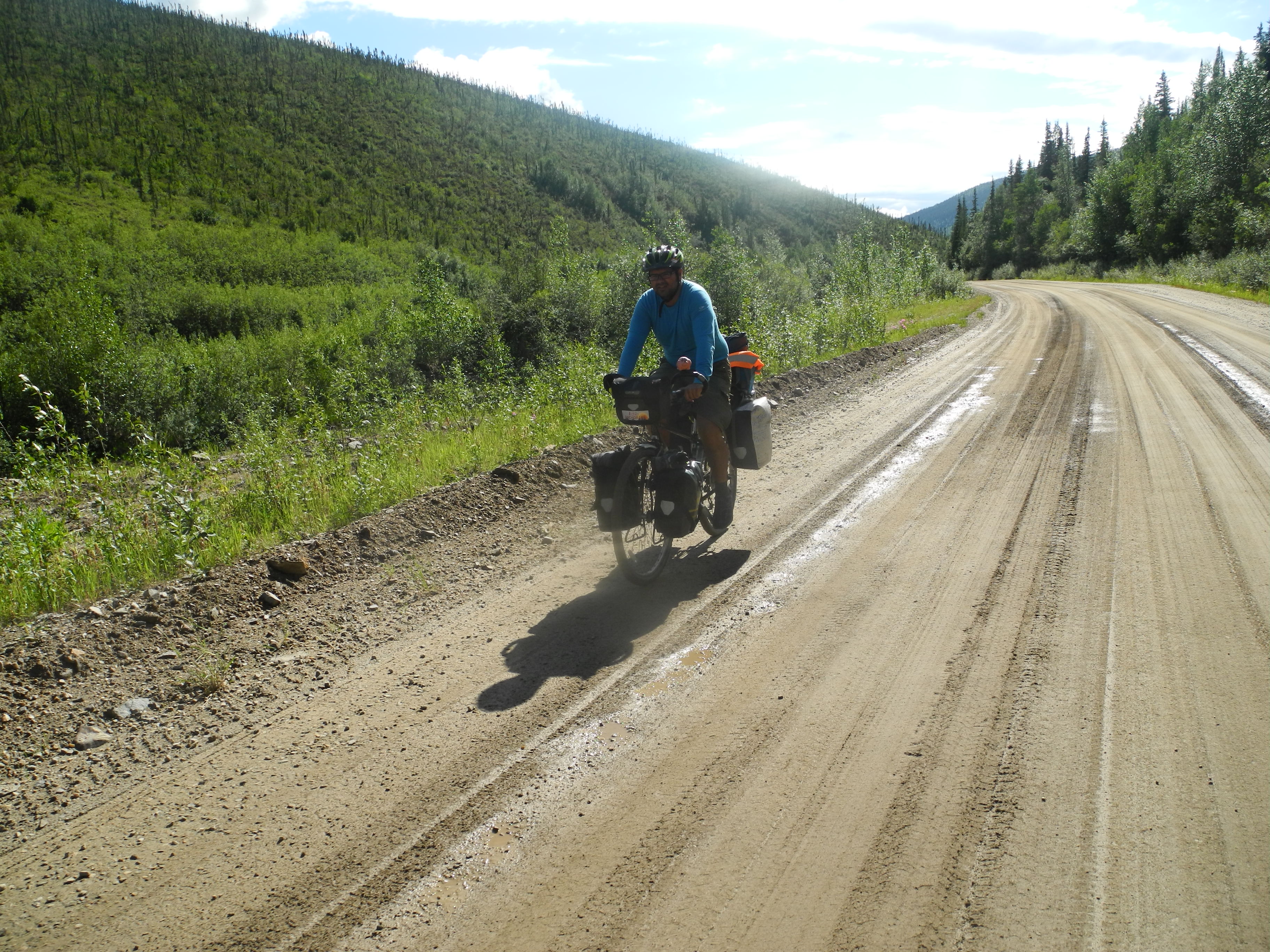
The road surface got worse soon and the climb turned steeper. It was a hot day and I was sweating at speeds of 3-4.5 km/h. I made a good feast for the mosquitoes. One of them sat down on my eye. I gave it a good punch, but missed. The mosquito was alive and my eye hurt. I like to blame this not so bright idea on the hot sun melting my brain.
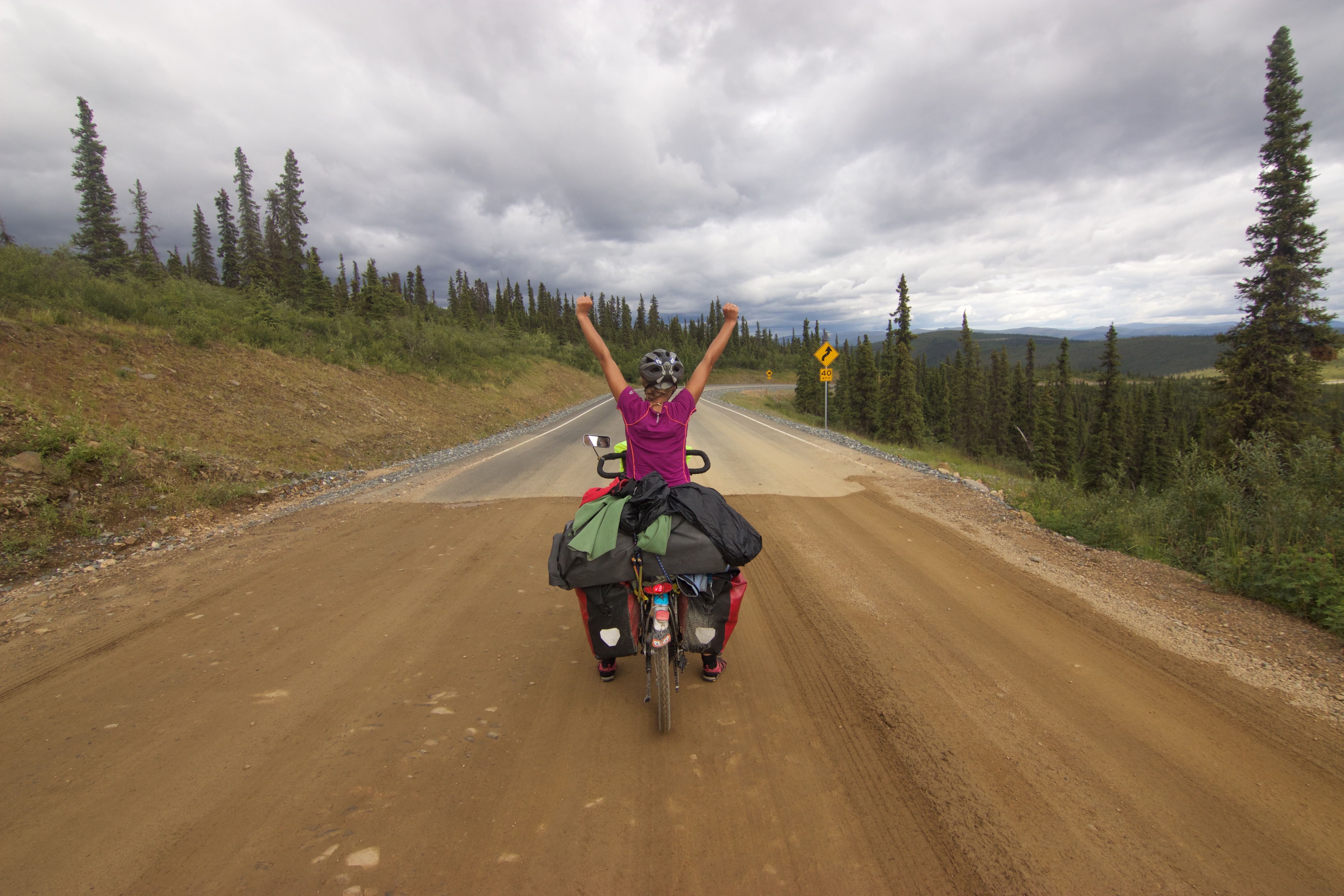
By the way THIS is what we had to climb on the way to Chicken. Looks scary, but it was surprisingly doable

Sometimes I feel like I drive a loaded truck
Teaming up with Martine from Québec
It was a bit of a fight, but eventually we made it up to the range, where the road split. We had finished the Taylor Highway and continued on the (now paved) Top of the World Highway.
Back on the pavement!
There were some ups and downs, but we were high up enough and it was late enough in the evening, that we didn’t sweat too badly anymore. “Boundary”’s first buildings were in sight, when the first rain drops fell down. Not again!
Martine on her bike
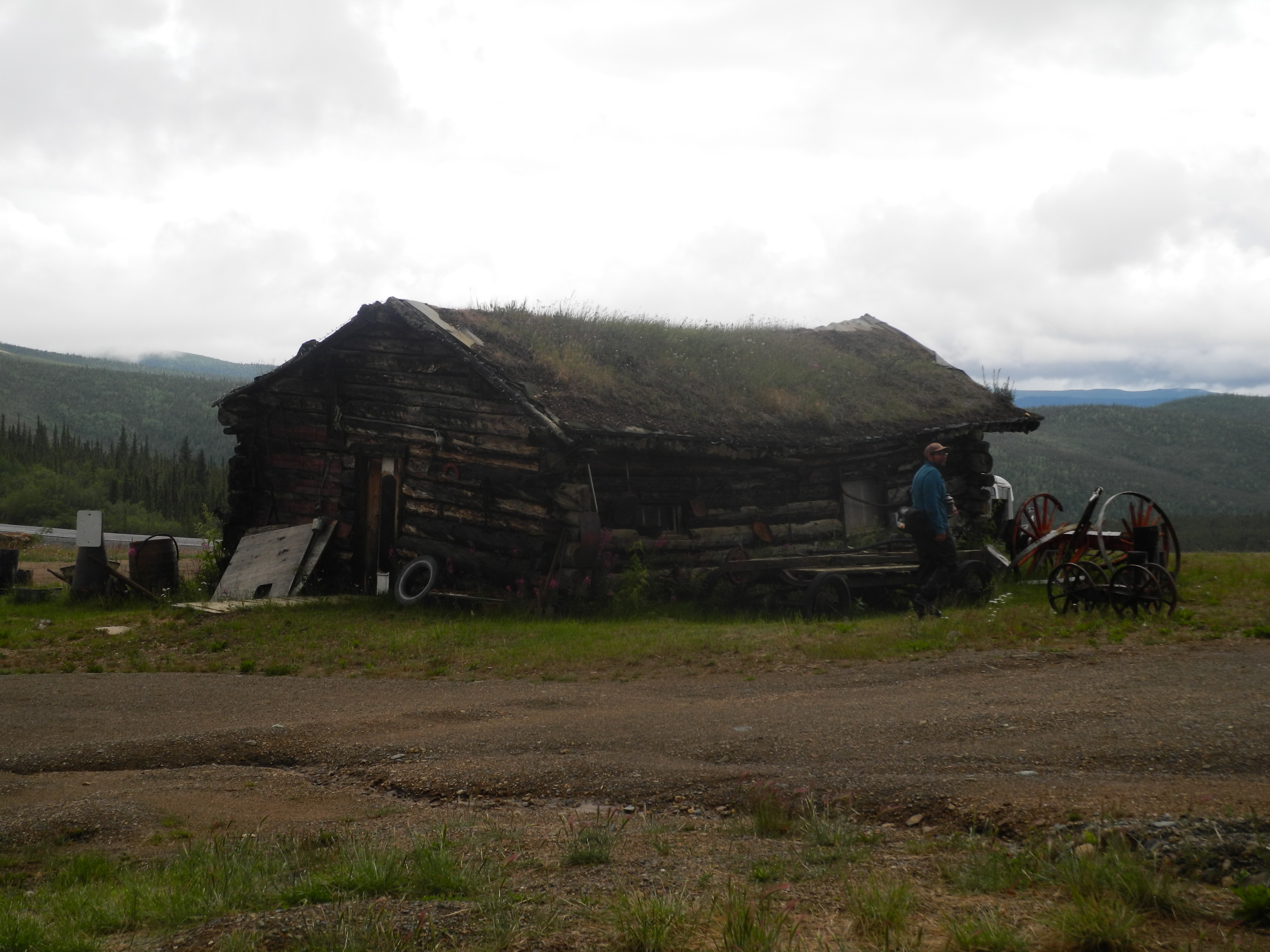
We biked like crazy, as fast as we just possibly could. And we made it in time. Boundary was a very very small village. We spent the night inside an old warped log cabin.
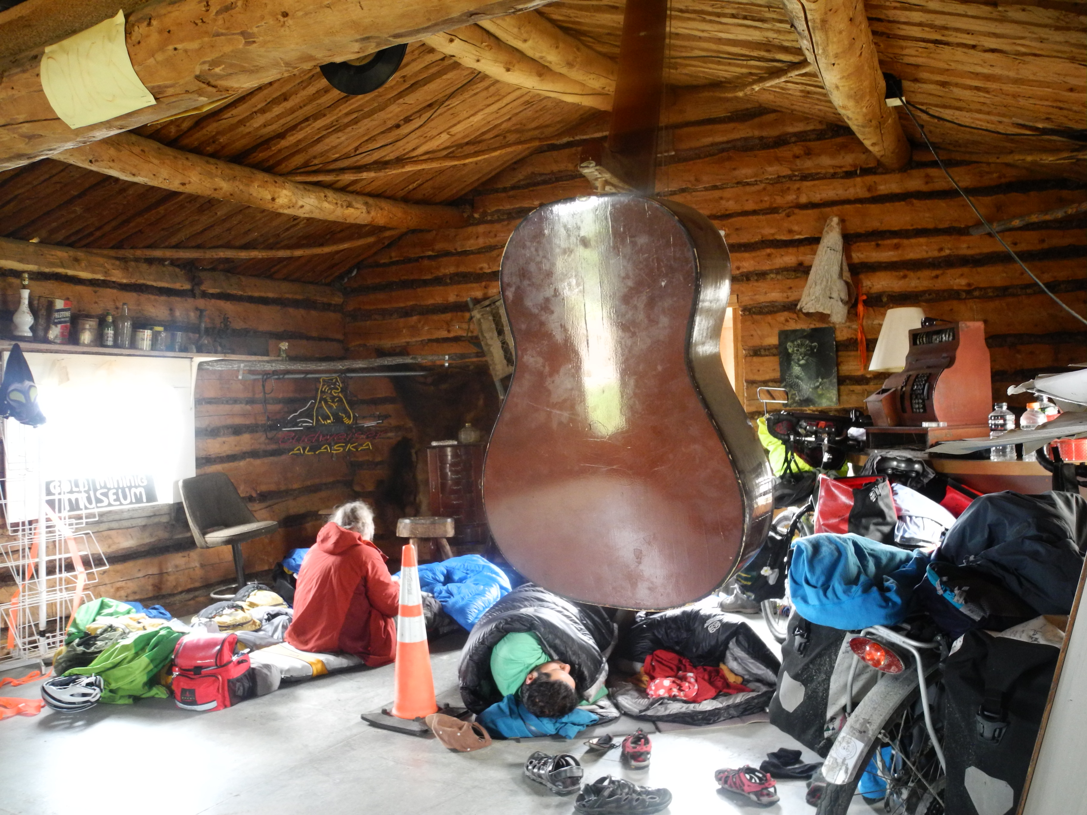
Comfy indoors camping in Boundary, Alaska
The walls were so crooked that the entrance was “at your own risk”. Inside the cabin there were all kinds of artefacts for the old times. What now works as a museum has been built in 1926 by the mining community for shelter.
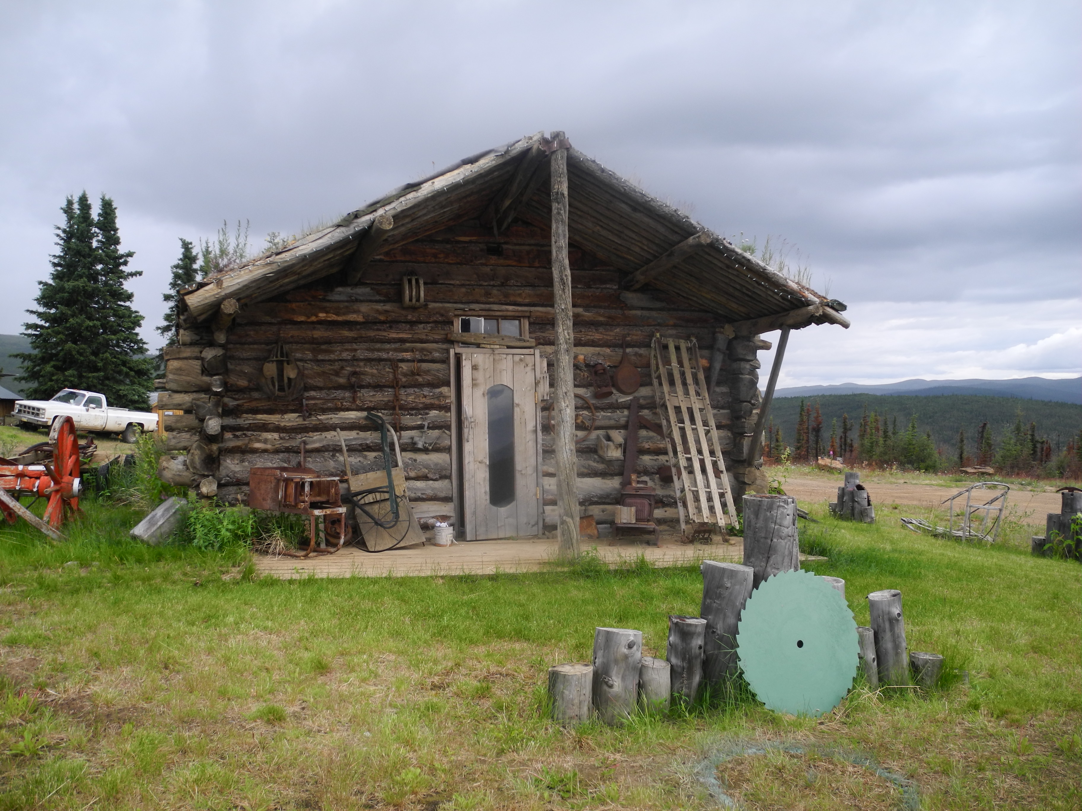
Home for tonight: Boundary’s Museum
It was great so sleep indoors for a change, but the millions of mosquitoes and Martine’s squeaky airbed kept me up most of the night. At least the cabin didn’t collapse in the wind.
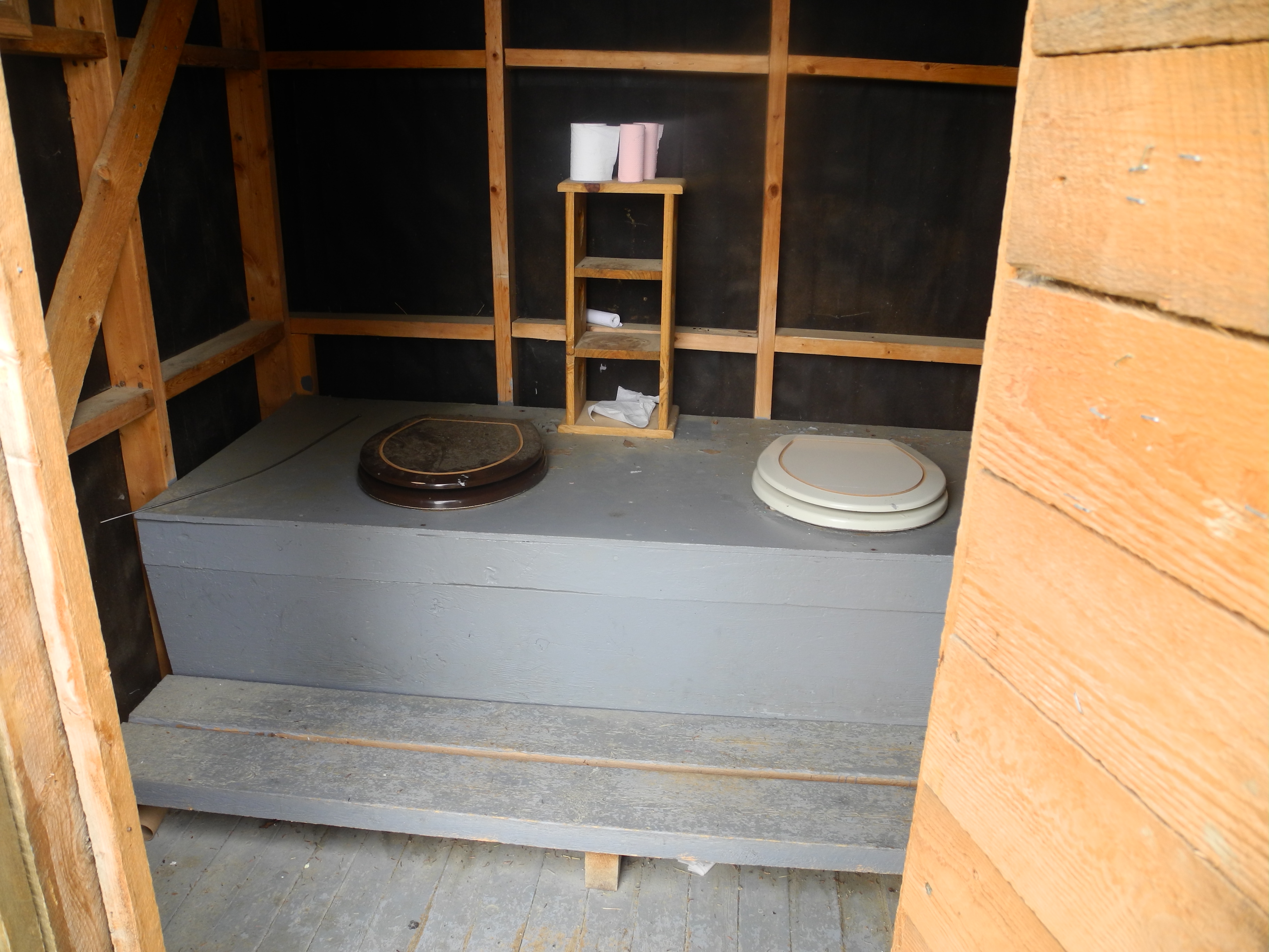
Outhouse for chatty people
It was a rainy morning when a man opened the door. His name was Tyler and he was Boundary’s inhabitant. The only one. This position automatically made him sheriff, mayor and caretaker of the museum too. He lived in a caravan behind the museum and was very happy to have some nice company to invite for a coffee.
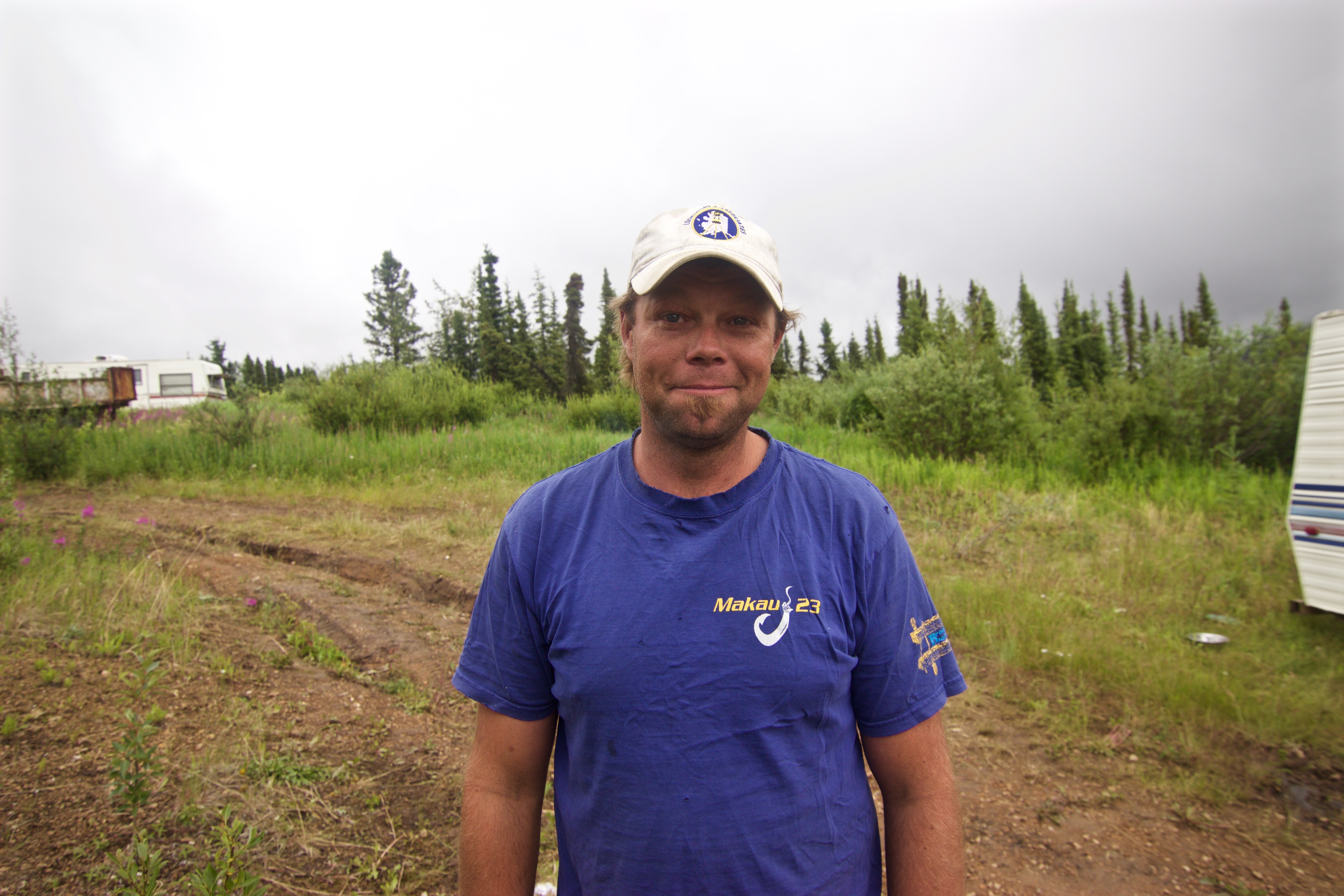
Tyler
Martine decided to get started, but Roberto and I followed Tyler into his green house where we drank coffee. Tyler told us about the crazy folks he had met here. Not long ago there was a Japanese guy who skateboarded all the way from the border with Canada down to Chicken.
We were pretty lucky in this old little cabin
Not much later there were 20 cyclists who had visited the “Chickenstock” (Chicken’s one and only annual music festival) and all of them spent the night together inside the museum. Tyler is always happy for some nice company, so, dear cyclists, don’t be shy and pay him a visit if you’re near!
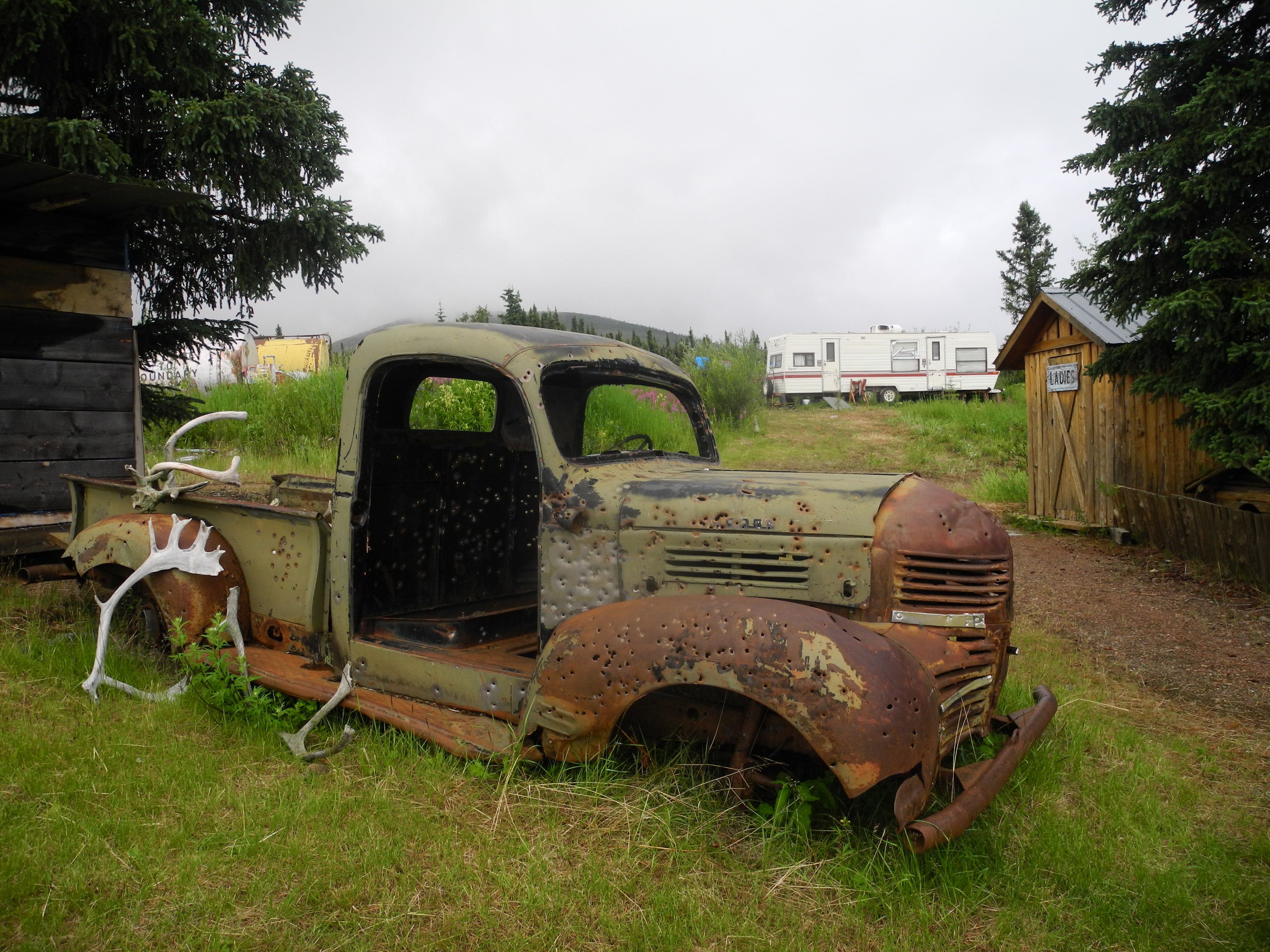
Tyler’s old car cemetery
The rain didn’t get much better and Tyler offered us to spend another night in the museum, but it was July 1st, Canada Day, and we wanted to reach Dawson City by nightfall, so that we could celebrate. And with Martine gone ahead there was no way we could just stay.

Goodbye Alaska …
I hadn’t heard too positive stories of the Canada-Alaska border, and prepared for the worst, but we were treated very friendly and respectfully and the officer even offered us drinking water for the way.
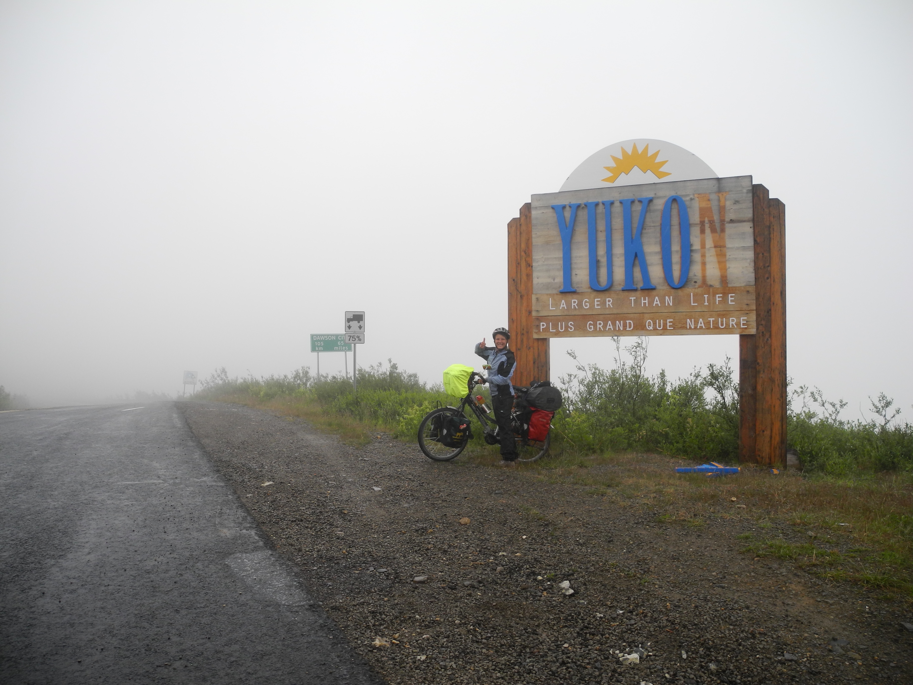
… Hello Yukon, Canada!
Just behind the border we reached the Top of the World Highway’s highest point. 1376 meter and the views were said to be just stunning. We can’t really agree to be honest, because all we saw was fog. We barely saw each other and the next few meters of the (now unpaved all the way into Dawson) road.

I’m on top of the world. But can’t see anything.
We stopped at the only rest area because we were in some desperate need for shelter. Feet and hands had gotten slightly numb and my stomach had been growling for hours.
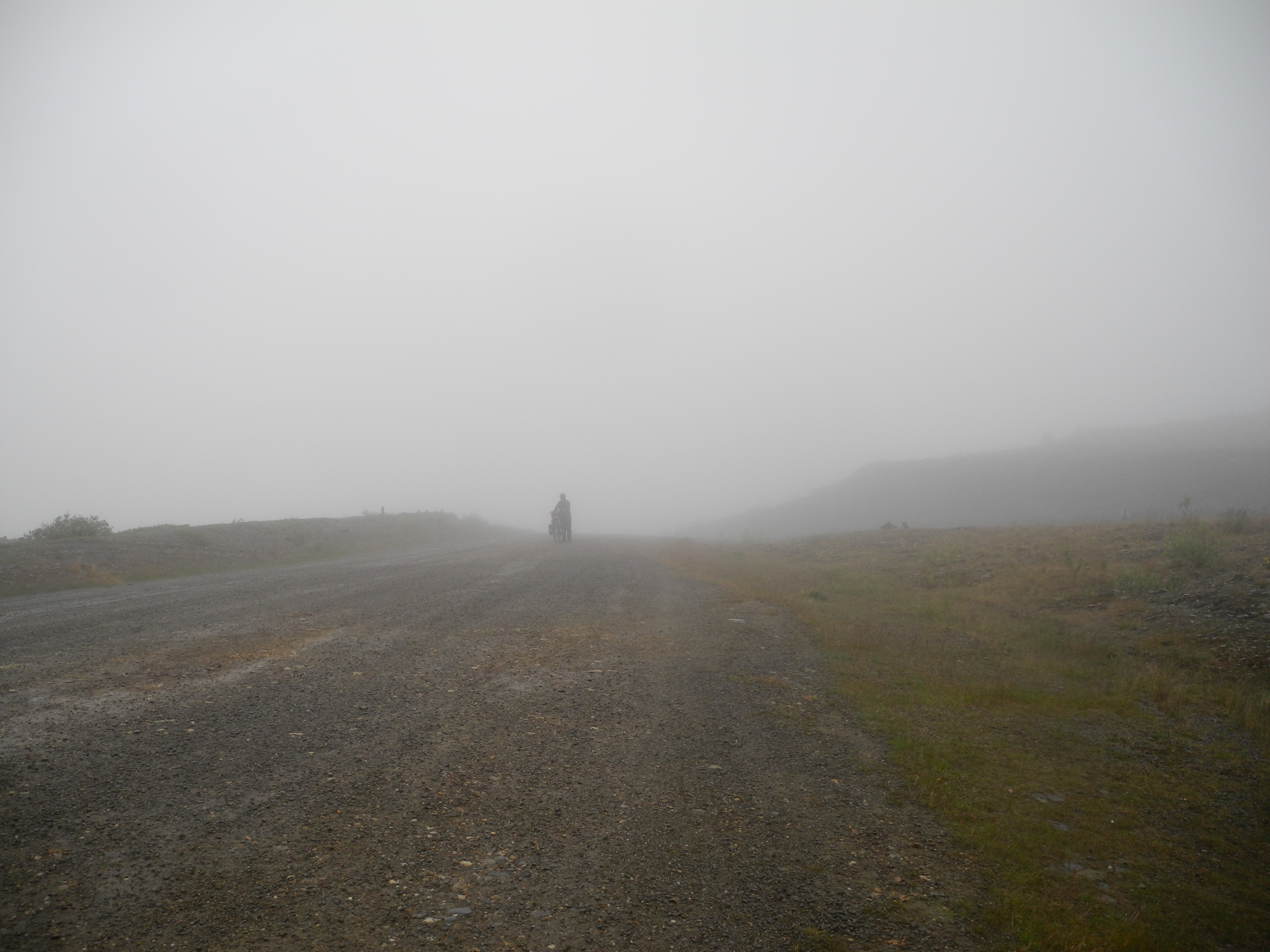
Not so great views.
Our only breakfast had been two granola bars each. So we took the bear canister and stood under the outhouse’s roof, chewing trail mix and gum bears. It was cold, but on the bright side thanks to the cold there was no poop-smell at all.

Snow, fog, cold and gravel.
We continued and I walked for a while to get my feet back alive. The road was steep as never before. Furthermore the surface had turned into rocks that were surrounded by mud. Up, down, up, down. By the end my speed went down to 2.5-3.5 km/h. I didn’t even know that my bike computer showed numbers that low. Here along the mountain ridge, there were said to be stunning views to all sides. All we saw was fog.
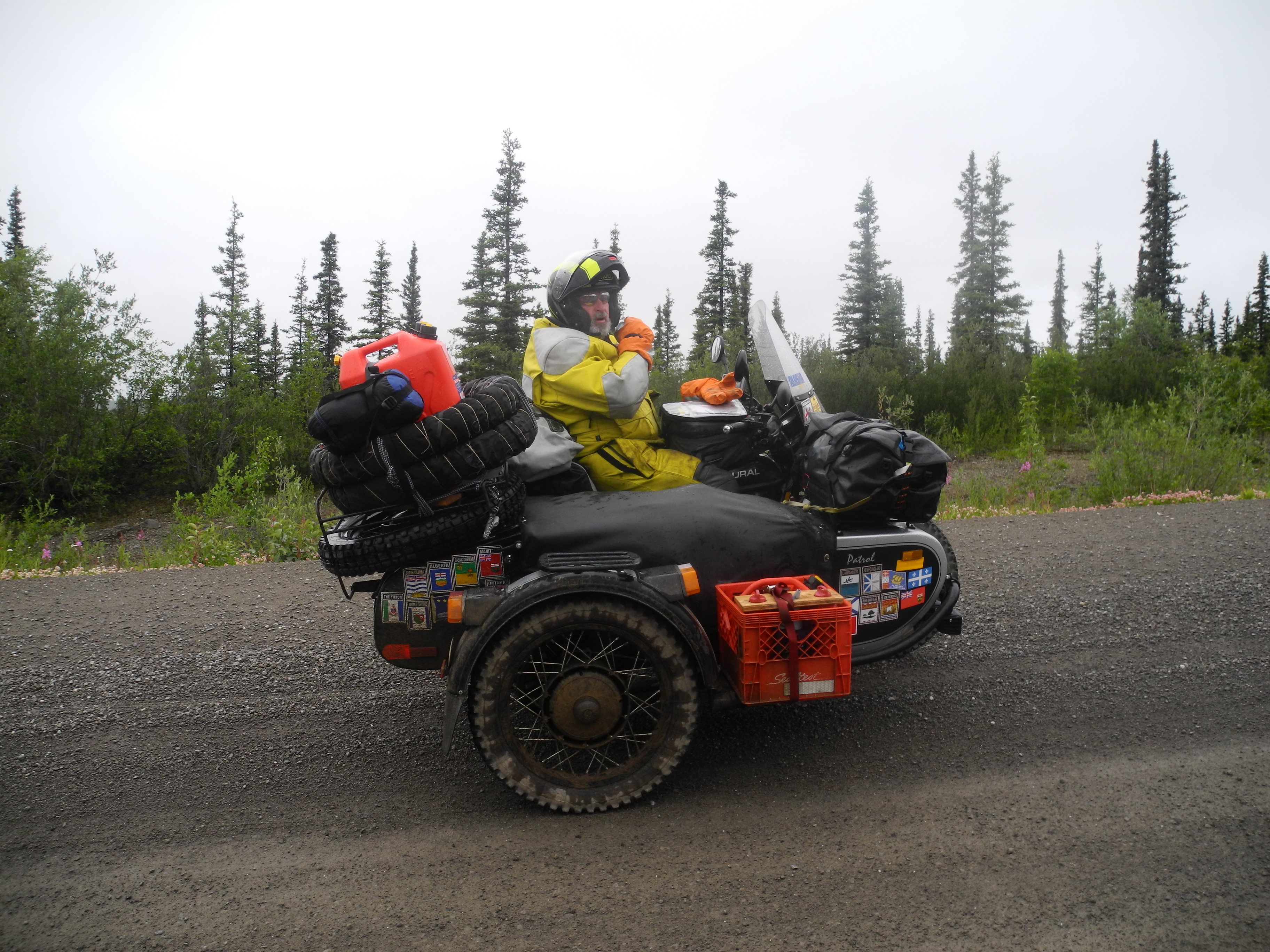
Help and chats on three wheels. Motorcyclists understand the cyclist’s needs and are always happy to help out.
There was hardly any traffic at all. Understandably. A passing motorcyclist stopped and offered us some water. Seriously, the motorcyclists and truck drivers have just been awesome so far. It had stopped raining for about 10 minutes, when a little bus stopped at our side.
At least the rain had stopped
The driver offered us a ride down into Dawson City. Well, as tempting as this offer sounded, we had already made it so far, we wanted to continue for those last 60 kilometers. The driver, being a bike traveler in his holidays, understood perfectly.
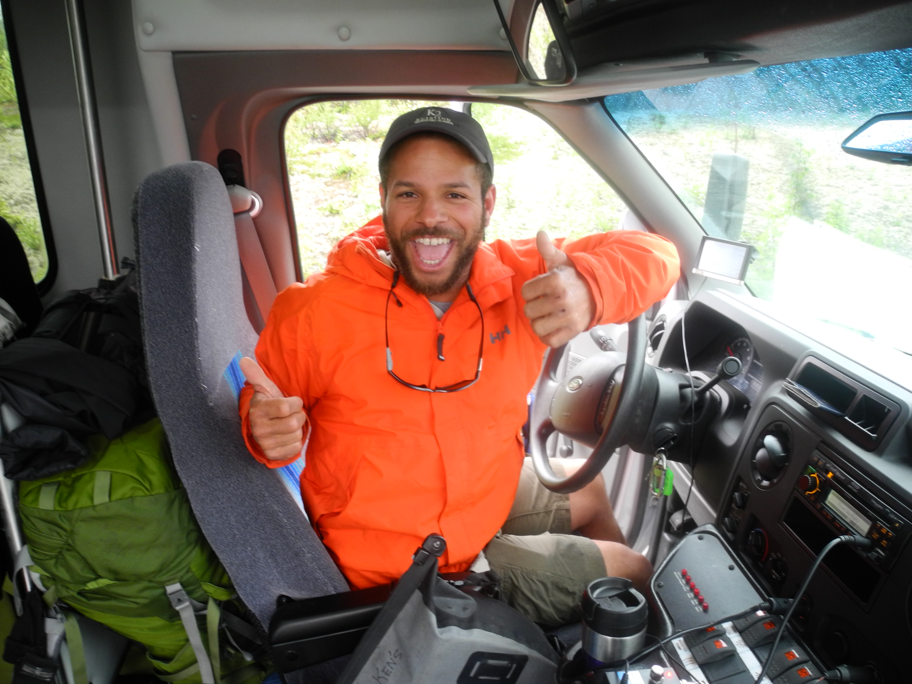
Cyclists-connection
Inside the bus there was a group of Germans on a guided tour and it didn’t take long for the first one to come over and ask us the usual. From where, to where, how long, how much longer, etc. He offered us two apples and hungry as I was I devoured mine within seconds. I saw the pitiful look in the man’s eyes and felt very embarrassed for my behavior. Now the bus started to move left and right and there they came. Half the people inside the bus brought us pretty much everything edible they had brought.
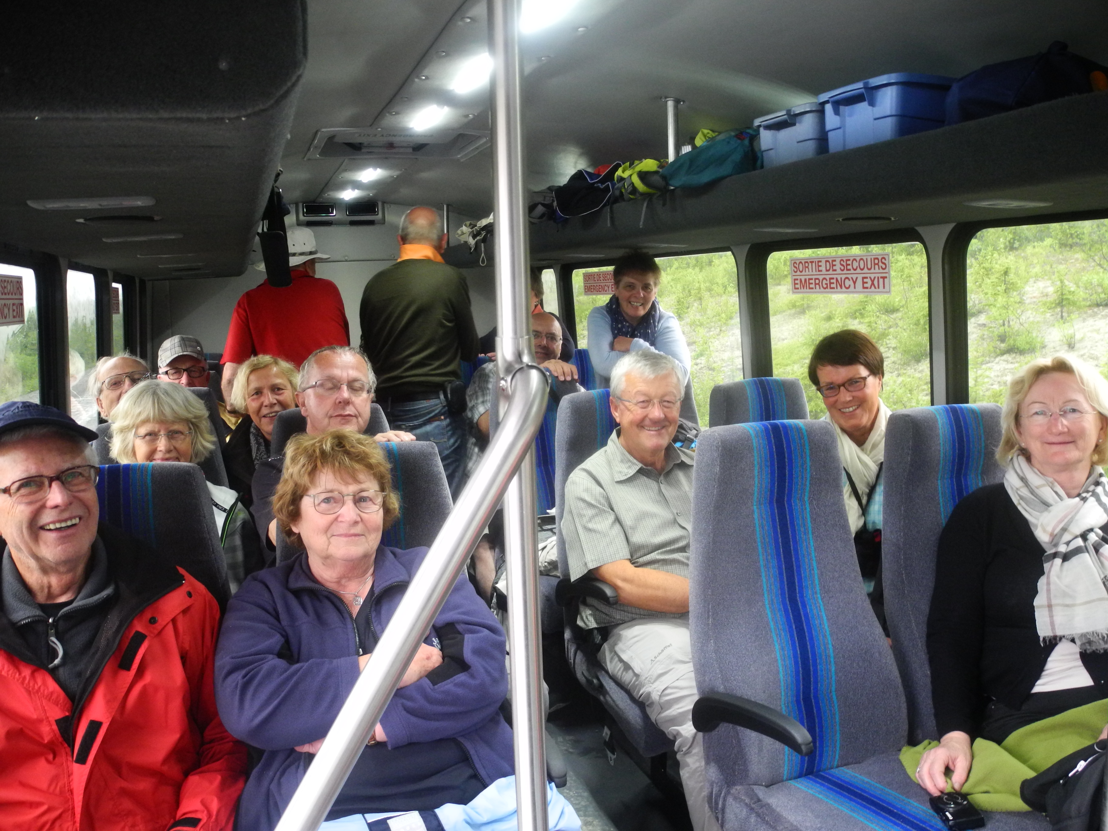
These nice people have clearly changed our day and we are very grateful.
I didn’t even know how to carry all that food. We had been given a pear, four apples, two bananas, two bags of raisins, four cheese wedges, half a loaf of bread, half a baguette, three quarters of a glass of jam, half a bag of cherries, a blueberry muffin, two cans of beer, one can of apple juice and twenty dollars. It felt a bit like Christmas. Even the weather was just right.
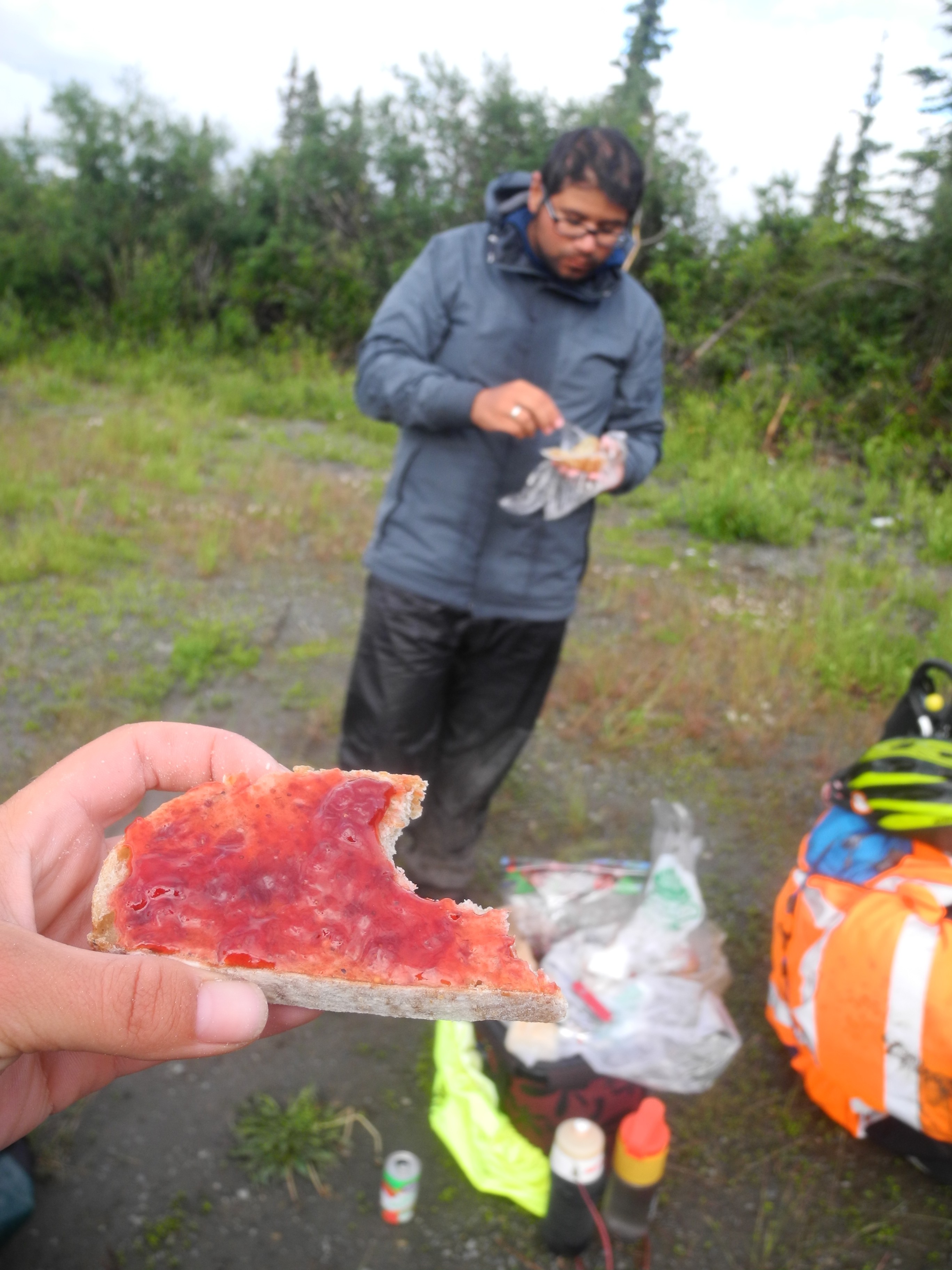
Feast on the side of the road
We lasted for about two kilometers, then we stopped and feasted. We camped some half an hour later on the side of the road, unable to find the unofficial campspot that the Milepost had mentioned.
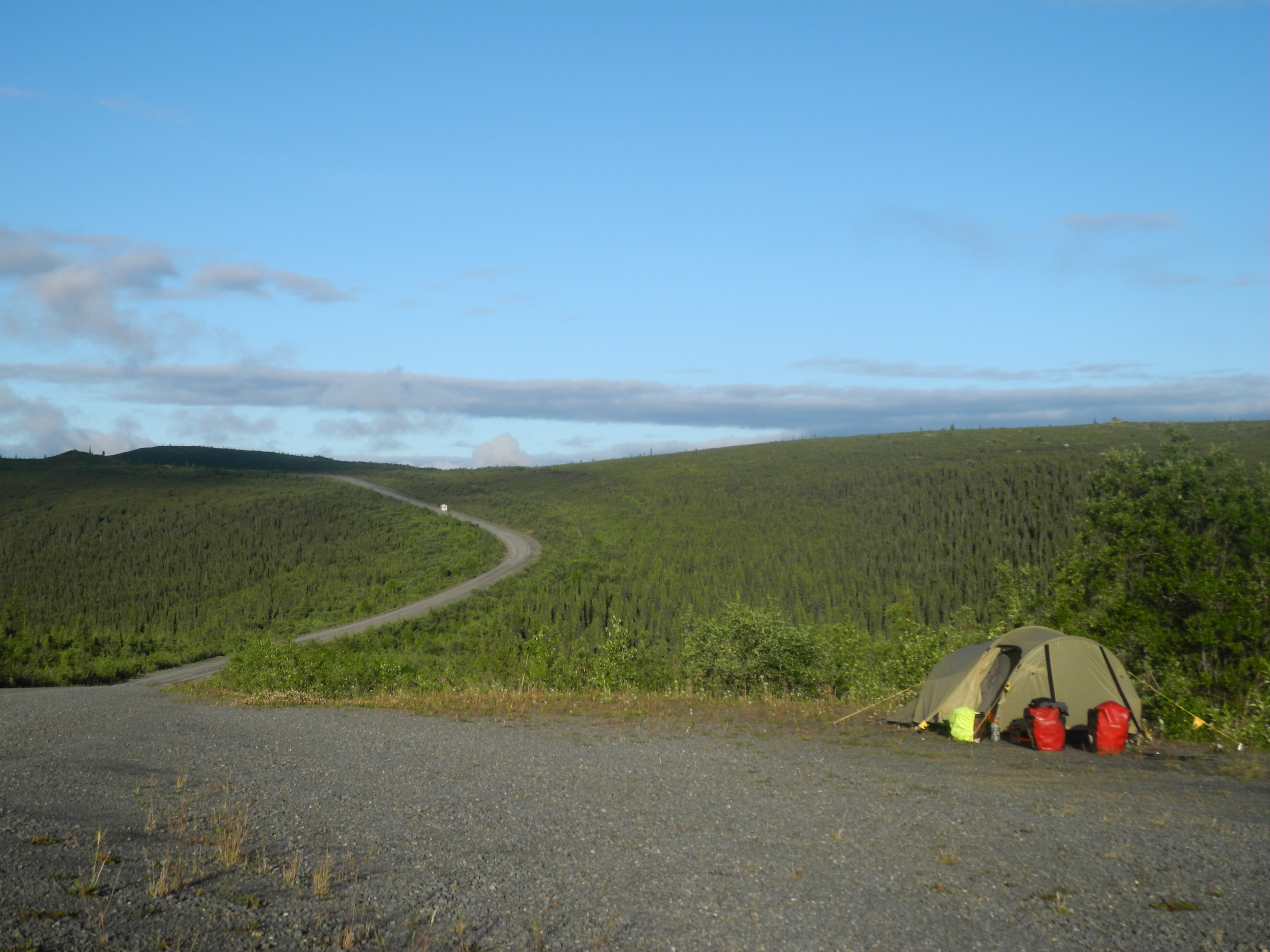
It was a sunny night after a rainy day.
We had just opened our cans of beer when – believe it or not – the sun came out. Better late than never.
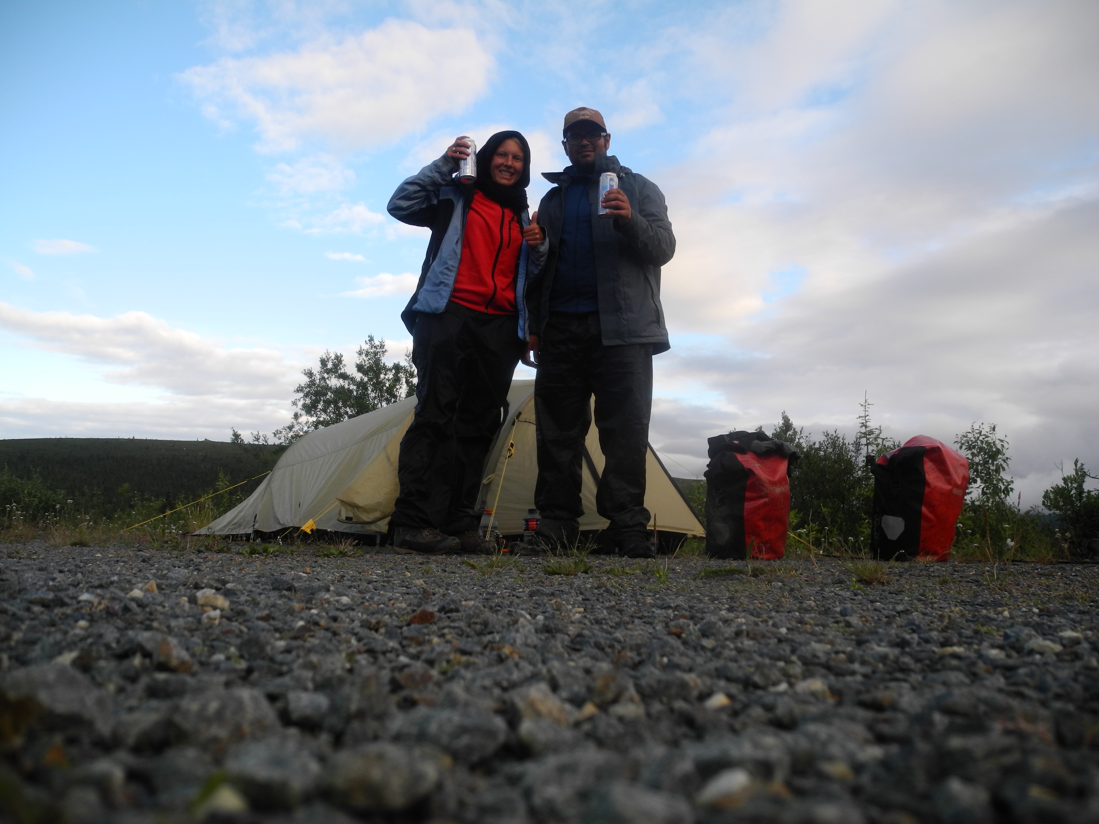
Cheers! We saved the beer for last.
We started the day with a good and filling breakfast. Calories in the belly turned into power in the legs. And that power was just what we needed so get over those hills.
Finally a truly filling breakfast
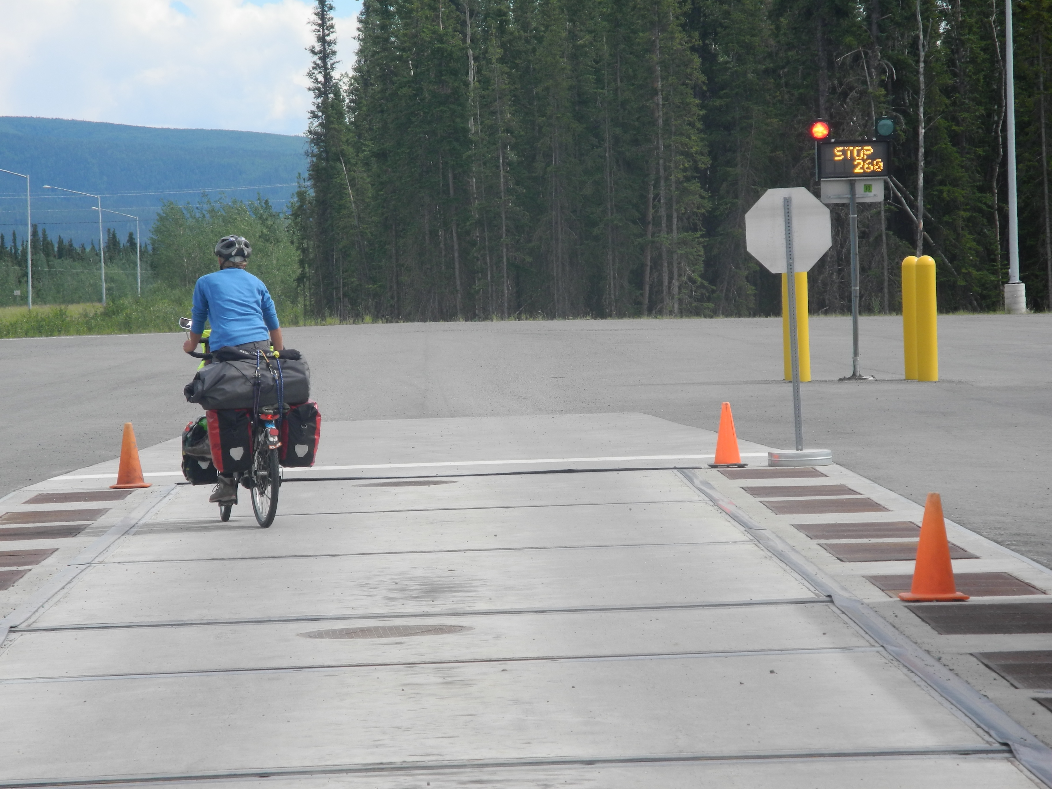
It was a cloudy and cold but dry day. We lost 800 meters during the last 14 kilometers and reached the Yukon ferry with icy hands and ruffled hair. Martine’s bike stood just outside the Tourist Information.
The Yukon. I still couldn’t believe it.
Finally we could enjoy the views down!
She had managed to find the unofficial campspot (only four kilometers further!) and even built a little stick-arrow and started a fire, hoping that we would see her.
Up and down and up and down. The Top of the World Highway and Taylor Highway were truly challenging.
Our bikes were in need of a shower
In the morning we must have – for the first time ever – started earlier than her and passed her well hidden tent. Together we went out to set camp. With good company and a half-price campspot I didn’t mind spending another night with earplugs.

Dawson City’s general store.
Dawson is a very interesting town. Roberto wrote an article on this beautiful place that you can check out here: Dawson City: The Golden City. First of all it is where the Yukon and the Klondike Rivers meet. These two rivers are the pure sound of Northern adventure and awesomeness for somebody who has read Jack London (half of his cabin is situated in Dawson City btw) and heaps of other books about the North.
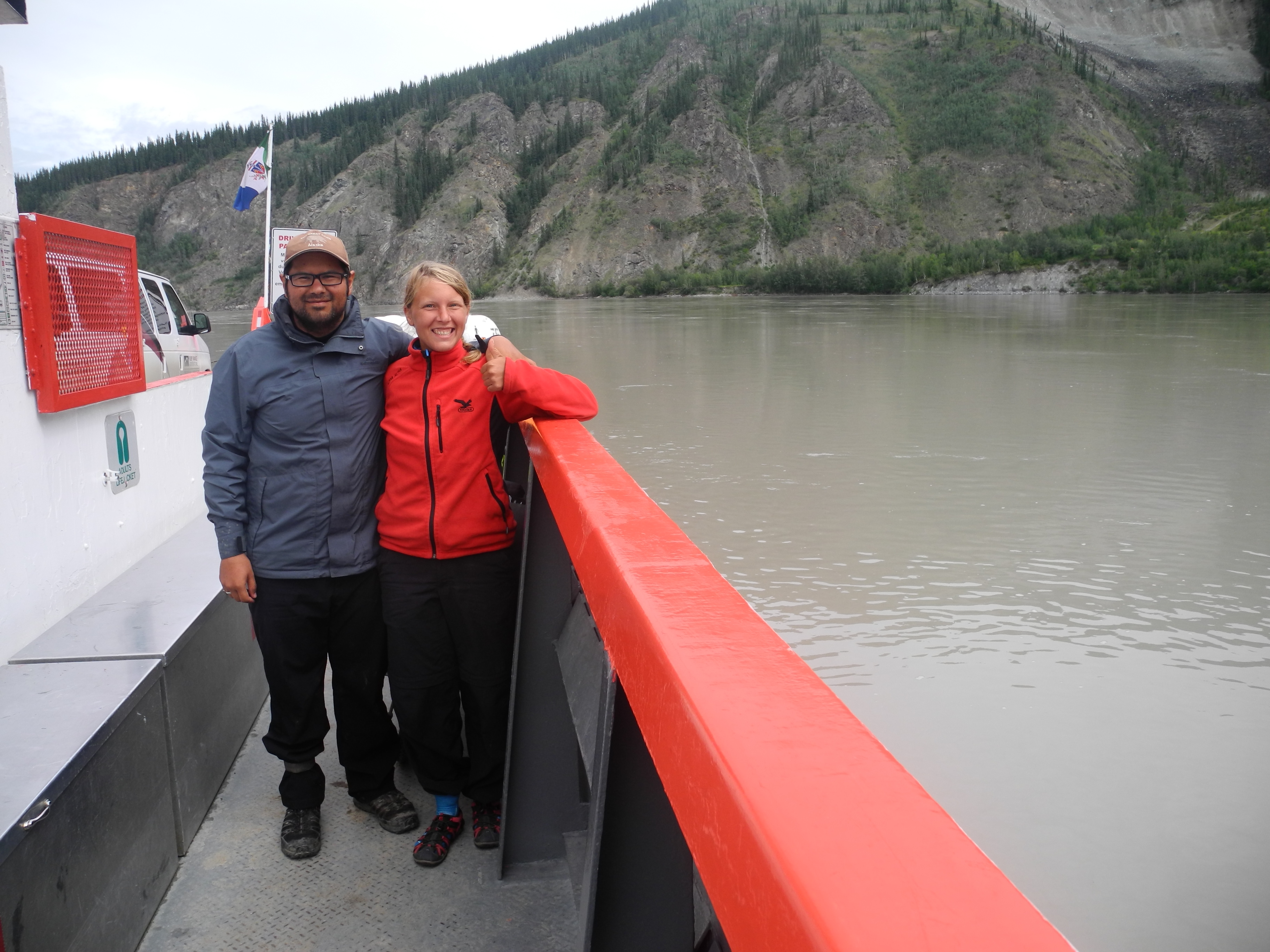
A free ferry takes people from one side of Yukon river to the other one
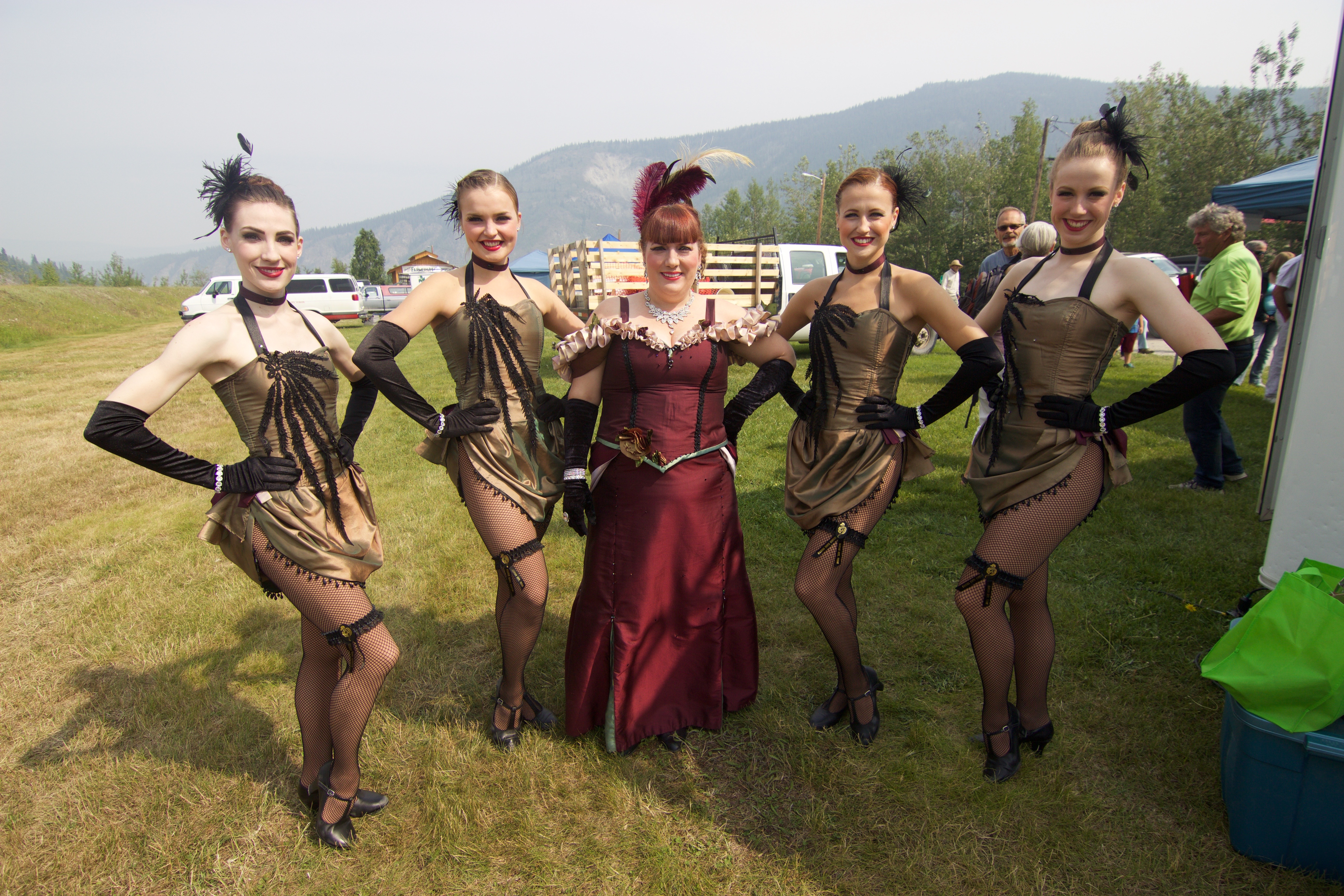
Dawson City used to be Yukon’s capital, as well as the gold mining capital. Today the capital in Whitehorse, but Dawson City remains a very popular tourist spot, the perfect example of “we want to show off our Wild West looks”. There is even a saloon (casino) with a cancan show.
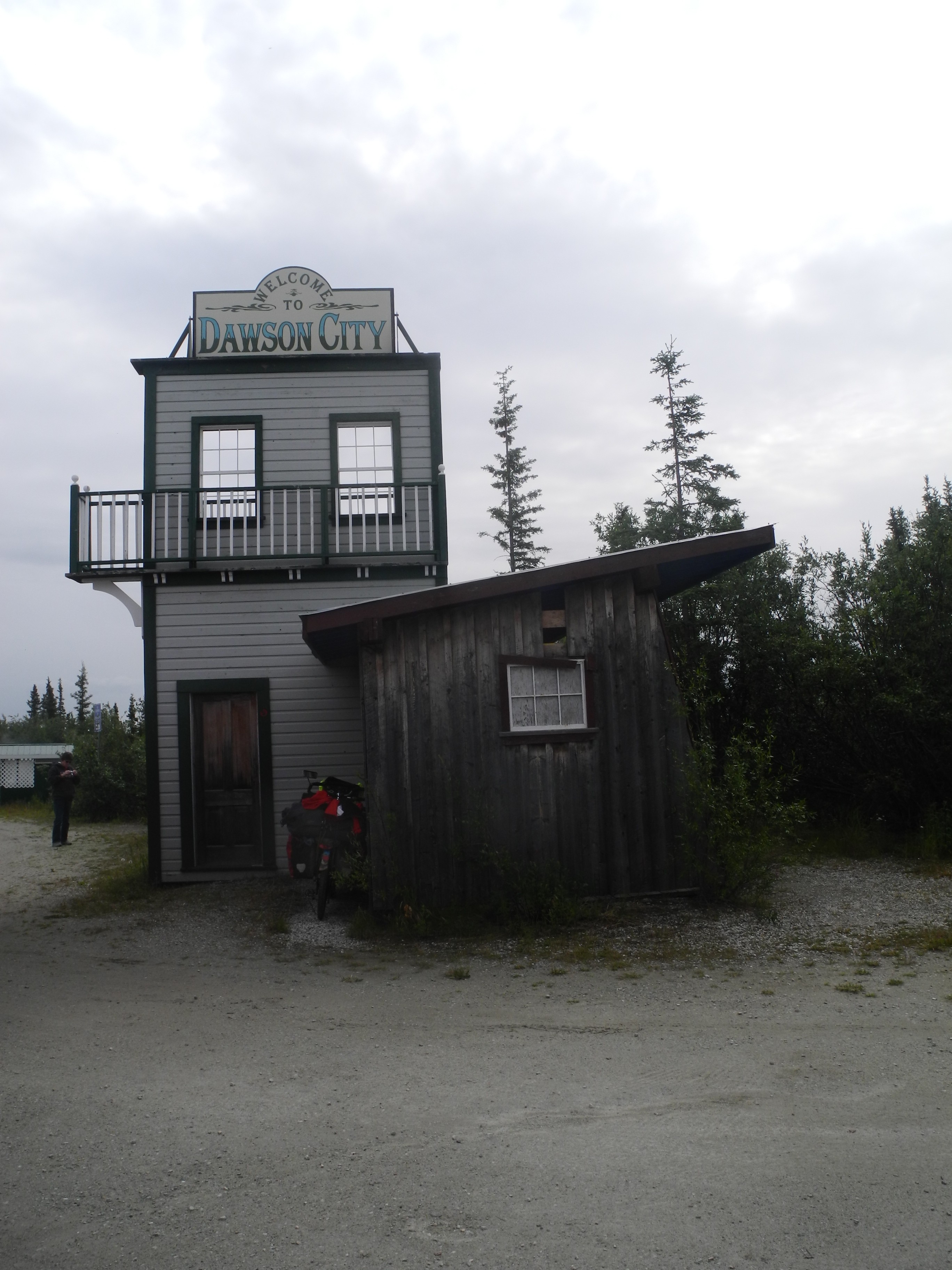
Welcome to Dawson City
Dawson city is home to several interesting people. There’s wannabe-cowboys, fulltime gold panners and gold miners, adolescents who go out on a weekend in muddy rubber boots (reminds me a bit of the dance club back in my home village) and heaps of hippies, hipsters, tourists with socks and sandals, as well as adventurer with canoes, bikes and campervans.
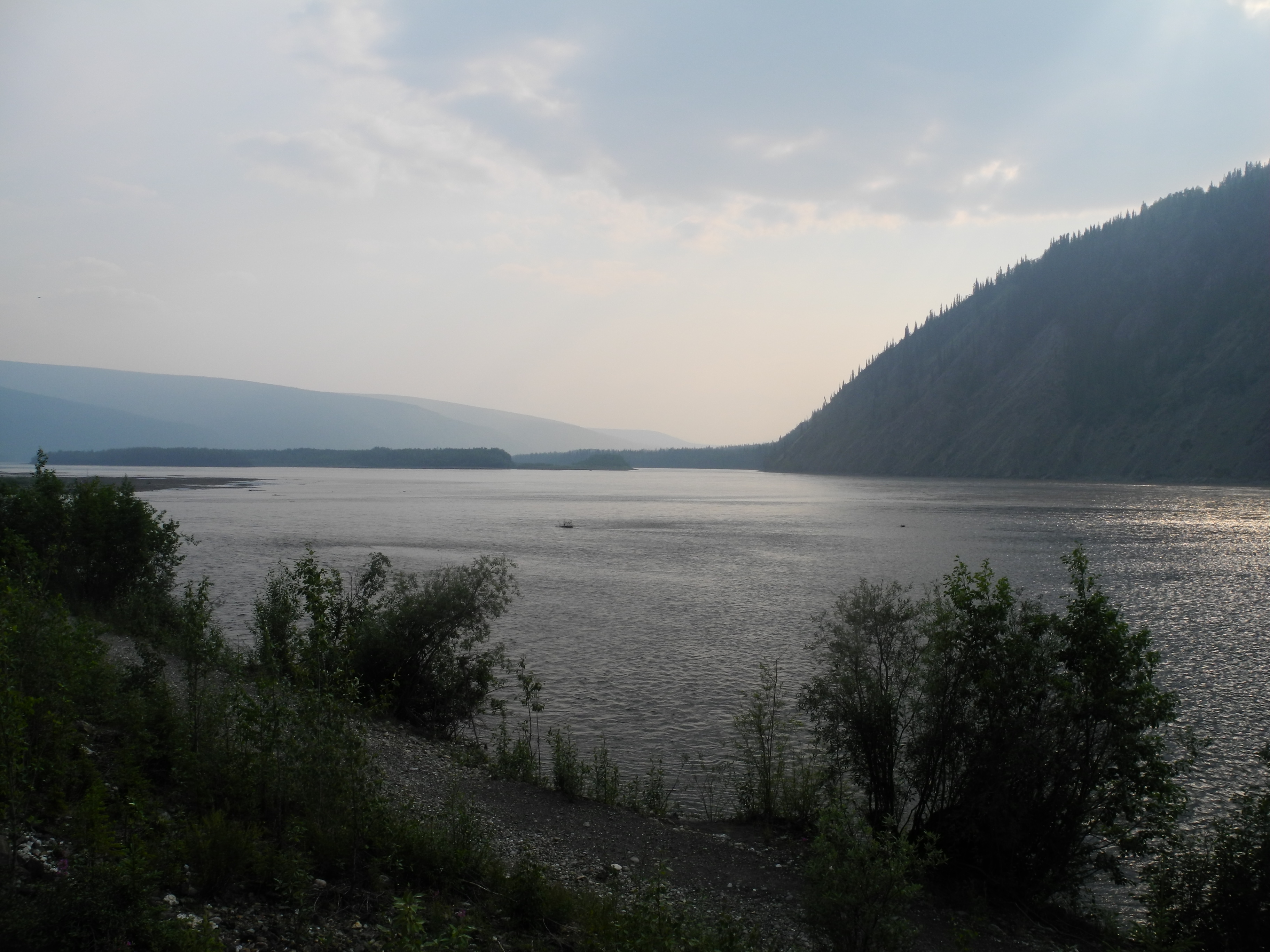
Where the Yukon and the Klondike meet
Dawson City is full of life
Dawson City has an airport and there is one bus company that you can charter ($109 to Whitehorse). Most people came here in their own vehicle. And there’s great musicians.
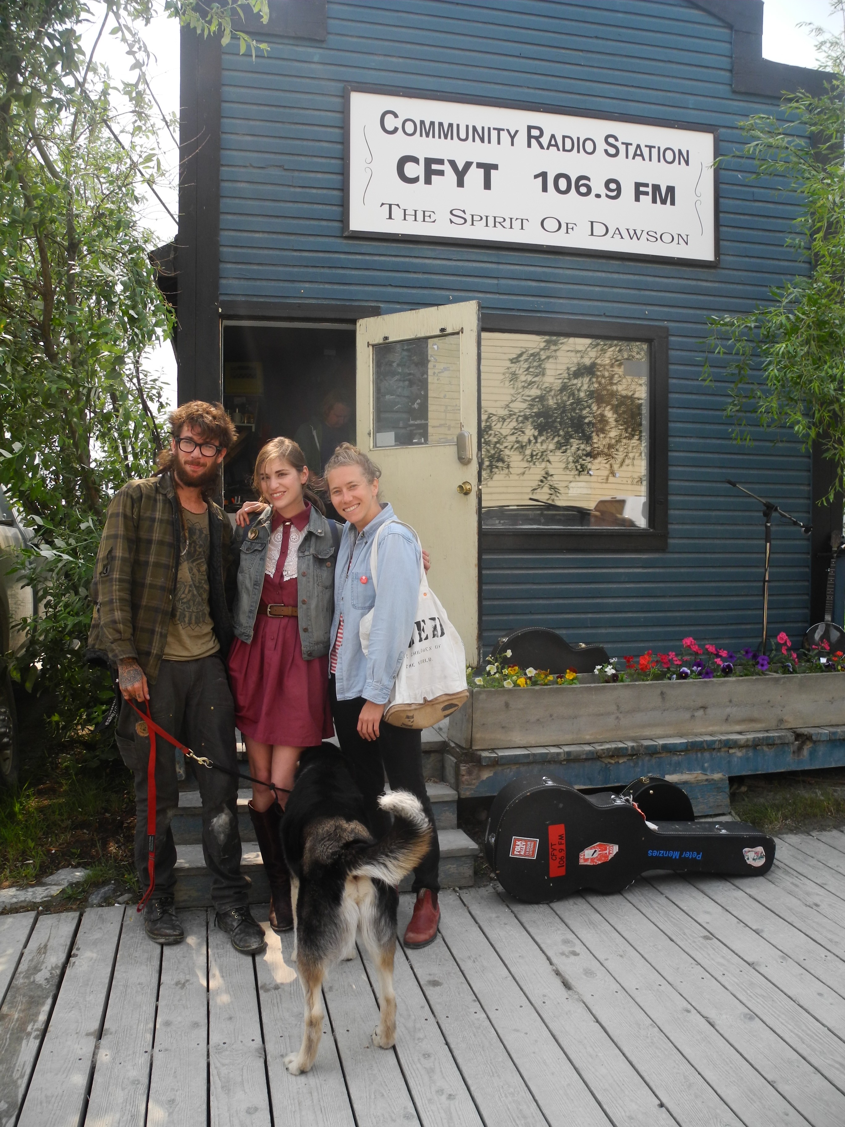
Cud Eastbound and Joey O’Neil who live in Dawson City with Dana Sipos from Yellowknife, NWT
We had the chance to meet Cud Eastbound and Joey O’Neil who have originally moved up here for a summer but then just fell in love with the North. And later we found out that Dawson City is also home to Caveman Bill, who lives in a cave on the other side of the Yukon River.
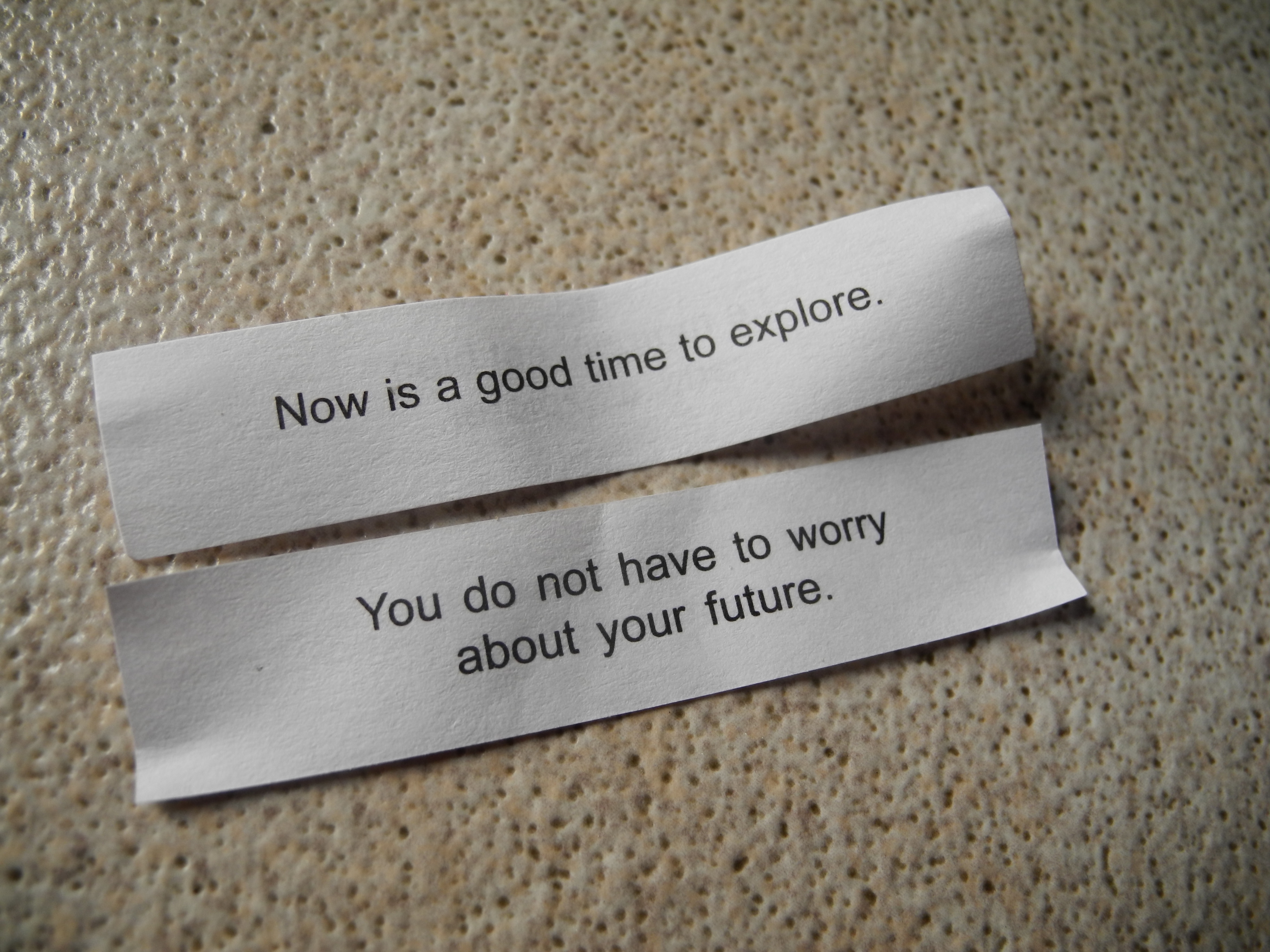
This is what we ha in our fortune cookies on the day before departure to the Dempster Highway
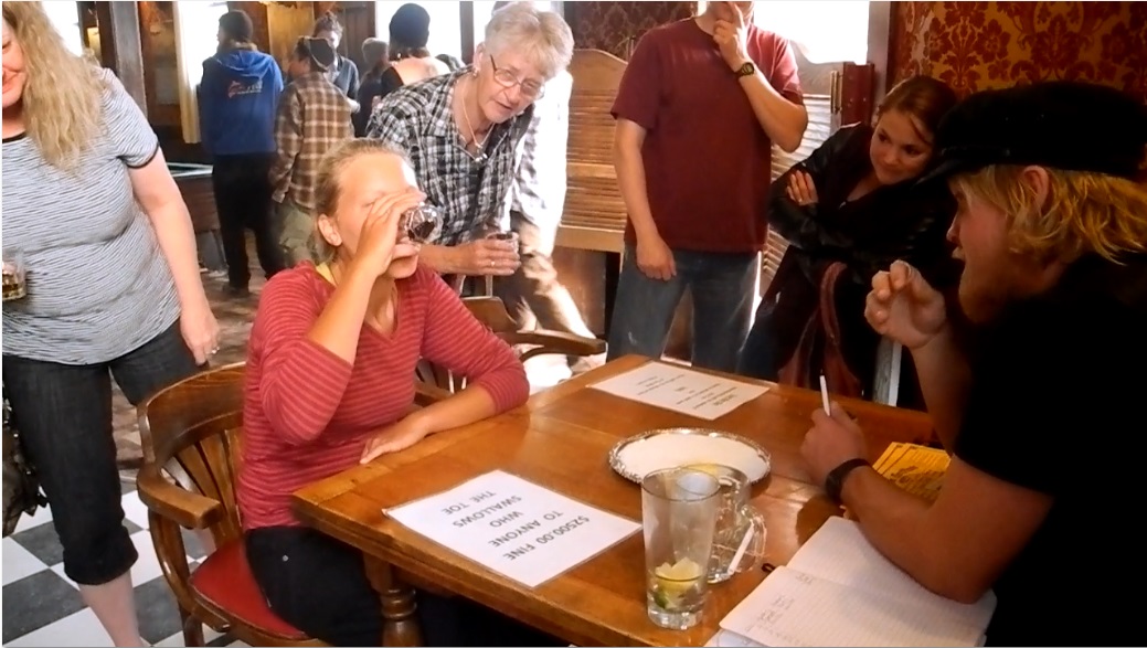
Quite some inhabitants (and even more tourists) are members of the “Sourtoe Cocktail Club”. The story: many years ago somebody got so cold feet that the toe turned blue and black and had to be amputated. It was preserved in alcohol. I can’t tell why, but I guess I’d also want to keep my toe as a souvenir from a cold walk. Today this toe sits in salt during the day, until the evening, when “The Captain” grabs it and for a fee of $5 puts it into people’s shot glasses.
The game is to drink your shot (with the black frozen human toe in it) and touch the toe with your lips. It is strictly forbidden to eat the toe though. This has been enforced with a high fee, growing in price exponentially with every toe that (accidentally or on purpose) has been eaten.
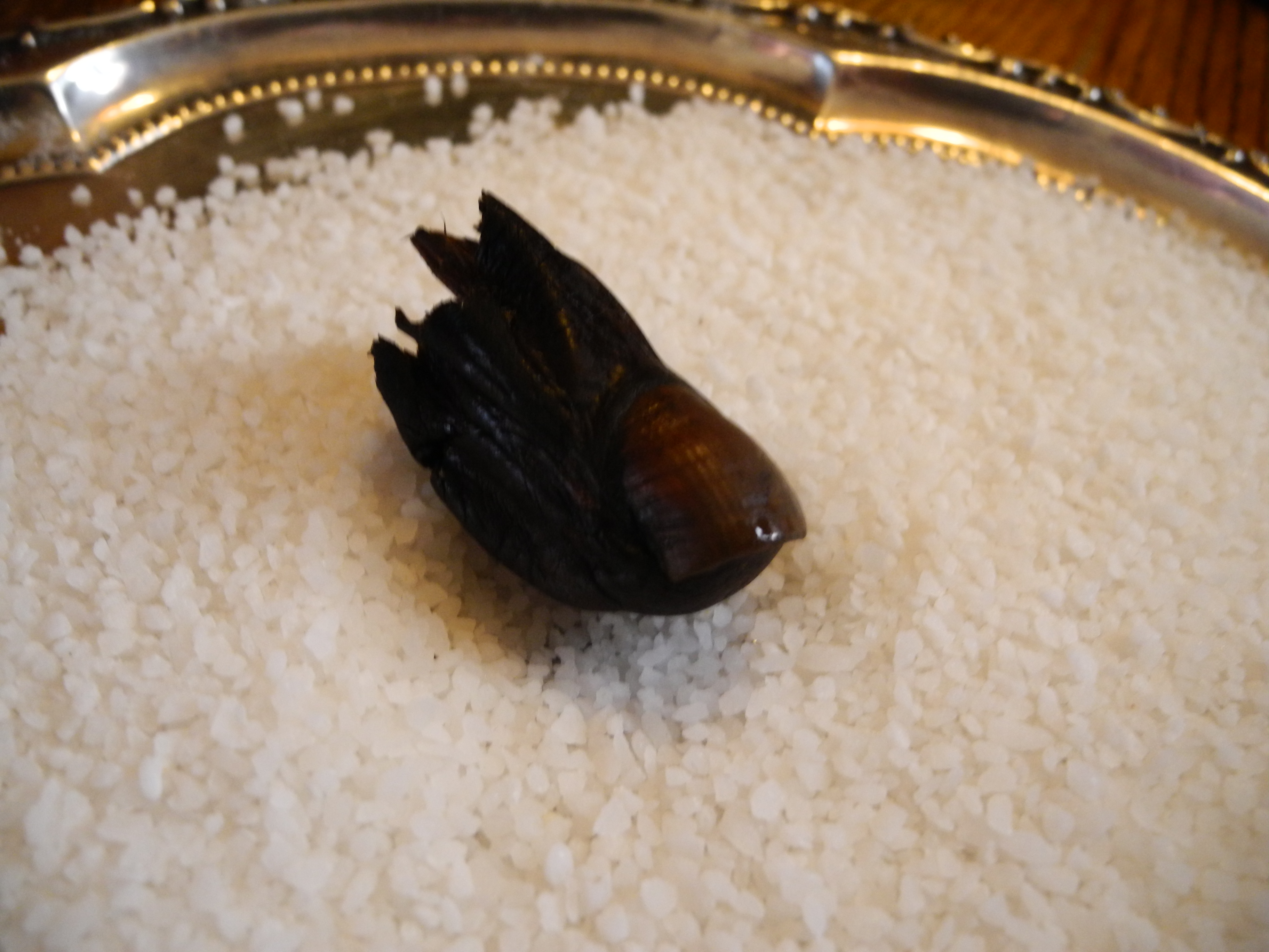
The toe
In July 2015 we were on toe number eleven ever since the beginning of the Sourtoe Cocktail Club. I am proud member sixteen thousand and something. I don’t know where toes number two to eleven came from (not sure if I want to know), but I have heard that for a while they used bear testicles due to a lack of human toes.
Not a problem …

… until the Captain decided to squeeze the last juices out of the toe and had me drink these drops too.
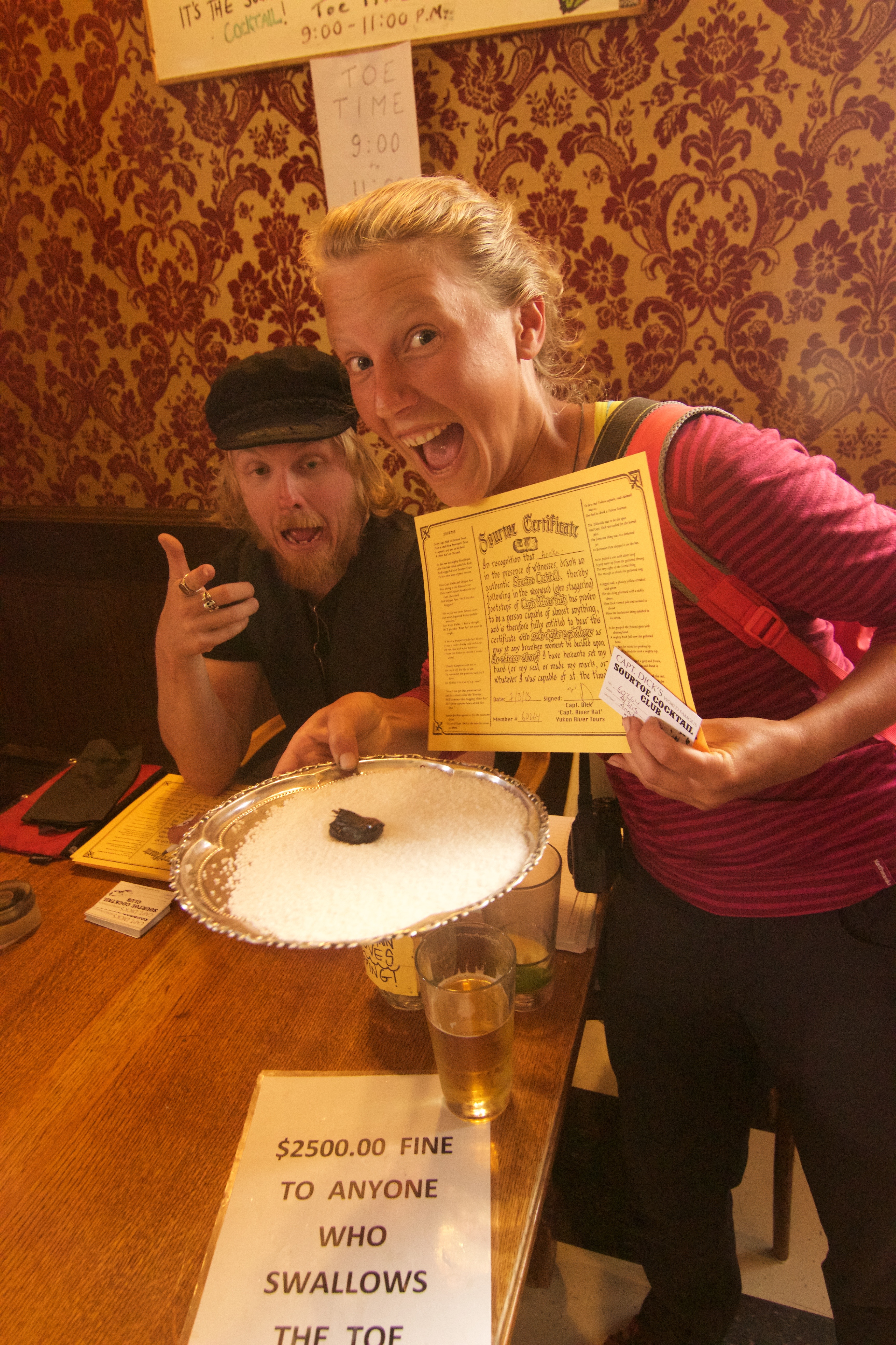
Totally worth it!
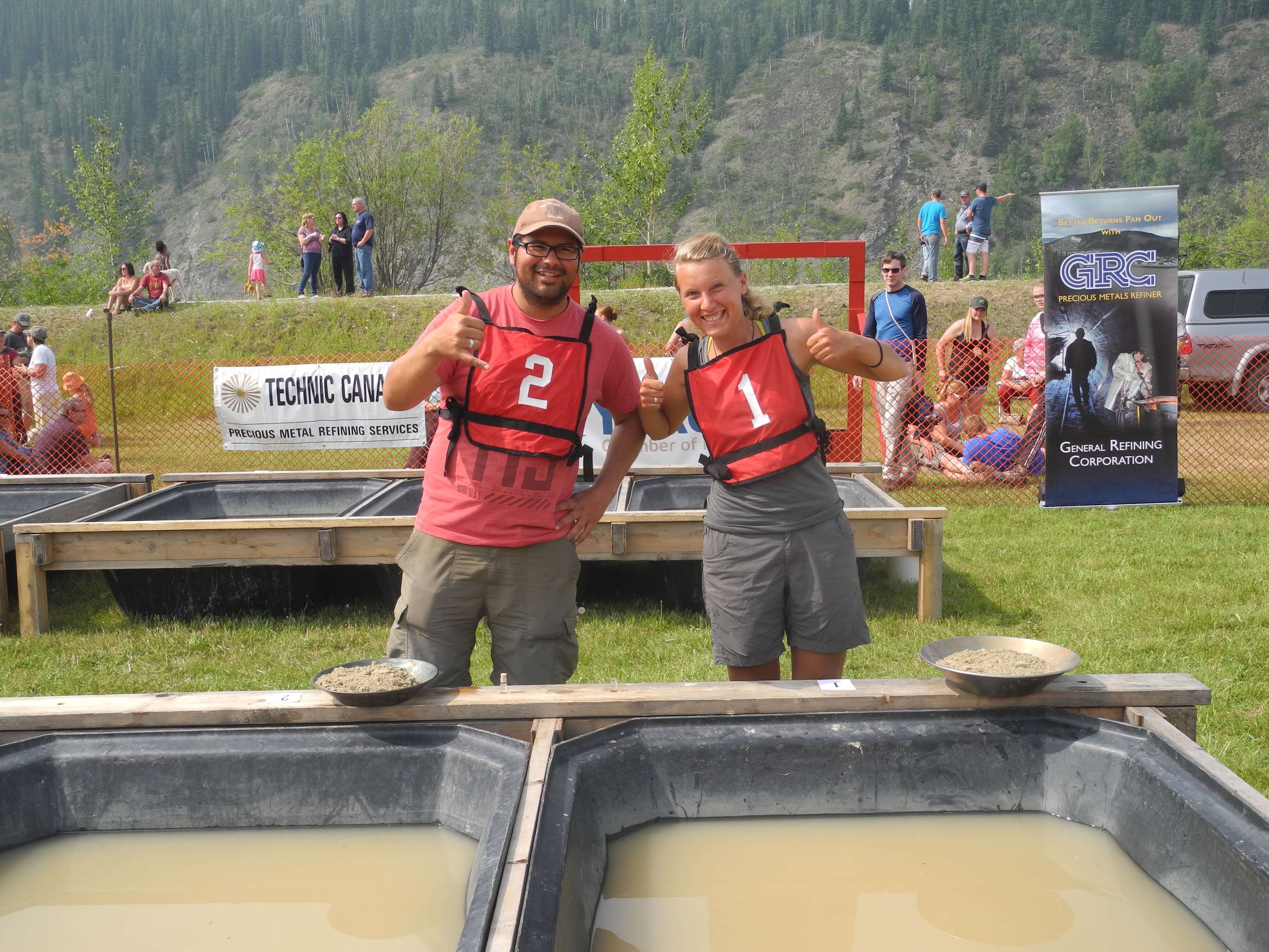
We spent three nights in Dawson City. After biking through Alaska without a single rest day, we very much deserved this. On the last day, Dawson City held the annual Dawson City Gold Panning Competition. The crème de la crème of gold panners panned alongside the “Cheechakos” (beginners).

Ready to get this started: Annika, Roberto and Martine
Of course as Tasting Travellers we had to give it a try. For $10 they provided us with the equipment, the training and in the end we even got to keep all the gold we found. That was a much better deal than our original plan: a 14 kilometer bike ride to the free claim with rented equipment and not a clue how to separate the gold from the sand.

Sand is much lighter than gold, so I mus try to shake the gold to the bottom of the pan and tip the sand out
Well, turned out we weren’t all without talent. Both of us found seven out of eight tiny gold flakes. Martine found four. But Roberto worked much faster and ended up on 3rd place of all Cheechakos.
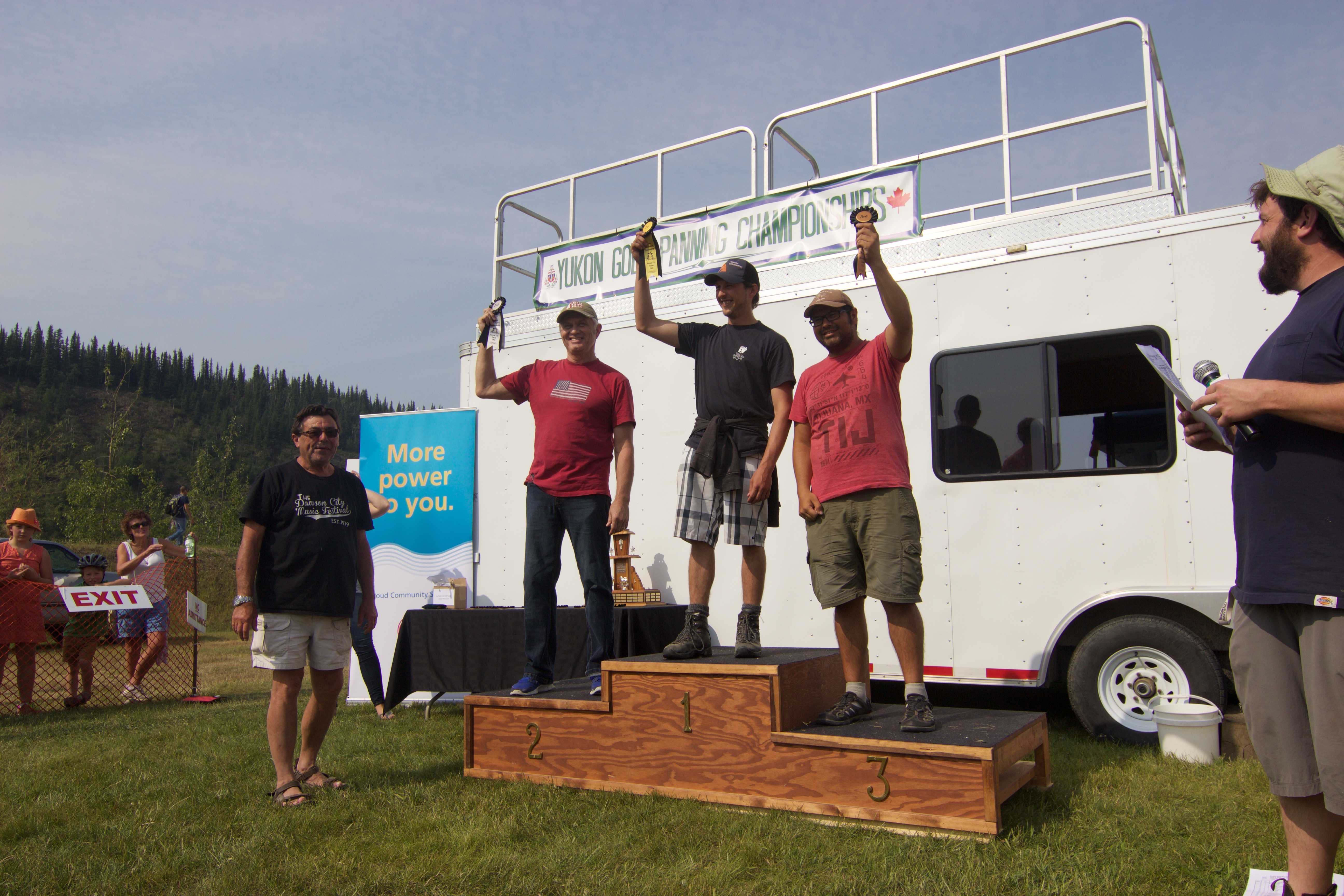
Roberto scores third at his first gold panning try!
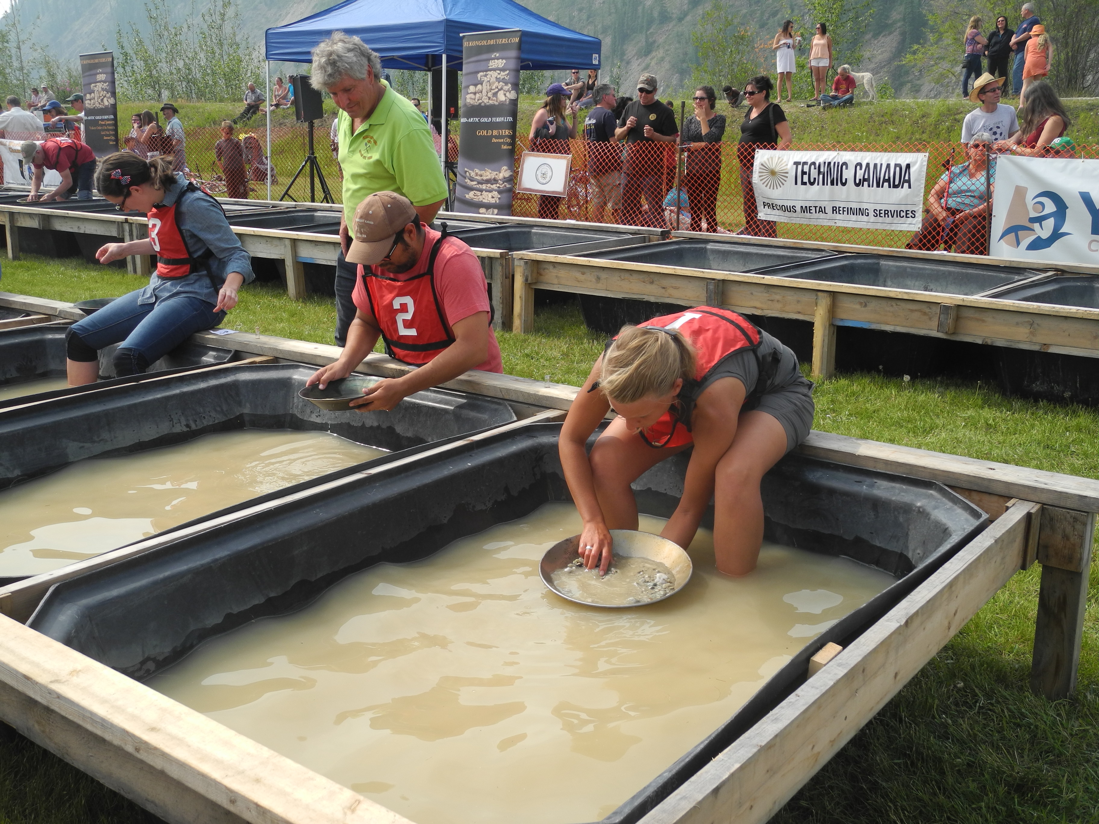
And so the contest began
While we were waiting for our turn, we saw two young women with Ortlieb handlebar bags. These make it really easy to spot the cyclist away from the bike. Denise and Luzia from Germany had been biking here from Halifax in the very east of the country and just like us they were planning to head up the Dempster Highway.

Training Mode
Proud contestants
The Dempster is a 740 Kilometers road with no pavement that crosses the Arctic Circle and was said to be full of bears. The more cyclists, the more noise and the less bears. We invited them to come along with us. Let’s bike into the arctic in a team of five!
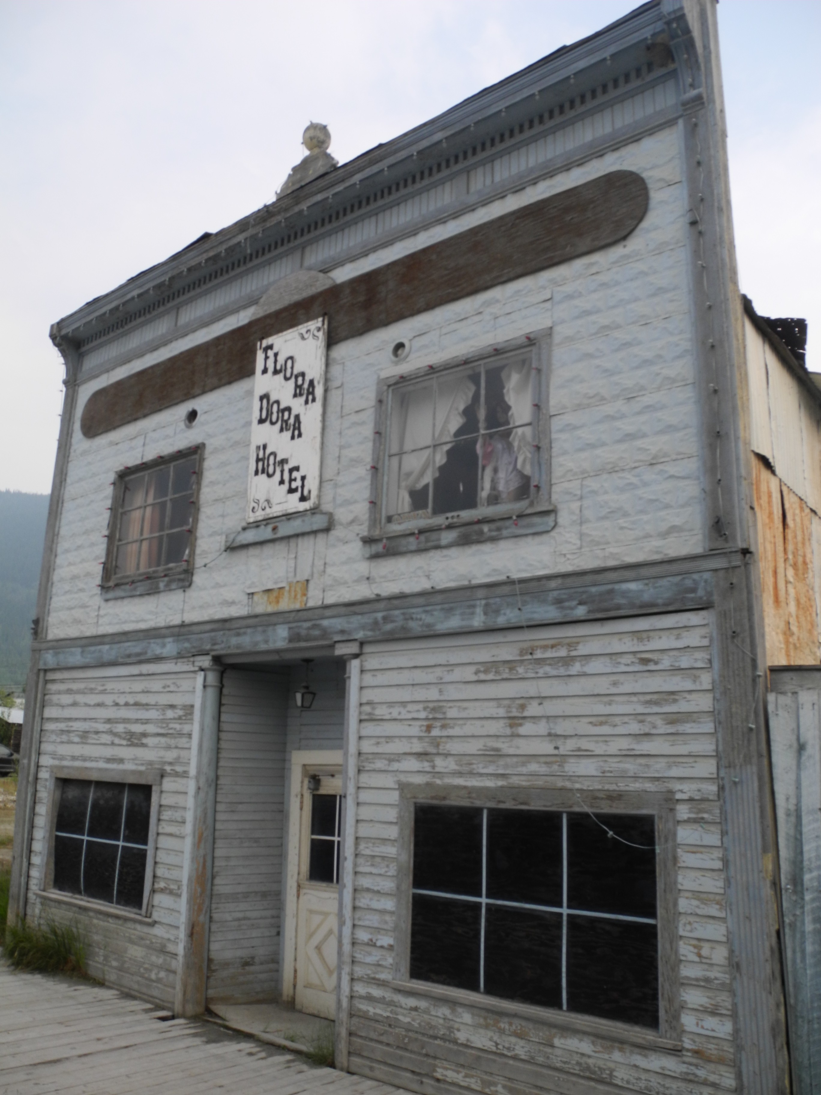
One of Dawson City’s old buildings
Missed the last one? Here’s Cycling Alaska Part 2
Read about our Arctic Adventures in our next blog entry: Cycling the Dempster Highway Part 1


Thank you the wonderful Photography of your trip to Dawson City. We were in Dawson for the Canada Parade in the morning in the rain and went the festivities at noon. We mostly likely passed you on the road. We had rain and fog all the way to Chicken and saw nothing of the incredible scenery. Now we have!!
Hello Don,
happy we could show you how the way from Chicken to Boundary would have looked like 🙂 I really wish we could have seen more too, but then again, now we have another good reason to return some day (and drive in a car hehehe).
Enjoy the travels and maybe meet you again some day up North!
Cheers,
Annika
I drove the highway the last days of July and was awesome but that wasn’t enough, and I felt the same as you guys I want to go back because there is too much to see. Thanks for share your cycling travels.
Hi Leonardo,
thanks a lot for your comment! I really hope that some day we get to go back up North and we get some better weather! Are you planning of going back any time soon?
Cheers,
Annika